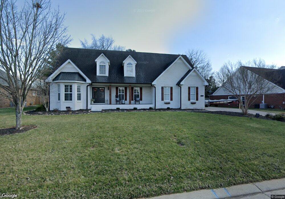
631 Stonetrace Dr Murfreesboro, TN 37128
Estimated Value: $391,000 - $471,000
--
Bed
4
Baths
1,957
Sq Ft
$218/Sq Ft
Est. Value
About This Home
This home is located at 631 Stonetrace Dr, Murfreesboro, TN 37128 and is currently estimated at $427,236, approximately $218 per square foot. 631 Stonetrace Dr is a home located in Rutherford County with nearby schools including Scales Elementary School, Rockvale Middle School, and Rockvale High School.
Ownership History
Date
Name
Owned For
Owner Type
Purchase Details
Closed on
Sep 9, 2002
Sold by
Alcorn Derek D and Alcorn Angela G
Bought by
Wyant Gregory W and Wyant Brooke L
Current Estimated Value
Purchase Details
Closed on
Feb 12, 2002
Sold by
Millennium Properties
Bought by
Alcorn Derek D and Alcorn Angela G
Home Financials for this Owner
Home Financials are based on the most recent Mortgage that was taken out on this home.
Original Mortgage
$128,800
Interest Rate
6.81%
Create a Home Valuation Report for This Property
The Home Valuation Report is an in-depth analysis detailing your home's value as well as a comparison with similar homes in the area
Home Values in the Area
Average Home Value in this Area
Purchase History
| Date | Buyer | Sale Price | Title Company |
|---|---|---|---|
| Wyant Gregory W | $178,800 | -- | |
| Alcorn Derek D | $23,000 | -- |
Source: Public Records
Mortgage History
| Date | Status | Borrower | Loan Amount |
|---|---|---|---|
| Previous Owner | Alcorn Derek D | $128,800 |
Source: Public Records
Tax History Compared to Growth
Tax History
| Year | Tax Paid | Tax Assessment Tax Assessment Total Assessment is a certain percentage of the fair market value that is determined by local assessors to be the total taxable value of land and additions on the property. | Land | Improvement |
|---|---|---|---|---|
| 2025 | $2,654 | $93,800 | $13,750 | $80,050 |
| 2024 | $2,654 | $93,800 | $13,750 | $80,050 |
| 2023 | $1,760 | $93,800 | $13,750 | $80,050 |
| 2022 | $1,440 | $89,100 | $13,750 | $75,350 |
| 2021 | $1,368 | $61,625 | $10,625 | $51,000 |
| 2020 | $1,368 | $61,625 | $10,625 | $51,000 |
| 2019 | $1,368 | $61,625 | $10,625 | $51,000 |
| 2018 | $1,879 | $61,625 | $0 | $0 |
| 2017 | $1,906 | $49,025 | $0 | $0 |
| 2016 | $1,906 | $49,025 | $0 | $0 |
| 2015 | $1,906 | $49,025 | $0 | $0 |
| 2014 | $1,219 | $49,025 | $0 | $0 |
| 2013 | -- | $50,725 | $0 | $0 |
Source: Public Records
Map
Nearby Homes
- 647 Stonetrace Dr
- 725 Stonetrace Dr
- 2905 Stonehedge Dr
- 627 Tidesridge Ct
- 2940 Waywood Dr
- 539 River Rock Blvd
- 2123 River Chase Dr
- 2113 River Chase Dr
- 2121 River Chase Dr
- 3315 Alta Ln
- 1518 Saint Andrews Dr
- 3331 Alta Ln
- 412 Conhocken Ct
- 1421 Rebecca Johns Dr
- 1442 Rebecca Johns Dr Unit V20
- 3303 Hampton Turner Dr
- 1710 Locerbie Dr
- 1111 Thomas Johns Ct
- 2018 Queenie Johns Dr
- 2022 Queenie Johns Dr
- 635 Stonetrace Dr
- 627 Stonetrace Dr
- 602 Tidesridge Ct
- 641 Stonetrace Dr
- 632 Stonetrace Dr
- 636 Stonetrace Dr
- 606 Tidesridge Ct
- 638 Stonetrace Dr
- 623 Stonetrace Dr
- 643 Stonetrace Dr
- 603 Tidesridge Ct
- 628 Stonetrace Dr
- 642 Stonetrace Dr
- 644 Stonetrace Dr
- 610 Tidesridge Ct
- 624 Stonetrace Dr
- 607 Tidesridge Ct
- 619 Stonetrace Dr
- 648 Stonetrace Dr
- 650 Stonetrace Dr