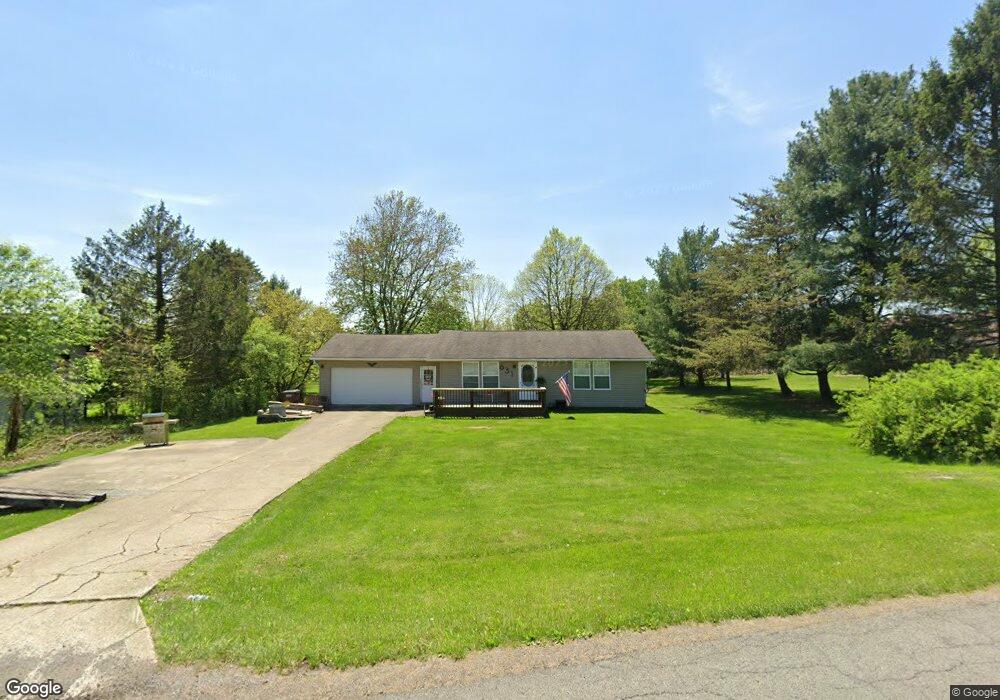
631 Winesap Cir Howard, OH 43028
Apple Valley NeighborhoodEstimated Value: $195,000 - $240,000
2
Beds
1
Bath
1,120
Sq Ft
$192/Sq Ft
Est. Value
About This Home
This home is located at 631 Winesap Cir, Howard, OH 43028 and is currently estimated at $215,581, approximately $192 per square foot. 631 Winesap Cir is a home located in Knox County with nearby schools including East Knox Elementary School and East Knox High School.
Ownership History
Date
Name
Owned For
Owner Type
Purchase Details
Closed on
Feb 25, 2010
Sold by
Rowe Matthew J and Rowe Felicia A
Bought by
Williams Ii Jeffery
Current Estimated Value
Home Financials for this Owner
Home Financials are based on the most recent Mortgage that was taken out on this home.
Original Mortgage
$91,836
Outstanding Balance
$61,023
Interest Rate
5.11%
Mortgage Type
New Conventional
Estimated Equity
$154,558
Purchase Details
Closed on
Sep 21, 2009
Sold by
Mcbride Robert Joseph and Mcbride Deborah S
Bought by
Bank Of America Na
Purchase Details
Closed on
Jan 15, 1997
Sold by
Mcbride Robert Joseph
Bought by
Mcbride Robert Joseph
Create a Home Valuation Report for This Property
The Home Valuation Report is an in-depth analysis detailing your home's value as well as a comparison with similar homes in the area
Home Values in the Area
Average Home Value in this Area
Purchase History
| Date | Buyer | Sale Price | Title Company |
|---|---|---|---|
| Williams Ii Jeffery | $66,300 | None Available | |
| Bank Of America Na | $37,500 | None Available | |
| Mcbride Robert Joseph | -- | -- |
Source: Public Records
Mortgage History
| Date | Status | Borrower | Loan Amount |
|---|---|---|---|
| Open | Williams Ii Jeffery | $91,836 |
Source: Public Records
Tax History
| Year | Tax Paid | Tax Assessment Tax Assessment Total Assessment is a certain percentage of the fair market value that is determined by local assessors to be the total taxable value of land and additions on the property. | Land | Improvement |
|---|---|---|---|---|
| 2024 | $1,906 | $47,680 | $3,100 | $44,580 |
| 2023 | $1,922 | $47,680 | $3,100 | $44,580 |
| 2022 | $1,548 | $32,890 | $2,140 | $30,750 |
| 2021 | $1,548 | $32,890 | $2,140 | $30,750 |
| 2020 | $1,474 | $32,890 | $2,140 | $30,750 |
| 2019 | $1,349 | $27,580 | $2,100 | $25,480 |
| 2018 | $1,264 | $27,580 | $2,100 | $25,480 |
| 2017 | $1,252 | $27,580 | $2,100 | $25,480 |
| 2016 | $1,178 | $25,540 | $1,950 | $23,590 |
| 2015 | $1,073 | $25,540 | $1,950 | $23,590 |
| 2014 | $1,075 | $25,540 | $1,950 | $23,590 |
| 2013 | $1,216 | $27,440 | $2,380 | $25,060 |
Source: Public Records
Map
Nearby Homes
- 50 Orchard Hills Ct
- 0 Crabapple Dr Unit 226006311
- 770 Winesap Cir
- 11 Crabtree Ct
- 0 Grant Rd Rd Unit 5190994
- 531 Crabapple Dr
- 406 Crabapple Dr
- 132 Lakeview Heights Dr
- Lots 392 & 393 Lakeview Heights Dr
- 0 Mcintosh Ct Unit 20250846
- 0 Mcintosh Ct Unit LOT 321
- 60 Appleseed Ct
- 63 Appleseed Ct
- 0 Northern Spy Dr Unit 226000222
- 153 Northern Spy Dr
- 0 Grant Rd Unit 9072637
- 0 Grant Rd Unit 230893
- 01 Grant Rd Rear
- 00 Grant Rd
- 12651 Grant Rd
- 623 Winesap Cir
- 639 Winesap Cir
- 556 Baldwin Dr
- 643 Winesap Cir
- 626 Winesap Cir
- 630 Winesap Cir
- 552 Baldwin Dr
- 622 Winesap Cir
- 53 Thornapple Ct
- 0 Baldwin Ct Unit 409 747087
- 0 Baldwin Ct Unit 409
- 0 Baldwin Heights Cir Unit 172
- 0 Baldwin Heights Cir Unit Lt141 2715987
- 0 Baldwin Heights Cir Unit Lot 34 2716858
- 0 Baldwin Ct Unit L396 9819219
- 0 Baldwin Ct Unit 9819223
- 0 Baldwin Heights Cir Unit 223030833
- 0 Baldwin Heights Cir Unit 9015996
- 0 Baldwin Heights Cir Unit 193 2804514
- 0 Baldwin Ct Unit Lot 396 2922760
Your Personal Tour Guide
Ask me questions while you tour the home.