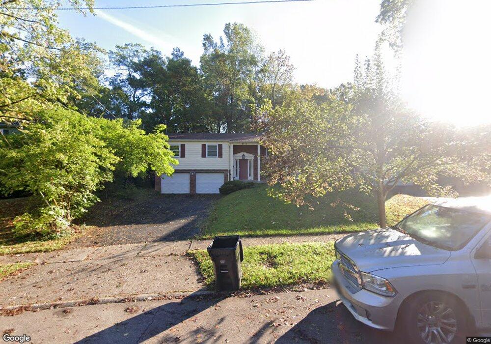
6310 Dawes Ln Cincinnati, OH 45230
Mount Washington NeighborhoodEstimated Value: $313,687 - $362,000
3
Beds
3
Baths
1,944
Sq Ft
$177/Sq Ft
Est. Value
About This Home
This home is located at 6310 Dawes Ln, Cincinnati, OH 45230 and is currently estimated at $344,422, approximately $177 per square foot. 6310 Dawes Ln is a home located in Hamilton County with nearby schools including Mt. Washington Elementary School, Clark Montessori High School, and Shroder High School.
Ownership History
Date
Name
Owned For
Owner Type
Purchase Details
Closed on
Oct 16, 2015
Sold by
Lecates Scott J
Bought by
Lecates Susan L
Current Estimated Value
Purchase Details
Closed on
Mar 4, 2004
Sold by
Williams Marilyn J and Williams Charles
Bought by
Lecates Scott J and Lecates Susan L
Create a Home Valuation Report for This Property
The Home Valuation Report is an in-depth analysis detailing your home's value as well as a comparison with similar homes in the area
Home Values in the Area
Average Home Value in this Area
Purchase History
| Date | Buyer | Sale Price | Title Company |
|---|---|---|---|
| Lecates Susan L | -- | None Available | |
| Lecates Scott J | $173,000 | -- |
Source: Public Records
Tax History
| Year | Tax Paid | Tax Assessment Tax Assessment Total Assessment is a certain percentage of the fair market value that is determined by local assessors to be the total taxable value of land and additions on the property. | Land | Improvement |
|---|---|---|---|---|
| 2025 | $5,169 | $83,860 | $10,395 | $73,465 |
| 2023 | $5,126 | $83,860 | $10,395 | $73,465 |
| 2022 | $4,658 | $68,352 | $8,778 | $59,574 |
| 2021 | $4,483 | $68,352 | $8,778 | $59,574 |
| 2020 | $4,613 | $68,352 | $8,778 | $59,574 |
| 2019 | $4,424 | $59,959 | $7,700 | $52,259 |
| 2018 | $4,431 | $59,959 | $7,700 | $52,259 |
| 2017 | $4,210 | $59,959 | $7,700 | $52,259 |
| 2016 | $4,357 | $61,226 | $7,700 | $53,526 |
| 2015 | $3,928 | $61,226 | $7,700 | $53,526 |
| 2014 | $3,956 | $61,226 | $7,700 | $53,526 |
| 2013 | $4,025 | $61,226 | $7,700 | $53,526 |
Source: Public Records
Map
Nearby Homes
- 6521 Glade Ave
- 1341 Mayland Dr
- 1319 Schirmer Ave
- 6604 Ambar Ave
- a Salem Rd
- 1741 Mears Ave
- 6123 Cambridge Ave
- 6952 Shadow Ridge Rd
- 1361 Bursal Ave
- 1508 Beth Ln
- 1305 Bursal Ave
- 6760 Bursal Ct
- 6381 Beaconwood Dr
- 6803 Le Conte Ave
- 1944 Rockland Ave
- 6168 Thole Rd
- 6802 Whitehall Ave
- 1184 Linden Hill Ln
- 1 Salem Rd
- 6201 Thole Rd
Your Personal Tour Guide
Ask me questions while you tour the home.