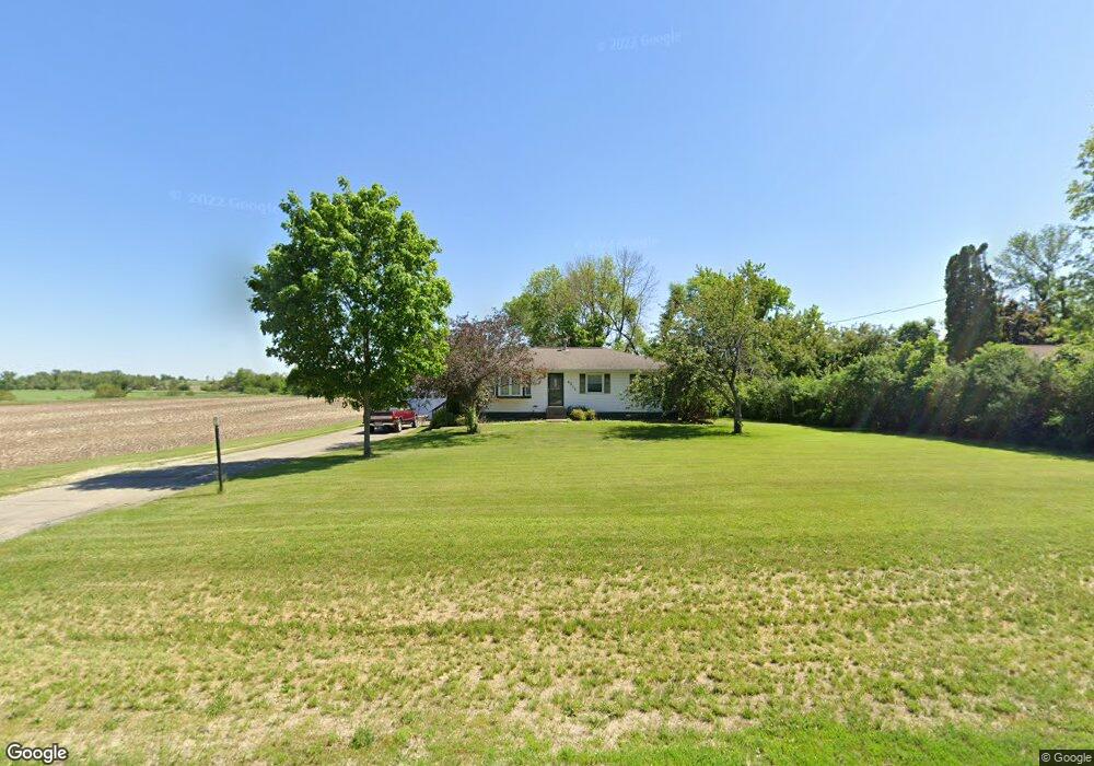
6311 Beverly Rd SW Cedar Rapids, IA 52404
Estimated Value: $244,000 - $360,000
3
Beds
3
Baths
1,092
Sq Ft
$294/Sq Ft
Est. Value
About This Home
This home is located at 6311 Beverly Rd SW, Cedar Rapids, IA 52404 and is currently estimated at $321,082, approximately $294 per square foot. 6311 Beverly Rd SW is a home located in Linn County with nearby schools including Prairie Crest Elementary School, Prairie View Elementary School, and Prairie Ridge Elementary School.
Ownership History
Date
Name
Owned For
Owner Type
Purchase Details
Closed on
Dec 16, 2005
Sold by
Langridge Robert A
Bought by
Zlatohlavek Michael F and Zlatohlavek Nancy K
Current Estimated Value
Home Financials for this Owner
Home Financials are based on the most recent Mortgage that was taken out on this home.
Original Mortgage
$154,700
Outstanding Balance
$87,530
Interest Rate
6.48%
Mortgage Type
Fannie Mae Freddie Mac
Estimated Equity
$233,552
Purchase Details
Closed on
Jun 30, 2002
Sold by
Siewert Wayne E
Bought by
Langridge Robert A
Home Financials for this Owner
Home Financials are based on the most recent Mortgage that was taken out on this home.
Original Mortgage
$130,000
Interest Rate
6.79%
Mortgage Type
Purchase Money Mortgage
Create a Home Valuation Report for This Property
The Home Valuation Report is an in-depth analysis detailing your home's value as well as a comparison with similar homes in the area
Home Values in the Area
Average Home Value in this Area
Purchase History
| Date | Buyer | Sale Price | Title Company |
|---|---|---|---|
| Zlatohlavek Michael F | $181,500 | None Available | |
| Langridge Robert A | $168,500 | -- |
Source: Public Records
Mortgage History
| Date | Status | Borrower | Loan Amount |
|---|---|---|---|
| Open | Zlatohlavek Michael F | $154,700 | |
| Previous Owner | Langridge Robert A | $130,000 |
Source: Public Records
Tax History Compared to Growth
Tax History
| Year | Tax Paid | Tax Assessment Tax Assessment Total Assessment is a certain percentage of the fair market value that is determined by local assessors to be the total taxable value of land and additions on the property. | Land | Improvement |
|---|---|---|---|---|
| 2025 | $4,114 | $344,100 | $78,000 | $266,100 |
| 2024 | $3,436 | $331,100 | $78,000 | $253,100 |
| 2023 | $3,436 | $331,100 | $78,000 | $253,100 |
| 2022 | $3,378 | $236,200 | $78,000 | $158,200 |
| 2021 | $3,064 | $236,100 | $78,000 | $158,100 |
| 2020 | $3,064 | $203,700 | $55,000 | $148,700 |
| 2019 | $2,934 | $196,900 | $55,000 | $141,900 |
| 2018 | $2,864 | $196,900 | $55,000 | $141,900 |
| 2017 | $2,932 | $194,900 | $55,000 | $139,900 |
| 2016 | $2,932 | $194,900 | $55,000 | $139,900 |
| 2015 | $2,918 | $194,900 | $55,000 | $139,900 |
| 2014 | $2,918 | $194,900 | $55,000 | $139,900 |
| 2013 | $2,742 | $194,900 | $55,000 | $139,900 |
Source: Public Records
Map
Nearby Homes
- 3712 Stoneview Cir SW Unit 3712
- 3516 Stoneview Cir SW Unit 3516
- 5705 Beverly Rd SW
- 3555 Stoney Point Rd SW Unit 3555
- 7106 Water View Dr SW
- 7104 Waterview Dr SW
- 3337 Stoneview Cir SW Unit 3337
- 3335 Stoneview Cir SW Unit 3335
- 5901 Williams Blvd SW
- 3600 Falcon View Rd SW
- 7110 Waterview Dr SW
- 7112 Water View Dr SW
- 3309 Stoneview Cir SW
- 4048 Lakeview Dr SW
- 3304 Stoneview Cir SW Unit 3304
- 4124 Lakeview Dr SW Unit 4124
- 3550 Stone Creek Cir SW Unit 313
- 3550 Stone Creek Cir SW Unit 105
- 315 Highland Ct
- 311 Highland Ave
- 6401 Beverly Rd SW
- 6405 Beverly Rd SW
- 6400 Beverly Rd SW
- 6200 Beverly Rd SW
- 6409 Beverly Rd SW
- 6500 Beverly Rd SW
- 6439 Williams Blvd
- 6429 Williams Blvd
- 500 Meadow Oak Cir
- 502 Meadow Oak Cir
- 558 Meadow Oak Cir
- 504 Meadow Oak Cir
- 556 Meadow Oak Cir
- 506 Meadow Oak Cir
- 554 Meadow Oak Cir
- 552 Meadow Oak Cir
- 508 Meadow Oak Cir
- 510 Meadow Oak Cir
- 566 Meadow Oak Cir
- 548 Meadow Oak Cir