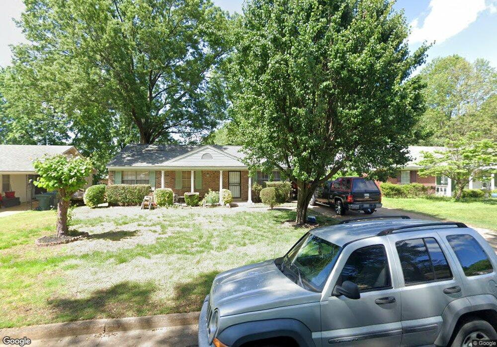
6312 Bronte Ave Memphis, TN 38134
Cordova NeighborhoodEstimated Value: $144,000 - $185,000
2
Beds
2
Baths
1,296
Sq Ft
$128/Sq Ft
Est. Value
About This Home
This home is located at 6312 Bronte Ave, Memphis, TN 38134 and is currently estimated at $165,576, approximately $127 per square foot. 6312 Bronte Ave is a home located in Shelby County with nearby schools including White Station Elementary School, White Station Middle, and White Station High.
Ownership History
Date
Name
Owned For
Owner Type
Purchase Details
Closed on
Jun 16, 2004
Sold by
Kennon Dwayne B and Kennon Vera J
Bought by
Sapien Jesus J and Zapien Maria Leticia
Current Estimated Value
Home Financials for this Owner
Home Financials are based on the most recent Mortgage that was taken out on this home.
Original Mortgage
$100,000
Outstanding Balance
$49,701
Interest Rate
6.25%
Mortgage Type
Purchase Money Mortgage
Estimated Equity
$115,875
Purchase Details
Closed on
Dec 2, 1997
Sold by
Kennon Gregory Dwayne and Kennon Leah Beth Teems
Bought by
Kennon Dwayne B and Kennon Vera J
Create a Home Valuation Report for This Property
The Home Valuation Report is an in-depth analysis detailing your home's value as well as a comparison with similar homes in the area
Home Values in the Area
Average Home Value in this Area
Purchase History
| Date | Buyer | Sale Price | Title Company |
|---|---|---|---|
| Sapien Jesus J | $100,000 | -- | |
| Kennon Dwayne B | $66,000 | -- |
Source: Public Records
Mortgage History
| Date | Status | Borrower | Loan Amount |
|---|---|---|---|
| Open | Sapien Jesus J | $100,000 |
Source: Public Records
Tax History Compared to Growth
Tax History
| Year | Tax Paid | Tax Assessment Tax Assessment Total Assessment is a certain percentage of the fair market value that is determined by local assessors to be the total taxable value of land and additions on the property. | Land | Improvement |
|---|---|---|---|---|
| 2025 | $899 | $35,525 | $5,750 | $29,775 |
| 2024 | $899 | $26,525 | $4,250 | $22,275 |
| 2023 | $1,616 | $26,525 | $4,250 | $22,275 |
| 2022 | $1,616 | $26,525 | $4,250 | $22,275 |
| 2021 | $1,635 | $26,525 | $4,250 | $22,275 |
| 2020 | $1,277 | $17,625 | $4,250 | $13,375 |
| 2019 | $1,277 | $17,625 | $4,250 | $13,375 |
| 2018 | $1,277 | $17,625 | $4,250 | $13,375 |
| 2017 | $724 | $17,625 | $4,250 | $13,375 |
| 2016 | $733 | $16,775 | $0 | $0 |
| 2014 | $733 | $16,775 | $0 | $0 |
Source: Public Records
Map
Nearby Homes
- 1472 Kinilwood St
- 1339 Mullins Station Rd
- 1289 Heathcliff Dr
- 0 Mullins Station Rd
- 6690 Whitten Pine Dr
- 1461 Phillips Rd
- 6774 Whitten Pine Dr
- 6838 Lagrange Cir N
- 6840 Lagrange Pines Rd
- 6830 Garmin Ln
- 6916 Lagrange Pines Rd
- 6880 Wrigley Dr
- 0 Summer Ave Unit 10195870
- 0 Summer Ave Unit 10200827
- 0 Summer Ave Unit 10195869
- 6925 Raleigh Lagrange Rd
- 6321 Ashton Rd
- 7020 Wynne Ridge Rd N
- 7004 Presmond Rd
- 5583 Crestview Rd
- 6306 Bronte Ave
- 6318 Bronte Ave
- 6309 Macon Rd
- 6298 Bronte Ave
- 6326 Bronte Ave
- 6317 Macon Rd
- 6303 Macon Rd
- 6323 Macon Rd
- 6313 Bronte Ave
- 6297 Macon Rd
- 6319 Bronte Ave
- 6305 Bronte Ave
- 6332 Bronte Ave
- 6297 Bronte Ave
- 6329 Macon Rd
- 1382 Heathcliff Dr
- 6333 Bronte Ave
- 6340 Bronte Ave
- 6335 Macon Rd
- 1337 Merimac Cove