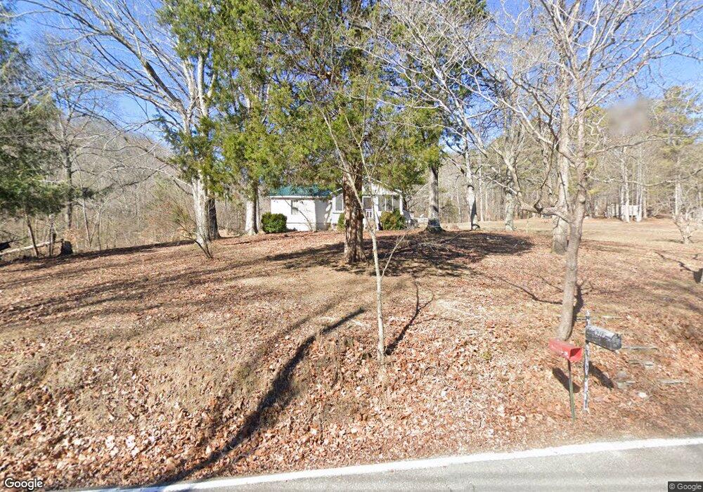
6313 White Oak Valley Cir Mc Donald, TN 37353
Estimated Value: $180,000 - $654,000
--
Bed
--
Bath
1,056
Sq Ft
$351/Sq Ft
Est. Value
About This Home
This home is located at 6313 White Oak Valley Cir, Mc Donald, TN 37353 and is currently estimated at $370,537, approximately $350 per square foot. 6313 White Oak Valley Cir is a home located in Hamilton County with nearby schools including Ooltewah Elementary School, Hunter Middle School, and Ooltewah High School.
Ownership History
Date
Name
Owned For
Owner Type
Purchase Details
Closed on
Aug 26, 2003
Sold by
Lewis David and Lewis Lynn
Bought by
Lewis Robert W
Current Estimated Value
Purchase Details
Closed on
Aug 14, 2003
Sold by
Coffee Jimmy and Coffee Eleanor
Bought by
Lewis Robert W
Purchase Details
Closed on
Nov 7, 1996
Sold by
Coffee Eleanor and Foy Glenda
Bought by
Lewis Lloyd and Lewis Debra
Home Financials for this Owner
Home Financials are based on the most recent Mortgage that was taken out on this home.
Original Mortgage
$53,100
Interest Rate
8.02%
Mortgage Type
Balloon
Create a Home Valuation Report for This Property
The Home Valuation Report is an in-depth analysis detailing your home's value as well as a comparison with similar homes in the area
Home Values in the Area
Average Home Value in this Area
Purchase History
| Date | Buyer | Sale Price | Title Company |
|---|---|---|---|
| Lewis Robert W | $10,000 | -- | |
| Lewis Robert W | $10,000 | -- | |
| Lewis Lloyd | $48,000 | -- |
Source: Public Records
Mortgage History
| Date | Status | Borrower | Loan Amount |
|---|---|---|---|
| Previous Owner | Lewis Lloyd | $53,100 |
Source: Public Records
Tax History Compared to Growth
Tax History
| Year | Tax Paid | Tax Assessment Tax Assessment Total Assessment is a certain percentage of the fair market value that is determined by local assessors to be the total taxable value of land and additions on the property. | Land | Improvement |
|---|---|---|---|---|
| 2024 | $817 | $36,525 | $0 | $0 |
| 2023 | $817 | $36,525 | $0 | $0 |
| 2022 | $817 | $36,525 | $0 | $0 |
| 2021 | $817 | $36,525 | $0 | $0 |
| 2020 | $840 | $30,375 | $0 | $0 |
| 2019 | $840 | $30,375 | $0 | $0 |
| 2018 | $840 | $30,375 | $0 | $0 |
| 2017 | $840 | $30,375 | $0 | $0 |
| 2016 | $814 | $0 | $0 | $0 |
| 2015 | $814 | $29,425 | $0 | $0 |
| 2014 | $814 | $0 | $0 | $0 |
Source: Public Records
Map
Nearby Homes
- 6707 White Oak Valley Cir
- 6130 Gilchrist Ln
- 6131 Gilchrist Ln
- 6118 Gilchrist Ln
- 6048 White Oak Valley Cir
- 6107 Gilchrist Ln
- 6124 Gilchrist Ln
- 9369 Hopi Trail
- 7160 Neville Dr
- 6508 Satjanon Dr
- 6775 Doughboys Ln
- 6515 Satjanon Dr
- 6771 Swiff Ln
- 6567 Satjanon Dr
- 10688 Pine Hill Rd
- 5674 S Lee Hwy
- 8806 Grey Wolf Dr
- Barrett Model Plan at Rogers Branch
- Kent Hodel Plan at Rogers Branch
- Sterling Model Plan at Rogers Branch
- 6323 White Oak Valley Cir
- 6325 White Oak Valley Cir
- 6261 White Oak Valley Cir
- 6821 White Oak Valley Cir
- 0 White Oak Valley Cir
- 6429 White Oak Valley Cir
- 6138 White Oak Valley Cir
- 10411 Lee Hwy
- 6115 White Oak Valley Cir
- 6301 White Oak Valley Cir
- 6114 White Oak Valley Cir
- 6509 White Oak Valley Cir
- 6111 White Oak Valley Cir
- 6110 White Oak Valley Cir
- 10433 Lee Hwy
- 6508 White Oak Valley Cir
- 6106 White Oak Valley Cir
- 6103 White Oak Valley Cir
- 6100 White Oak Valley Cir
- 6514 White Oak Valley Cir