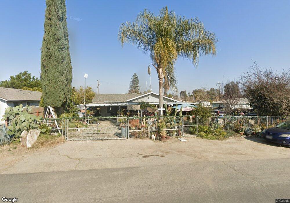
6316 W Gladys Ave Raisin City, CA 93652
Estimated Value: $262,000 - $315,000
4
Beds
2
Baths
1,350
Sq Ft
$212/Sq Ft
Est. Value
About This Home
This home is located at 6316 W Gladys Ave, Raisin City, CA 93652 and is currently estimated at $285,719, approximately $211 per square foot. 6316 W Gladys Ave is a home with nearby schools including Raisin City Elementary School.
Ownership History
Date
Name
Owned For
Owner Type
Purchase Details
Closed on
Aug 11, 2022
Sold by
Zuniga and Crystal
Bought by
Eloy Ramirez A and Ramirez Graciela
Current Estimated Value
Purchase Details
Closed on
Dec 29, 2017
Sold by
Ramirez Ramirez A and Ramirez Graciela
Bought by
Zuniga Maximiano and Ramirez Crystal
Purchase Details
Closed on
Jun 24, 2009
Sold by
Ramirez Eloy and Ramirez Veronica
Bought by
Ramirez Eloy A and Ramirez Graciela
Purchase Details
Closed on
Jul 29, 2003
Sold by
Ramirez Eloy A and Ramirez Graciela
Bought by
Ramirez Eloy and Ramirez Veronica
Create a Home Valuation Report for This Property
The Home Valuation Report is an in-depth analysis detailing your home's value as well as a comparison with similar homes in the area
Home Values in the Area
Average Home Value in this Area
Purchase History
| Date | Buyer | Sale Price | Title Company |
|---|---|---|---|
| Eloy Ramirez A | -- | None Listed On Document | |
| Zuniga Maximiano | -- | None Available | |
| Ramirez Eloy A | -- | None Available | |
| Ramirez Eloy | -- | None Available |
Source: Public Records
Tax History Compared to Growth
Tax History
| Year | Tax Paid | Tax Assessment Tax Assessment Total Assessment is a certain percentage of the fair market value that is determined by local assessors to be the total taxable value of land and additions on the property. | Land | Improvement |
|---|---|---|---|---|
| 2025 | $1,449 | $133,847 | $13,513 | $120,334 |
| 2023 | $1,425 | $128,652 | $12,990 | $115,662 |
| 2022 | $1,406 | $126,131 | $12,736 | $113,395 |
| 2021 | $1,371 | $123,659 | $12,487 | $111,172 |
| 2020 | $1,366 | $122,392 | $12,359 | $110,033 |
| 2019 | $1,344 | $119,993 | $12,117 | $107,876 |
| 2018 | $1,321 | $117,641 | $11,880 | $105,761 |
| 2017 | $1,296 | $115,336 | $11,648 | $103,688 |
| 2016 | $1,255 | $113,075 | $11,420 | $101,655 |
| 2015 | $1,308 | $111,378 | $11,249 | $100,129 |
| 2014 | $1,296 | $109,197 | $11,029 | $98,168 |
Source: Public Records
Map
Nearby Homes
- 5920 W Springfield Ave
- 9707 S Henderson Rd
- 10420 Manning Ave
- 9890 S Hayes Ave
- 10690 S Henderson Rd
- 2186 S Ivy Ave
- 7455 W Lincoln Ave
- 6066 S Cornelia Ave
- 2328 S Cherry Ave
- 0 S Marks Ave Unit 637440
- 11561 S Hughes Ave
- 12441 S Henderson Rd
- 1176 W Parlier Ave
- 0 S Walnut Ave Unit 631183
- 0 S Walnut Ave Unit 627754
- 12250 S Jameson Ave
- 1375 W Rose Ave
- 2810 W Missouri Ave
- 2680 W Malaga Ave
- 2423 W Sandy St
- 9161 S Oleander Ave
- 6352 W Gladys Ave
- 6321 W Myrtle Ave
- 6341 W Myrtle Ave
- 6319 W Myrtle Ave
- 9162 S Oleander Ave
- 9142 S Oleander Ave
- 6353 W Myrtle Ave
- 9184 S Oleander Ave
- 9124 S Oleander Ave
- 6340 W Myrtle Ave
- 7280 S Springfield Ave
- 6320 W Myrtle Ave
- 6269 W Gladys Ave
- 6350 W Myrtle Ave
- 9100 S Oleander Ave
- 9153 S Ormus Ave
- 9139 S Ormus Ave
- 6330 W Bowles Ave
- 9161 S Ormus Ave