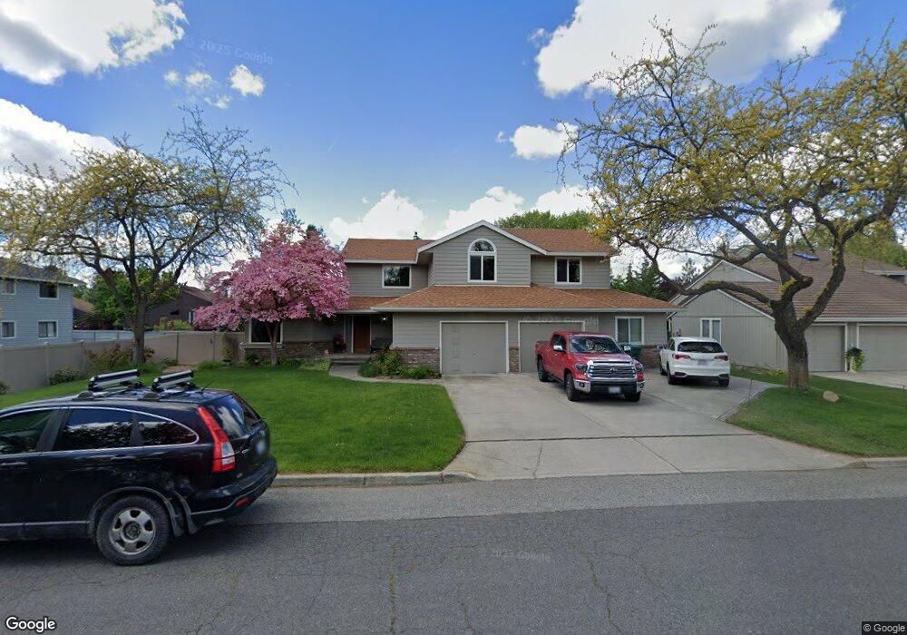
6318 S Ray Ct Spokane, WA 99223
Moran Prairie NeighborhoodEstimated Value: $608,853 - $696,000
3
Beds
3
Baths
2,958
Sq Ft
$224/Sq Ft
Est. Value
About This Home
This home is located at 6318 S Ray Ct, Spokane, WA 99223 and is currently estimated at $661,213, approximately $223 per square foot. 6318 S Ray Ct is a home located in Spokane County with nearby schools including Mullan Road Elementary School, Sacajawea Middle School, and Ferris High School.
Ownership History
Date
Name
Owned For
Owner Type
Purchase Details
Closed on
Aug 17, 2001
Sold by
Wallace John R and Wallace Elizabeth H
Bought by
Maxwell James A and Maxwell Amy C
Current Estimated Value
Home Financials for this Owner
Home Financials are based on the most recent Mortgage that was taken out on this home.
Original Mortgage
$160,000
Outstanding Balance
$62,594
Interest Rate
7.19%
Estimated Equity
$598,619
Purchase Details
Closed on
Jun 9, 1995
Sold by
Smith Kevin C and Smith Cathy C
Bought by
Wallace John R and Wallace Elizabeth H
Home Financials for this Owner
Home Financials are based on the most recent Mortgage that was taken out on this home.
Original Mortgage
$155,600
Interest Rate
8.37%
Create a Home Valuation Report for This Property
The Home Valuation Report is an in-depth analysis detailing your home's value as well as a comparison with similar homes in the area
Home Values in the Area
Average Home Value in this Area
Purchase History
| Date | Buyer | Sale Price | Title Company |
|---|---|---|---|
| Maxwell James A | $203,000 | Spokane County Title Co | |
| Wallace John R | $194,500 | -- |
Source: Public Records
Mortgage History
| Date | Status | Borrower | Loan Amount |
|---|---|---|---|
| Open | Maxwell James A | $160,000 | |
| Previous Owner | Wallace John R | $155,600 |
Source: Public Records
Tax History
| Year | Tax Paid | Tax Assessment Tax Assessment Total Assessment is a certain percentage of the fair market value that is determined by local assessors to be the total taxable value of land and additions on the property. | Land | Improvement |
|---|---|---|---|---|
| 2025 | $5,672 | $555,900 | $110,000 | $445,900 |
| 2024 | $5,672 | $549,900 | $95,000 | $454,900 |
| 2023 | $5,286 | $539,900 | $85,000 | $454,900 |
| 2022 | $5,196 | $526,100 | $75,000 | $451,100 |
| 2021 | $4,533 | $374,700 | $60,000 | $314,700 |
| 2020 | $3,590 | $285,000 | $55,000 | $230,000 |
| 2019 | $3,030 | $245,000 | $45,000 | $200,000 |
| 2018 | $3,299 | $227,500 | $45,000 | $182,500 |
| 2017 | $3,126 | $217,900 | $42,000 | $175,900 |
| 2016 | $3,067 | $209,900 | $42,000 | $167,900 |
| 2015 | $2,948 | $203,800 | $42,000 | $161,800 |
| 2014 | -- | $196,700 | $40,000 | $156,700 |
| 2013 | -- | $0 | $0 | $0 |
Source: Public Records
Map
Nearby Homes
- 6315 S Moran Dr
- 2920 E 62nd Ave
- 3514 E 61st Ave
- 3326 E 55th Ave
- 6018 S Stone St
- 2106 E 63rd Ave
- 2215 E 58th Ct
- 5915 S Dearborn Rd
- 3408 E 48th Ct
- 6111 S Pittsburg St
- 2209 E 52nd Ln
- 1804 E 63rd Ave
- 1718 E 60th Ave
- 5110 S Glenngrae Ct
- 1607 E 63rd Ave
- 2202 E 50th Ave
- 4517 S Sheri Ct Unit C
- 4420 E 51st Ln
- 4503 S Sheri Ct Unit 2
- 1504 E 64th Ave
Your Personal Tour Guide
Ask me questions while you tour the home.