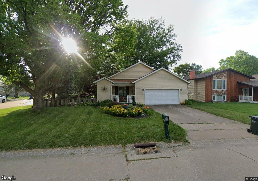
6319 N Howell St Davenport, IA 52806
North Side NeighborhoodEstimated Value: $180,000 - $209,121
2
Beds
2
Baths
1,208
Sq Ft
$162/Sq Ft
Est. Value
About This Home
This home is located at 6319 N Howell St, Davenport, IA 52806 and is currently estimated at $196,280, approximately $162 per square foot. 6319 N Howell St is a home located in Scott County with nearby schools including Cumberland Hall School, Academy Of Continuing Education, and Wood Intermediate School.
Ownership History
Date
Name
Owned For
Owner Type
Purchase Details
Closed on
Aug 2, 2023
Sold by
Peeters Mary Ellen
Bought by
Mary Ellen Peeters Revocable Trust
Current Estimated Value
Create a Home Valuation Report for This Property
The Home Valuation Report is an in-depth analysis detailing your home's value as well as a comparison with similar homes in the area
Home Values in the Area
Average Home Value in this Area
Purchase History
| Date | Buyer | Sale Price | Title Company |
|---|---|---|---|
| Mary Ellen Peeters Revocable Trust | -- | None Listed On Document |
Source: Public Records
Tax History Compared to Growth
Tax History
| Year | Tax Paid | Tax Assessment Tax Assessment Total Assessment is a certain percentage of the fair market value that is determined by local assessors to be the total taxable value of land and additions on the property. | Land | Improvement |
|---|---|---|---|---|
| 2025 | $2,420 | $179,460 | $34,410 | $145,050 |
| 2024 | $2,470 | $167,790 | $34,410 | $133,380 |
| 2023 | $2,740 | $167,790 | $34,410 | $133,380 |
| 2022 | $2,750 | $140,520 | $28,160 | $112,360 |
| 2021 | $2,750 | $140,520 | $28,160 | $112,360 |
| 2020 | $2,608 | $132,200 | $28,160 | $104,040 |
| 2019 | $2,538 | $124,910 | $28,160 | $96,750 |
| 2018 | $2,478 | $124,910 | $28,160 | $96,750 |
| 2017 | $676 | $124,910 | $28,160 | $96,750 |
| 2016 | $2,404 | $121,790 | $0 | $0 |
| 2015 | $2,404 | $120,200 | $0 | $0 |
| 2014 | $2,402 | $120,200 | $0 | $0 |
| 2013 | $2,354 | $0 | $0 | $0 |
| 2012 | -- | $128,460 | $30,790 | $97,670 |
Source: Public Records
Map
Nearby Homes
- Lot 65 W 66th St
- 6504 Cedar St
- 2012 W 68th St
- 2110 W 68th St
- 1724 W 69th St
- 000 Pacific St
- 2714 W 66th St
- 2822 High Point Dr
- 1415 W 59th St
- 2113 W 75th Place
- 5510 N Division St
- 5803 Fillmore Ln
- 1301 W 62nd Ct
- SWQ - Division W 76th St
- Division St N & W 76th St
- SEQ - Division W 76th St
- 6050 Hillandale Rd
- 5735 Taylor St
- 5824 Hillandale Rd
- 5812 Hillandale Rd
- 6313 N Howell St
- 1834 W 64th St
- 1805 W 64th St
- 6303 N Howell St
- 6320 Wilkes Ave
- 6324 N Howell St
- 6316 N Howell St
- 1810 W 64th St
- 6318 Wilkes Ave
- 6404 N Howell St
- 6411 N Howell St
- 6308 N Howell St
- 6229 N Howell St
- 6410 Wilkes Ave
- 6410 N Howell St
- 6302 N Howell St
- 6310 Wilkes Ave
- 6223 N Howell St
- 6418 Wilkes Ave
- 6325 Wilkes Ave