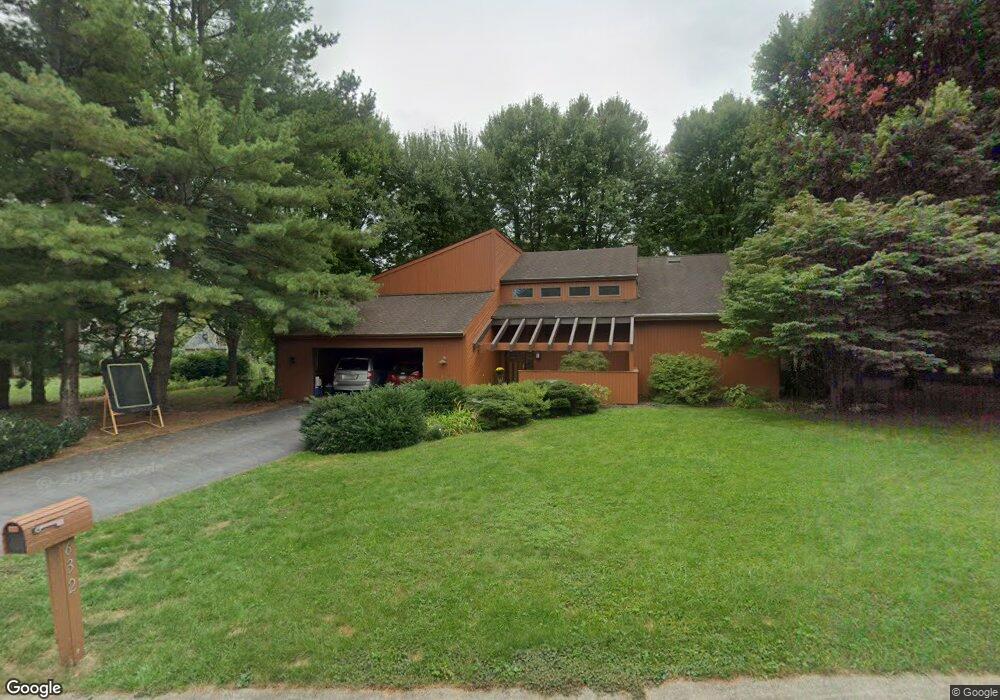
632 Laurel Ln Lancaster, PA 17601
Kissel Hill NeighborhoodEstimated Value: $634,000 - $829,000
4
Beds
3
Baths
3,624
Sq Ft
$194/Sq Ft
Est. Value
About This Home
This home is located at 632 Laurel Ln, Lancaster, PA 17601 and is currently estimated at $702,533, approximately $193 per square foot. 632 Laurel Ln is a home located in Lancaster County with nearby schools including Neff School, Landis Run Intermediate School, and Manheim Township Middle School.
Ownership History
Date
Name
Owned For
Owner Type
Purchase Details
Closed on
Jun 26, 2009
Sold by
Vieth Richard F and Vieth Norma Jean
Bought by
Witmer Matthew J and Vorhis Natalie K
Current Estimated Value
Home Financials for this Owner
Home Financials are based on the most recent Mortgage that was taken out on this home.
Original Mortgage
$354,600
Outstanding Balance
$226,084
Interest Rate
4.86%
Mortgage Type
Stand Alone First
Estimated Equity
$476,449
Create a Home Valuation Report for This Property
The Home Valuation Report is an in-depth analysis detailing your home's value as well as a comparison with similar homes in the area
Home Values in the Area
Average Home Value in this Area
Purchase History
| Date | Buyer | Sale Price | Title Company |
|---|---|---|---|
| Witmer Matthew J | $394,000 | Conestoga Title Insurance Co |
Source: Public Records
Mortgage History
| Date | Status | Borrower | Loan Amount |
|---|---|---|---|
| Open | Witmer Matthew J | $354,600 |
Source: Public Records
Tax History Compared to Growth
Tax History
| Year | Tax Paid | Tax Assessment Tax Assessment Total Assessment is a certain percentage of the fair market value that is determined by local assessors to be the total taxable value of land and additions on the property. | Land | Improvement |
|---|---|---|---|---|
| 2025 | $6,950 | $321,200 | $90,400 | $230,800 |
| 2024 | $6,950 | $321,200 | $90,400 | $230,800 |
| 2023 | $6,769 | $321,200 | $90,400 | $230,800 |
| 2022 | $6,655 | $321,200 | $90,400 | $230,800 |
| 2021 | $6,506 | $321,200 | $90,400 | $230,800 |
| 2020 | $6,506 | $321,200 | $90,400 | $230,800 |
| 2019 | $6,443 | $321,200 | $90,400 | $230,800 |
| 2018 | $4,746 | $321,200 | $90,400 | $230,800 |
| 2017 | $5,865 | $230,500 | $57,700 | $172,800 |
| 2016 | $5,865 | $230,500 | $57,700 | $172,800 |
| 2015 | $1,474 | $230,500 | $57,700 | $172,800 |
| 2014 | $4,189 | $230,500 | $57,700 | $172,800 |
Source: Public Records
Map
Nearby Homes
- 438 Coach House Ln
- 354 Valleybrook Dr
- 333 Ashford Dr
- 446 Valleybrook Dr Unit 446
- 141 Summer Ln
- 539 Sierra Ln
- 2524 Saddle Dr
- 514 Dolly Dr
- 2380 Lititz Pike
- 614 Dolly Dr
- 60 Waverly Ave
- 212 Greenview Dr Unit T2212
- 406 Teddy Ave
- 2648 Stagecoach Ln
- 13 Alderwood Way
- 81 Buch Ave
- 120 Baneberry Ln
- 1006 Cobblestone Ln
- 301 Fletcher Dr - Parkside Phase 5 Lot 36
- 1233 Hunsicker Rd
- 640 Laurel Ln
- 608 Laurel Ln
- 600 Laurel Ln
- 637 Laurel Ln
- 601 Laurel Ln
- 609 Laurel Ln
- 616 Laurel Ln
- 2930 Brookfield Rd
- 2924 Brookfield Rd
- 2936 Brookfield Rd
- 592 Laurel Ln
- 624 Laurel Ln
- 621 Laurel Ln
- 595 Laurel Ln
- 604 Wallingford Rd
- 608 Wallingford Rd
- 600 Wallingford Rd
- 2942 Brookfield Rd
- 612 Wallingford Rd
- 2912 Brookfield Rd