Estimated Value: $343,000 - $383,000
3
Beds
2
Baths
1,798
Sq Ft
$200/Sq Ft
Est. Value
About This Home
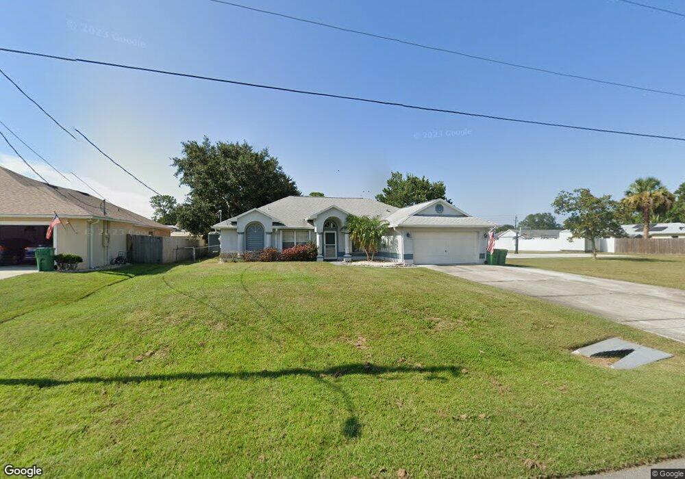
This home is located at 6320 Angus St, Cocoa, FL 32927 and is currently estimated at $360,376, approximately $200 per square foot. 6320 Angus St is a home located in Brevard County with nearby schools including Enterprise Elementary School, Space Coast Junior/Senior High School, and East Atlantic Prep of Brevard County.
Ownership History
Date
Name
Owned For
Owner Type
Purchase Details
Closed on
Sep 24, 2020
Sold by
Petit James P
Bought by
Petit James P and Petit Vivian M
Current Estimated Value
Purchase Details
Closed on
Oct 9, 1998
Sold by
Mercedes Homes Inc
Bought by
Petit James P
Home Financials for this Owner
Home Financials are based on the most recent Mortgage that was taken out on this home.
Original Mortgage
$95,706
Outstanding Balance
$21,044
Interest Rate
6.95%
Estimated Equity
$339,332
Purchase Details
Closed on
May 21, 1998
Sold by
Kimbley James and Kimbley Rose
Bought by
Mercedes Homes Inc
Create a Home Valuation Report for This Property
The Home Valuation Report is an in-depth analysis detailing your home's value as well as a comparison with similar homes in the area
Home Values in the Area
Average Home Value in this Area
Purchase History
| Date | Buyer | Sale Price | Title Company |
|---|---|---|---|
| Petit James P | -- | Accommodation | |
| Petit James P | $97,800 | -- | |
| Mercedes Homes Inc | $12,000 | -- |
Source: Public Records
Mortgage History
| Date | Status | Borrower | Loan Amount |
|---|---|---|---|
| Open | Petit James P | $95,706 |
Source: Public Records
Tax History Compared to Growth
Tax History
| Year | Tax Paid | Tax Assessment Tax Assessment Total Assessment is a certain percentage of the fair market value that is determined by local assessors to be the total taxable value of land and additions on the property. | Land | Improvement |
|---|---|---|---|---|
| 2025 | $2,000 | $156,280 | -- | -- |
| 2024 | $1,959 | $151,880 | -- | -- |
| 2023 | $1,959 | $147,460 | $0 | $0 |
| 2022 | $1,265 | $97,860 | $0 | $0 |
| 2021 | $1,258 | $95,010 | $0 | $0 |
| 2020 | $1,262 | $93,700 | $0 | $0 |
| 2019 | $1,198 | $91,600 | $0 | $0 |
| 2018 | $1,190 | $89,900 | $0 | $0 |
| 2017 | $1,182 | $88,060 | $0 | $0 |
| 2016 | $1,183 | $86,250 | $18,000 | $68,250 |
| 2015 | $1,196 | $85,660 | $15,000 | $70,660 |
| 2014 | $1,196 | $84,980 | $11,000 | $73,980 |
Source: Public Records
Map
Nearby Homes
- 6115 Allmont St
- 6295 Banyan St
- 6105 Banyan St
- 6545 Addie Ave
- 6481 Muller Ave
- 6530 Bethel St
- 23-35-21-JX-B-2 Aruin St
- 6365 Homestead Ave
- 6665 Addie Ave
- 6198 Dees Rd
- 6470 Aberdeen Ave
- 00000 Golfview Ave
- 6118 Dees Rd
- 5915 Akers St
- 6070 Baltimore Ave
- 6010 Fay Blvd
- 0 Golfview Ave
- 5715 Fairbridge St
- 6309 Alleghany Ave
- 4650 N Highway 1 Hwy
- 6330 Angus St
- 6265 Corsica Blvd
- 6275 Corsica Blvd
- 6340 Angus St
- 6325 Angus St
- 6470 Ailes Ave
- 6315 Angus St
- 6478 Ailes Ave
- 6285 Corsica Blvd
- 6245 Corsica Blvd
- 6460 Ailes Ave
- 6310 Angus St
- 6440 Ailes Ave
- 6420 Ailes Ave
- 0 Ailes Ave
- 6355 Angus Rd
- 6355 Angus St
- 6450 Ailes Ave
- 6316 Dearman St
- 6360 Angus St