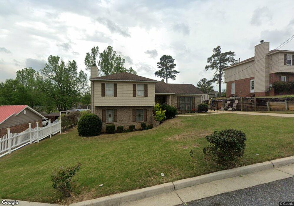
6320 Browning Dr Columbus, GA 31907
Eastern Columbus NeighborhoodEstimated Value: $185,943 - $192,000
4
Beds
3
Baths
1,852
Sq Ft
$103/Sq Ft
Est. Value
About This Home
This home is located at 6320 Browning Dr, Columbus, GA 31907 and is currently estimated at $190,236, approximately $102 per square foot. 6320 Browning Dr is a home located in Muscogee County with nearby schools including Wesley Heights Elementary School, East Columbus Magnet Academy, and Kendrick High School.
Ownership History
Date
Name
Owned For
Owner Type
Purchase Details
Closed on
Jul 15, 2025
Sold by
Milners Rental Properties Llc
Bought by
Middleton Place Properties Llc
Current Estimated Value
Purchase Details
Closed on
Jul 10, 2013
Sold by
Milner Harvey L
Bought by
Milners Rental Properties Llc
Create a Home Valuation Report for This Property
The Home Valuation Report is an in-depth analysis detailing your home's value as well as a comparison with similar homes in the area
Home Values in the Area
Average Home Value in this Area
Purchase History
| Date | Buyer | Sale Price | Title Company |
|---|---|---|---|
| Middleton Place Properties Llc | -- | None Listed On Document | |
| Middleton Place Properties Llc | -- | None Listed On Document | |
| Middleton Place Properties Llc | -- | None Listed On Document | |
| Middleton Place Properties Llc | -- | None Listed On Document | |
| Milners Rental Properties Llc | -- | -- |
Source: Public Records
Tax History Compared to Growth
Tax History
| Year | Tax Paid | Tax Assessment Tax Assessment Total Assessment is a certain percentage of the fair market value that is determined by local assessors to be the total taxable value of land and additions on the property. | Land | Improvement |
|---|---|---|---|---|
| 2025 | $2,119 | $54,120 | $8,756 | $45,364 |
| 2024 | $2,119 | $54,120 | $8,756 | $45,364 |
| 2023 | $1,846 | $59,744 | $8,756 | $50,988 |
| 2022 | $1,913 | $46,860 | $8,756 | $38,104 |
| 2021 | $1,572 | $38,504 | $8,756 | $29,748 |
| 2020 | $1,573 | $38,504 | $8,756 | $29,748 |
| 2019 | $1,578 | $38,504 | $8,756 | $29,748 |
| 2018 | $1,578 | $38,504 | $8,756 | $29,748 |
| 2017 | $1,583 | $38,504 | $8,756 | $29,748 |
| 2016 | $1,697 | $41,140 | $6,400 | $34,740 |
| 2015 | $1,699 | $41,140 | $6,400 | $34,740 |
| 2014 | $680 | $41,140 | $6,400 | $34,740 |
| 2013 | -- | $41,140 | $6,400 | $34,740 |
Source: Public Records
Map
Nearby Homes
- 1754 Mazor Dr
- 1925 Woodhollow Dr
- 1826 Woodhollow Dr
- 1607 Mazor Dr
- 6213 Fitzgerald Dr
- 6916 Bradshaw Dr
- 1322 Melford Dr
- 6032 Cordova Rd
- 6620 Cove Cir
- 6047 Capri Cir
- 6061 Luna Dr
- 6033 Luna Dr
- 6119 Mill Branch Rd
- 2708 Courtland Ave
- 1068 Valencia Dr
- 5920 Gleneden Dr
- 5929 Gleneden Dr
- 6188 Valencia Dr
- 2216 Hunter Ct
- 2525 Corineth Dr
- 6314 Browning Dr
- 6326 Browning Dr
- 6313 Albright Dr
- 6332 Browning Dr
- 6308 Browning Dr
- 6307 Albright Dr
- 6319 Albright Dr
- 6319 Browning Dr
- 6301 Albright Dr
- 6313 Browning Dr
- 6325 Albright Dr
- 6338 Browning Dr
- 6325 Browning Dr
- 6307 Browning Dr
- 6239 Albright Dr
- 6331 Albright Dr
- 6331 Browning Dr
- 6301 Browning Dr
- 6240 Browning Dr
- 1711 Mazor Dr