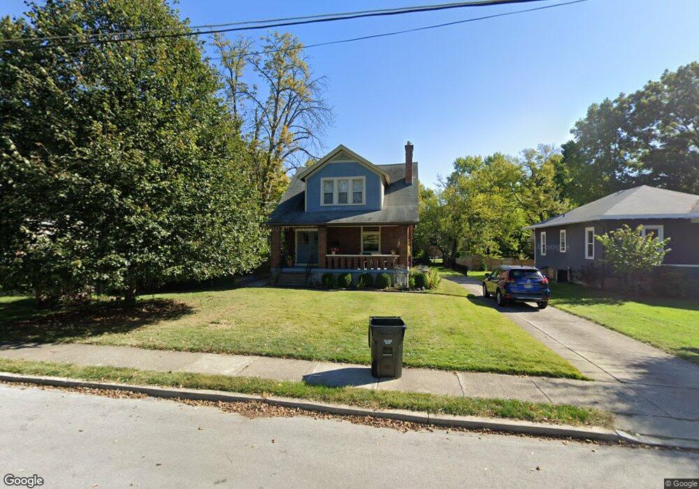
6320 Delphos Ave Cincinnati, OH 45213
Pleasant Ridge NeighborhoodEstimated Value: $339,000 - $433,000
About This Home
This home is located at 6320 Delphos Ave, Cincinnati, OH 45213 and is currently estimated at $363,733, approximately $259 per square foot. 6320 Delphos Ave is a home located in Hamilton County with nearby schools including Pleasant Ridge Montessori School, Shroder High School, and Clark Montessori High School.
Ownership History
We collect this data history from publicly available records. To have your information removed, we recommend requesting removal directly through your county’s website.
Purchase Details
Home Financials for this Owner
Home Financials are based on the most recent Mortgage that was taken out on this home.Purchase Details
Home Values in the Area
Average Home Value in this Area
Purchase History
We collect this data history from publicly available records. To have your information removed, we recommend requesting removal directly through your county’s website.
| Date | Buyer | Sale Price | Title Company |
|---|---|---|---|
| -- | -- | ||
| -- | -- |
Mortgage History
We collect this data history from publicly available records. To have your information removed, we recommend requesting removal directly through your county’s website.
| Date | Status | Borrower | Loan Amount |
|---|---|---|---|
| Open | $126,400 |
Tax History
We collect this data history from publicly available records. To have your information removed, we recommend requesting removal directly through your county’s website.
| Year | Tax Paid | Tax Assessment Tax Assessment Total Assessment is a certain percentage of the fair market value that is determined by local assessors to be the total taxable value of land and additions on the property. | Land | Improvement |
|---|---|---|---|---|
| 2025 | $5,032 | $81,561 | $28,613 | $52,948 |
| 2023 | $4,989 | $81,561 | $28,613 | $52,948 |
| 2022 | $4,474 | $65,566 | $21,578 | $43,988 |
| 2021 | $4,303 | $65,566 | $21,578 | $43,988 |
| 2020 | $4,429 | $65,566 | $21,578 | $43,988 |
| 2019 | $4,138 | $56,039 | $18,442 | $37,597 |
| 2018 | $4,145 | $56,039 | $18,442 | $37,597 |
| 2017 | $3,937 | $56,039 | $18,442 | $37,597 |
| 2016 | $4,656 | $65,381 | $18,386 | $46,995 |
| 2015 | $4,198 | $65,381 | $18,386 | $46,995 |
| 2014 | $4,228 | $65,381 | $18,386 | $46,995 |
| 2013 | $4,097 | $62,269 | $17,511 | $44,758 |
Map
- 6244 Montgomery Rd
- 6114 Woodmont Ave
- 6610 Hudson Pkwy
- 6424 Montgomery Rd
- 3119 N Farmcrest Dr
- 6311 Iris Ave
- 3111 Parkview Ave
- 6300 Lisbon Ave
- 2784 Losantiville Ave
- 6738 Dante Ave
- 5915 Pandora Ave
- 6408 Girard Ave
- 5907 Woodmont Ave
- 6826 Bantry Ave
- 5829 Pandora Ave
- 5913 Kimberly Ave
- 6458 Crestview Ave
- 6454 Crestview Ave
- 6462 Crestview Ave
- 6466 Crestview Ave
- 6316 Delphos Ave
- 3257 Beredith Place
- 3253 Beredith Place
- 6312 Delphos Ave
- 3261 Beredith Place
- 3265 Beredith Place
- 3232 Harvest Ave
- 3234 Harvest Ave
- 3269 Beredith Place
- 3230 Harvest Ave
- 3228 Harvest Ave
- 6309 Kincaid Rd
- 6313 Kincaid Rd
- 3239 Beredith Place
- 6305 Kincaid Rd
- 3273 Beredith Place
- 6303 Kincaid Rd
- 3238 Harvest Ave
- 6321 Delphos Ave
- 3235 Beredith Place
Ask me questions while you tour the home.