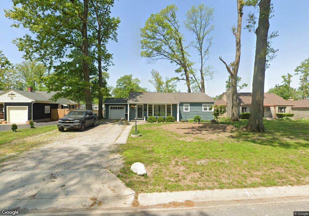
6320 Maywood Cir Fort Wayne, IN 46819
Southwest Fort Wayne NeighborhoodEstimated Value: $161,000 - $185,000
3
Beds
1
Bath
1,220
Sq Ft
$143/Sq Ft
Est. Value
About This Home
This home is located at 6320 Maywood Cir, Fort Wayne, IN 46819 and is currently estimated at $174,471, approximately $143 per square foot. 6320 Maywood Cir is a home located in Allen County with nearby schools including Maplewood Elementary School, Miami Middle School, and Wayne High School.
Ownership History
Date
Name
Owned For
Owner Type
Purchase Details
Closed on
Feb 16, 2019
Sold by
Walker Tillman Sarah and Walker Sarah L
Bought by
Walker Tillman Sarah and Tillman Troy
Current Estimated Value
Home Financials for this Owner
Home Financials are based on the most recent Mortgage that was taken out on this home.
Original Mortgage
$59,000
Interest Rate
4.3%
Mortgage Type
New Conventional
Create a Home Valuation Report for This Property
The Home Valuation Report is an in-depth analysis detailing your home's value as well as a comparison with similar homes in the area
Home Values in the Area
Average Home Value in this Area
Purchase History
| Date | Buyer | Sale Price | Title Company |
|---|---|---|---|
| Walker Tillman Sarah | -- | Timios Inc |
Source: Public Records
Mortgage History
| Date | Status | Borrower | Loan Amount |
|---|---|---|---|
| Closed | Walker Tillman Sarah | $59,000 |
Source: Public Records
Tax History Compared to Growth
Tax History
| Year | Tax Paid | Tax Assessment Tax Assessment Total Assessment is a certain percentage of the fair market value that is determined by local assessors to be the total taxable value of land and additions on the property. | Land | Improvement |
|---|---|---|---|---|
| 2024 | $1,071 | $132,800 | $24,500 | $108,300 |
| 2022 | $953 | $105,800 | $17,300 | $88,500 |
| 2021 | $855 | $96,900 | $17,300 | $79,600 |
| 2020 | $844 | $95,200 | $17,300 | $77,900 |
| 2019 | $733 | $87,700 | $17,300 | $70,400 |
| 2018 | $431 | $66,500 | $17,300 | $49,200 |
| 2017 | $454 | $67,300 | $17,300 | $50,000 |
| 2016 | $410 | $61,700 | $17,300 | $44,400 |
| 2014 | $436 | $65,600 | $17,300 | $48,300 |
| 2013 | $413 | $63,900 | $17,300 | $46,600 |
Source: Public Records
Map
Nearby Homes
- 6305 Bluffton Rd
- 6510 Old Trail Rd
- 2707 Prairie Grove Dr
- 6725 Lakewood Ct
- 1805 Lakewood Dr
- 2904 Pinewood Dr
- 3013 Prairie Grove Dr
- 7324 Springhill Dr
- 2702 Westward Dr
- 3001 Sandpoint Rd
- 7101 Baer Rd
- 5707 Chester Blvd
- 5345 Winchester Rd
- 6706 Fernwood Ave
- 3015 Mcarthur Dr
- 1627 Saint Louis Ave
- 5137 Tyrone Rd
- 5205 Kyle Rd
- 2444 Sandpoint Rd
- 5516 Indiana Ave
- 6316 Maywood Cir
- 6324 Maywood Cir
- 6313 Bluffton Rd
- 6312 Maywood Cir
- 6404 Maywood Cir
- 6311 Bluffton Rd
- 6315 Bluffton Rd
- 6317 Maywood Cir
- 6309 Bluffton Rd
- 6323 Maywood Cir
- 6310 Maywood Cir
- 6411 Bluffton Rd
- 6311 Maywood Cir
- 6412 Maywood Cir
- 6407 Maywood Cir
- 6307 Bluffton Rd
- 6309 Maywood Cir
- 6307 Maywood Cir
- 6418 Maywood Cir
- 6421 Maywood Cir