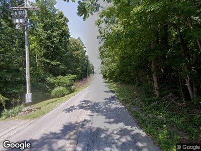
6320 N Tunnel Rd Unionville, IN 47468
Estimated Value: $227,000 - $304,000
3
Beds
2
Baths
2,006
Sq Ft
$130/Sq Ft
Est. Value
About This Home
This home is located at 6320 N Tunnel Rd, Unionville, IN 47468 and is currently estimated at $261,004, approximately $130 per square foot. 6320 N Tunnel Rd is a home located in Monroe County with nearby schools including Unionville Elementary School, Tri-North Middle School, and Bloomington High School North.
Ownership History
Date
Name
Owned For
Owner Type
Purchase Details
Closed on
Oct 7, 2020
Sold by
Foster Carol S and Foster Daniel J
Bought by
Foster Jessica L
Current Estimated Value
Purchase Details
Closed on
Oct 7, 2009
Sold by
Young Maurice T and Young Mabel L
Bought by
Foster Carol S and Foster Daniel J
Home Financials for this Owner
Home Financials are based on the most recent Mortgage that was taken out on this home.
Original Mortgage
$100,000
Outstanding Balance
$68,499
Interest Rate
5.19%
Mortgage Type
New Conventional
Create a Home Valuation Report for This Property
The Home Valuation Report is an in-depth analysis detailing your home's value as well as a comparison with similar homes in the area
Home Values in the Area
Average Home Value in this Area
Purchase History
| Date | Buyer | Sale Price | Title Company |
|---|---|---|---|
| Foster Jessica L | -- | None Available | |
| Foster Carol S | -- | None Available |
Source: Public Records
Mortgage History
| Date | Status | Borrower | Loan Amount |
|---|---|---|---|
| Closed | Foster Carol S | $100,000 |
Source: Public Records
Tax History Compared to Growth
Tax History
| Year | Tax Paid | Tax Assessment Tax Assessment Total Assessment is a certain percentage of the fair market value that is determined by local assessors to be the total taxable value of land and additions on the property. | Land | Improvement |
|---|---|---|---|---|
| 2023 | $1,183 | $165,100 | $52,000 | $113,100 |
| 2022 | $729 | $118,700 | $39,000 | $79,700 |
| 2021 | $754 | $112,500 | $39,000 | $73,500 |
| 2020 | $570 | $102,500 | $26,300 | $76,200 |
| 2019 | $1,356 | $102,500 | $26,300 | $76,200 |
| 2018 | $1,371 | $102,500 | $26,300 | $76,200 |
| 2017 | $1,342 | $99,600 | $26,300 | $73,300 |
| 2016 | $1,304 | $98,600 | $26,300 | $72,300 |
| 2014 | $1,211 | $95,700 | $26,000 | $69,700 |
Source: Public Records
Map
Nearby Homes
- 7898 E Browning Ct
- 6630 Rust Rd
- 6630 Rust Rd Unit 2A and 2B
- 6164 N Shuffle Creek Rd
- 5105 E Earl Young Rd
- 6820 E Rust Rd
- 6825 E State Road 45
- 6820 E State Road 45
- 6437 Wellston Dr
- 0 N Hilltop Dr Unit 202516944
- 6412 E Wellston Dr
- Lot 63 N Viking Ridge Rd Unit 63
- 6425 E Wellston Dr
- 8015 N Lakeview Dr
- 8027 N Lakeview Dr
- 8713 Midview Dr
- 8781 E Southshore Dr
- 2 E Boltinghouse Rd Unit Tract 2
- 2 E Boltinghouse Rd
- 8899 E Southshore Dr
- 6320 N Tunnel Rd
- 6325 N Tunnel Rd
- 6595 E Robinson Rd
- 6591 E Robinson Rd
- 6587 E Robinson Rd
- 6525 E Robinson Rd
- 6570 N Utt Dr
- 6505 E Robinson Rd
- 6199 N Tunnel Rd
- 6550 N Utt Dr
- 6520 N Utt Dr
- 6580 N Utt Dr
- 6495 E Robinson Rd
- 6598 N Utt Dr
- 6640 N Utt Dr
- 6485 E Robinson Rd
- 6555 N Utt Dr
- 6660 N Utt Dr
- 6510 N Utt Dr
- 6565 N Utt Dr
