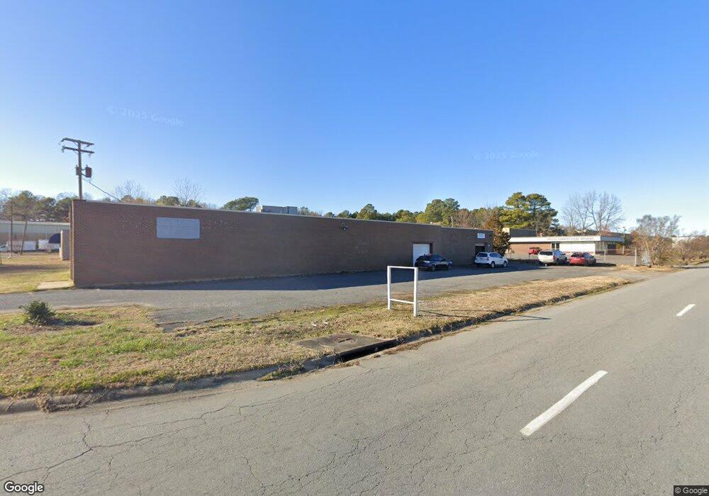
6320 Scott Hamilton Dr Little Rock, AR 72209
Upper Baseline NeighborhoodEstimated Value: $220,308
--
Bed
--
Bath
5,500
Sq Ft
$40/Sq Ft
Est. Value
About This Home
This home is located at 6320 Scott Hamilton Dr, Little Rock, AR 72209 and is currently estimated at $220,308, approximately $40 per square foot. 6320 Scott Hamilton Dr is a home located in Pulaski County with nearby schools including Wakefield Elementary School, Cloverdale Middle School, and Little Rock Southwest High School.
Ownership History
Date
Name
Owned For
Owner Type
Purchase Details
Closed on
Jun 2, 2023
Sold by
Special Ops Uniforms Of Arkansas Inc
Bought by
Ccp Investment Co
Current Estimated Value
Purchase Details
Closed on
Jul 24, 2019
Sold by
Sns Llc
Bought by
Special Ops Uniforms Of Arkansas Inc
Purchase Details
Closed on
Nov 10, 2010
Sold by
G K J Family Limited Partnership
Bought by
Sns Llc
Create a Home Valuation Report for This Property
The Home Valuation Report is an in-depth analysis detailing your home's value as well as a comparison with similar homes in the area
Home Values in the Area
Average Home Value in this Area
Purchase History
| Date | Buyer | Sale Price | Title Company |
|---|---|---|---|
| Ccp Investment Co | $205,000 | Commerce Title | |
| Special Ops Uniforms Of Arkansas Inc | $215,000 | Lenders Title Company | |
| Sns Llc | $230,000 | Standard Abstract & Title Co |
Source: Public Records
Tax History Compared to Growth
Tax History
| Year | Tax Paid | Tax Assessment Tax Assessment Total Assessment is a certain percentage of the fair market value that is determined by local assessors to be the total taxable value of land and additions on the property. | Land | Improvement |
|---|---|---|---|---|
| 2025 | $2,911 | $41,580 | $8,903 | $32,677 |
| 2024 | $2,911 | $41,580 | $8,903 | $32,677 |
| 2023 | $2,911 | $41,580 | $8,903 | $32,677 |
| 2022 | $2,911 | $41,580 | $8,903 | $32,677 |
| 2021 | $3,298 | $46,780 | $8,900 | $37,880 |
| 2020 | $3,275 | $46,780 | $8,900 | $37,880 |
| 2019 | $3,275 | $46,780 | $8,900 | $37,880 |
| 2018 | $3,275 | $46,780 | $8,900 | $37,880 |
| 2017 | $3,275 | $46,780 | $8,900 | $37,880 |
| 2016 | $3,192 | $45,600 | $12,720 | $32,880 |
| 2015 | $3,197 | $45,600 | $12,720 | $32,880 |
| 2014 | $3,197 | $45,600 | $12,720 | $32,880 |
Source: Public Records
Map
Nearby Homes
- 11 Eaton Dr
- 6609 W Wakefield Dr
- 19 Harrow Dr
- 29 Rugby Dr
- 31 Allyson Cir
- 22 Daven Ct
- 13 Daven Ct
- 4712 Gum Springs Rd
- 14 Wellford Dr
- 4905 Gum Springs Rd Unit 4907 Gum Springs Rd
- 105 Lancaster Rd
- 5303 Westminister Dr
- 84 Lancaster Rd
- 24 Rosemoor Dr
- 40 Wellford Dr
- 51 Hill Ln
- 5419 Western Ln
- 5215 Gum Springs Rd
- 000 Young Rd
- 26 Dellwood Dr
- 0 Scott Hamilton
- 6011 Scott Hamilton Dr
- 5+/-Acre Murray St
- 4.65+/-Acre Murray St
- 5 Murray St
- 4.65 acre on Murray St
- 0 Murray St
- 6219 Murray St
- 6200 Patterson Rd
- 5 Oxford Cir
- 3 Oxford Cir
- 6703 E Wakefield Dr
- 6701 E Wakefield Dr
- 4 Oxford Cir
- 6705 E Wakefield Dr
- 6707 E Wakefield Dr
- 2923 W 65th St
- 6709 E Wakefield Dr
- 6615 E Wakefield Dr
- 6801 E Wakefield Dr