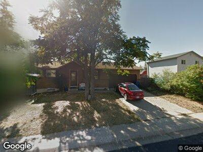
6320 W 111th Ave Westminster, CO 80020
Sheridan Green NeighborhoodEstimated Value: $522,000 - $567,000
3
Beds
3
Baths
848
Sq Ft
$632/Sq Ft
Est. Value
About This Home
This home is located at 6320 W 111th Ave, Westminster, CO 80020 and is currently estimated at $535,647, approximately $631 per square foot. 6320 W 111th Ave is a home located in Jefferson County with nearby schools including Sheridan Green Elementary School, Mandalay Middle School, and Standley Lake High School.
Ownership History
Date
Name
Owned For
Owner Type
Purchase Details
Closed on
Feb 13, 2015
Sold by
Borg Warren William
Bought by
Ssb Two Llc
Current Estimated Value
Purchase Details
Closed on
Dec 16, 2005
Sold by
Borders Brett B
Bought by
Warren E Borg Trust B and Borg Blanche
Purchase Details
Closed on
Sep 19, 1997
Sold by
Borders Brett B and Borders Sherri
Bought by
Borders Brett B
Purchase Details
Closed on
Apr 25, 1997
Sold by
Leslie Cadigan and Leslie D
Bought by
Borders Brett B and Borders Sherri
Home Financials for this Owner
Home Financials are based on the most recent Mortgage that was taken out on this home.
Original Mortgage
$119,905
Interest Rate
7.92%
Mortgage Type
FHA
Create a Home Valuation Report for This Property
The Home Valuation Report is an in-depth analysis detailing your home's value as well as a comparison with similar homes in the area
Home Values in the Area
Average Home Value in this Area
Purchase History
| Date | Buyer | Sale Price | Title Company |
|---|---|---|---|
| Ssb Two Llc | -- | None Available | |
| Ssb Two Llc | -- | None Available | |
| Warren E Borg Trust B | $199,000 | Title America | |
| Borders Brett B | -- | -- | |
| Borders Brett B | $121,000 | Title America |
Source: Public Records
Mortgage History
| Date | Status | Borrower | Loan Amount |
|---|---|---|---|
| Previous Owner | Borders Brett B | $160,000 | |
| Previous Owner | Borders Brett B | $147,200 | |
| Previous Owner | Borders Brett B | $119,905 |
Source: Public Records
Tax History Compared to Growth
Tax History
| Year | Tax Paid | Tax Assessment Tax Assessment Total Assessment is a certain percentage of the fair market value that is determined by local assessors to be the total taxable value of land and additions on the property. | Land | Improvement |
|---|---|---|---|---|
| 2024 | $2,130 | $27,964 | $10,628 | $17,336 |
| 2023 | $2,130 | $27,964 | $10,628 | $17,336 |
| 2022 | $1,859 | $23,909 | $7,730 | $16,179 |
| 2021 | $1,887 | $24,596 | $7,952 | $16,644 |
| 2020 | $1,788 | $23,446 | $7,895 | $15,551 |
| 2019 | $1,760 | $23,446 | $7,895 | $15,551 |
| 2018 | $1,473 | $18,975 | $5,760 | $13,215 |
| 2017 | $1,319 | $18,975 | $5,760 | $13,215 |
| 2016 | $1,332 | $17,783 | $6,233 | $11,550 |
| 2015 | $1,128 | $17,783 | $6,233 | $11,550 |
| 2014 | $1,128 | $14,033 | $5,572 | $8,461 |
Source: Public Records
Map
Nearby Homes
- 6132 W 113th Ave
- 6120 W 111th Ave
- 11031 Marshall St
- 6720 W 112th Place
- 11041 Newland St
- 11397 Kendall St
- 10961 Gray Cir
- 11524 Marshall Ct
- 5831 W 108th Place
- 11510 Otis St
- 5455 W 112th Place
- 10890 Depew Place
- 430 Chestnut Way
- 325 Mulberry Cir
- 11402 Benton Ct
- 234 Cypress Cir
- 11525 Eaton Ct
- 11539 Depew Ct
- 405 Cypress St
- 5425 W 115th Place
- 6320 W 111th Ave
- 6330 W 111th Ave
- 6310 W 111th Ave
- 6321 W 110th Place
- 6311 W 110th Place
- 6331 W 110th Place
- 6410 W 111th Ave
- 6321 W 111th Ave
- 6331 W 111th Ave
- 6290 W 111th Ave
- 6311 W 111th Ave
- 6420 W 111th Ave
- 6341 W 111th Ave
- 6299 W 110th Place
- 6299 W 111th Ave
- 6411 W 111th Ave
- 6320 W 110th Place
- 6421 W 110th Place
- 6330 W 110th Place
- 6280 W 111th Ave