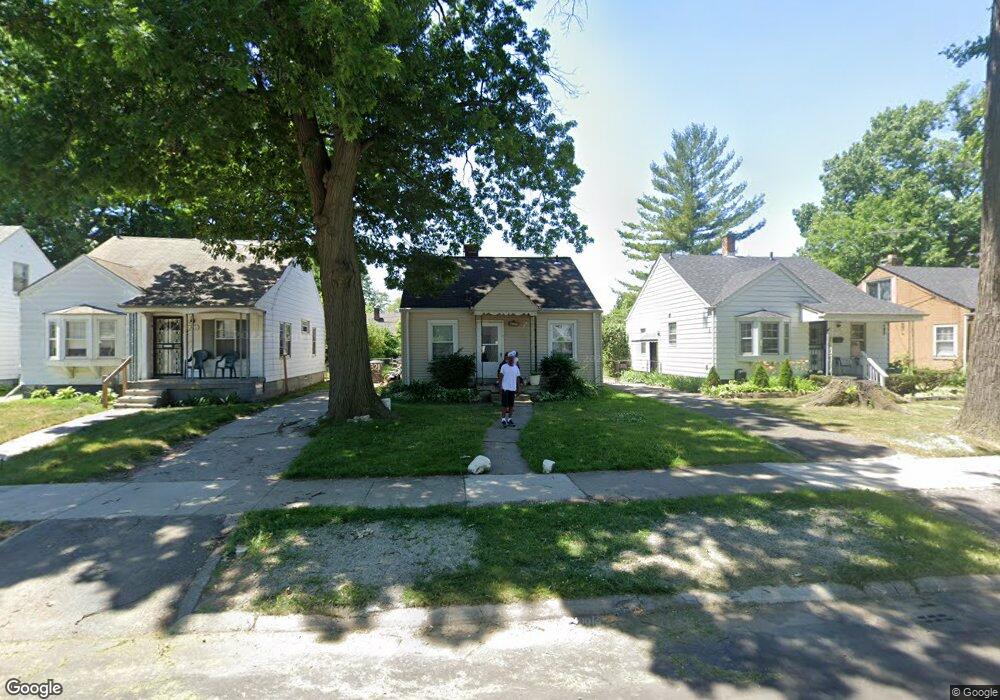
6321 Radnor St Detroit, MI 48224
Cornerstone Village NeighborhoodEstimated Value: $56,000 - $84,950
2
Beds
1
Bath
731
Sq Ft
$96/Sq Ft
Est. Value
About This Home
This home is located at 6321 Radnor St, Detroit, MI 48224 and is currently estimated at $69,988, approximately $95 per square foot. 6321 Radnor St is a home located in Wayne County with nearby schools including Marquette Elementary-Middle School, Edward 'Duke' Ellington Conservatory of Music and Art, and Charles L. Spain Elementary-Middle School.
Ownership History
Date
Name
Owned For
Owner Type
Purchase Details
Closed on
Sep 18, 2008
Sold by
Trott and Trott P
Bought by
Bourdeau Douglas
Current Estimated Value
Purchase Details
Closed on
May 30, 2008
Sold by
Mortgage Electronic Registration Systems
Bought by
Federal National Mortgage Association
Purchase Details
Closed on
May 29, 2008
Sold by
Stockard Theresa M
Bought by
Mortgage Electronic Registration Systems
Create a Home Valuation Report for This Property
The Home Valuation Report is an in-depth analysis detailing your home's value as well as a comparison with similar homes in the area
Home Values in the Area
Average Home Value in this Area
Purchase History
| Date | Buyer | Sale Price | Title Company |
|---|---|---|---|
| Bourdeau Douglas | $3,600 | Warranty Title Agency Llc | |
| Federal National Mortgage Association | -- | None Available | |
| Mortgage Electronic Registration Systems | $60,328 | None Available |
Source: Public Records
Tax History Compared to Growth
Tax History
| Year | Tax Paid | Tax Assessment Tax Assessment Total Assessment is a certain percentage of the fair market value that is determined by local assessors to be the total taxable value of land and additions on the property. | Land | Improvement |
|---|---|---|---|---|
| 2025 | $894 | $27,700 | $0 | $0 |
| 2024 | $894 | $23,700 | $0 | $0 |
| 2023 | $867 | $17,700 | $0 | $0 |
| 2022 | $918 | $13,800 | $0 | $0 |
| 2021 | $896 | $11,000 | $0 | $0 |
| 2020 | $895 | $9,900 | $0 | $0 |
| 2019 | $883 | $8,500 | $0 | $0 |
| 2018 | $787 | $7,100 | $0 | $0 |
| 2017 | $137 | $7,200 | $0 | $0 |
| 2016 | $925 | $9,100 | $0 | $0 |
| 2015 | $910 | $9,100 | $0 | $0 |
| 2013 | $1,296 | $12,955 | $0 | $0 |
| 2010 | -- | $18,994 | $1,010 | $17,984 |
Source: Public Records
Map
Nearby Homes
- 6306 Farmbrook St
- 6166 Farmbrook St
- 6137 Radnor St
- 6144 Radnor St
- 6301 Lodewyck St
- 17918 Chester St
- 17817 Chester St
- 5951 Radnor St
- 5937 Radnor St
- 5981 University Place
- 8850 Farmbrook St
- 21111 Moross Rd
- 18959 Rockcastle St
- 17601 Chester St
- 6015 Hereford St
- 5795 Marseilles St
- 6326 Neff Ave
- 6160 Neff Ave
- 21746 Moross Rd
- 9438 Camley St
- 6329 Radnor St
- 6311 Radnor St
- 6303 Radnor St
- 6335 Radnor St
- 6324 Farmbrook St
- 6343 Radnor St
- 6316 Farmbrook St
- 6332 Farmbrook St
- 6340 Farmbrook St
- 6351 Radnor St
- 6215 Radnor St
- 6346 Farmbrook St
- 6346 Farmbrook St
- 6316 Radnor St
- 6324 Radnor St
- 6310 Radnor St
- 6330 Radnor St
- 6330 Radnor St
- 6361 Radnor St
- 6300 Radnor St