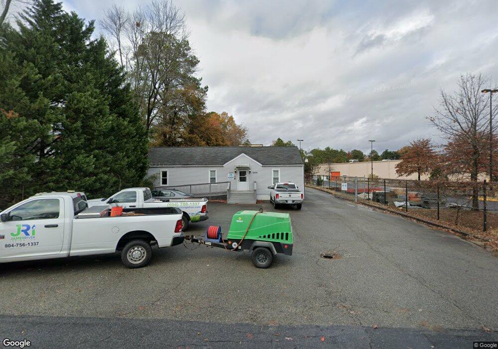
6326 Mallory Dr Richmond, VA 23226
Crestview NeighborhoodEstimated Value: $549,438
--
Bed
--
Bath
2,862
Sq Ft
$192/Sq Ft
Est. Value
About This Home
This home is located at 6326 Mallory Dr, Richmond, VA 23226 and is currently estimated at $549,438, approximately $191 per square foot. 6326 Mallory Dr is a home located in Henrico County with nearby schools including Crestview Elementary School, Tuckahoe Middle School, and Douglas S. Freeman High School.
Ownership History
Date
Name
Owned For
Owner Type
Purchase Details
Closed on
May 23, 2016
Sold by
Harding Management Inc A Virginia Corpor
Bought by
Mallory Re Llc A Virginia Limited Liabil
Current Estimated Value
Home Financials for this Owner
Home Financials are based on the most recent Mortgage that was taken out on this home.
Original Mortgage
$185,000
Outstanding Balance
$146,888
Interest Rate
3.58%
Mortgage Type
Credit Line Revolving
Estimated Equity
$402,550
Purchase Details
Closed on
Feb 1, 1996
Sold by
Meyer George B
Bought by
Cook Anita M
Home Financials for this Owner
Home Financials are based on the most recent Mortgage that was taken out on this home.
Original Mortgage
$200,000
Interest Rate
7.25%
Mortgage Type
Commercial
Create a Home Valuation Report for This Property
The Home Valuation Report is an in-depth analysis detailing your home's value as well as a comparison with similar homes in the area
Home Values in the Area
Average Home Value in this Area
Purchase History
| Date | Buyer | Sale Price | Title Company |
|---|---|---|---|
| Mallory Re Llc A Virginia Limited Liabil | $285,000 | Attorney | |
| Cook Anita M | $220,000 | -- |
Source: Public Records
Mortgage History
| Date | Status | Borrower | Loan Amount |
|---|---|---|---|
| Open | Mallory Re Llc A Virginia Limited Liabil | $185,000 | |
| Previous Owner | Cook Anita M | $200,000 |
Source: Public Records
Tax History Compared to Growth
Tax History
| Year | Tax Paid | Tax Assessment Tax Assessment Total Assessment is a certain percentage of the fair market value that is determined by local assessors to be the total taxable value of land and additions on the property. | Land | Improvement |
|---|---|---|---|---|
| 2025 | $2,936 | $345,500 | $50,000 | $295,500 |
| 2024 | $2,936 | $333,500 | $50,000 | $283,500 |
| 2023 | $2,835 | $333,500 | $50,000 | $283,500 |
| 2022 | $2,680 | $315,300 | $50,000 | $265,300 |
| 2021 | $1,036 | $266,100 | $45,000 | $221,100 |
| 2020 | $2,315 | $266,100 | $45,000 | $221,100 |
| 2019 | $2,293 | $263,600 | $45,000 | $218,600 |
| 2018 | $2,072 | $238,200 | $45,000 | $193,200 |
| 2017 | $2,078 | $238,900 | $45,000 | $193,900 |
| 2016 | $2,056 | $236,300 | $45,000 | $191,300 |
| 2015 | $1,178 | $248,700 | $60,000 | $188,700 |
| 2014 | $1,178 | $244,500 | $60,000 | $184,500 |
Source: Public Records
Map
Nearby Homes
- 6304 Engel Rd
- 6401 Millhiser Ave
- 6900 Dartmouth Ave
- 6423 Millhiser Ave
- 6608 W Grace St
- 6500 W Grace St
- 5423 Falmouth St
- 6424 W Grace St
- 6614 W Franklin St
- 1815 Harvard Rd
- 6213 Monument Ave
- 1008 Bevridge Rd
- 6229 W Franklin St
- Lot 11 Bethlehem Rd
- TBD Bethlehem Rd
- Lot 9 Bethlehem Rd
- 6512 Dustin Dr
- 1007 Orchard Rd
- 6221 Dustin Dr
- 6700 Kirkwood St
- 6328 Mallory Dr
- 6329 Antler Rd
- 6400 Mallory Dr
- 6327 Mallory Dr
- 6402 Mallory Dr
- 6325 Mallory Dr
- 6329 Mallory Dr
- 2002 Redman Rd
- 6401 Mallory Dr
- 6323 Mallory Dr
- 2004 Redman Rd
- 6321 Mallory Dr
- 6404 Mallory Dr
- 6328 Antler Rd
- 2006 Redman Rd
- 6326 Antler Rd
- 6406 Mallory Dr
- 6330 Rigsby Rd
- 6501 W Broad St
- 6324 Rigsby Rd
