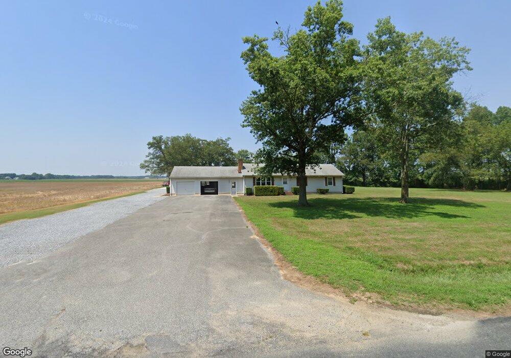
6327 Owls Nest Rd Seaford, DE 19973
Estimated Value: $251,897 - $376,000
3
Beds
--
Bath
1,456
Sq Ft
$216/Sq Ft
Est. Value
About This Home
This home is located at 6327 Owls Nest Rd, Seaford, DE 19973 and is currently estimated at $313,974, approximately $215 per square foot. 6327 Owls Nest Rd is a home located in Sussex County with nearby schools including Seaford Central Elementary School, Frederick Douglass Elementary School, and Seaford Middle School.
Ownership History
Date
Name
Owned For
Owner Type
Purchase Details
Closed on
Mar 21, 2016
Bought by
Johnson Robert
Current Estimated Value
Home Financials for this Owner
Home Financials are based on the most recent Mortgage that was taken out on this home.
Original Mortgage
$437,005
Outstanding Balance
$346,804
Interest Rate
3.73%
Estimated Equity
-$32,830
Purchase Details
Closed on
Feb 7, 1995
Bought by
Johnson Robert W
Create a Home Valuation Report for This Property
The Home Valuation Report is an in-depth analysis detailing your home's value as well as a comparison with similar homes in the area
Home Values in the Area
Average Home Value in this Area
Purchase History
| Date | Buyer | Sale Price | Title Company |
|---|---|---|---|
| Johnson Robert | -- | -- | |
| Johnson Robert W | -- | -- |
Source: Public Records
Mortgage History
| Date | Status | Borrower | Loan Amount |
|---|---|---|---|
| Open | Johnson Robert W | $437,005 | |
| Closed | Johnson Robert W | -- |
Source: Public Records
Tax History Compared to Growth
Tax History
| Year | Tax Paid | Tax Assessment Tax Assessment Total Assessment is a certain percentage of the fair market value that is determined by local assessors to be the total taxable value of land and additions on the property. | Land | Improvement |
|---|---|---|---|---|
| 2025 | $441 | $21,850 | $1,100 | $20,750 |
| 2024 | $653 | $21,850 | $1,100 | $20,750 |
| 2023 | $1,101 | $21,850 | $1,100 | $20,750 |
| 2022 | $1,073 | $21,850 | $1,100 | $20,750 |
| 2021 | $1,078 | $21,850 | $1,100 | $20,750 |
| 2020 | $1,167 | $21,850 | $1,100 | $20,750 |
| 2019 | $1,023 | $21,850 | $1,100 | $20,750 |
| 2018 | $998 | $21,850 | $0 | $0 |
| 2017 | $947 | $21,850 | $0 | $0 |
| 2016 | $910 | $21,850 | $0 | $0 |
| 2015 | $908 | $21,850 | $0 | $0 |
| 2014 | $860 | $21,850 | $0 | $0 |
Source: Public Records
Map
Nearby Homes
- 22502 Atlanta Rd
- 6998 Atlanta Cir
- 6873 Robin Dr
- 21023 Wesley Church Rd
- 23075 Atlanta Rd
- 1102 Wythe Ln
- 4662 Briarhook Rd
- 22411 Conrail Rd
- 0 Helens Ln
- 312 Plantation Dr
- 413 Plantation Dr
- 21084 Atlanta Rd
- 408 Plantation Dr
- Fairfield Slab Plan at Belle Ayre
- Pembroke Slab Plan at Belle Ayre
- Princeton Slab Plan at Belle Ayre
- Charleston Slab Plan at Belle Ayre
- Hanover Slab Plan at Belle Ayre
- 1123 Magnolia Dr
- 503 Chatham Dr
- 6327 Owls Nest Rd
- 6322 Owls Nest Rd
- 6294 Owls Nest Rd
- 6467 Earle Ln
- 6270 Owls Nest Rd
- 6489 Earle Ln
- 6250 Owls Nest Rd
- 6494 Earle Ln
- 6494 Earle Ln
- 6494 Earle Ln
- 6515 Earle Ln
- 6506 Earle Ln
- 6512 Earle Ln
- 6512 Earle Ln
- 6452 Owls Nest Rd
- 22534 Atlanta Rd
- lot 2 Atlanta Rd
- 99998 Atlanta Rd
- 99999999 Atlanta Rd
- 22594 Atlanta Rd