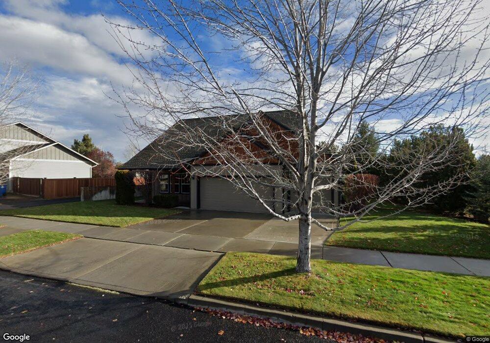
63278 Stonewood Dr Bend, OR 97701
Boyd Acres NeighborhoodEstimated Value: $658,000 - $761,000
4
Beds
3
Baths
2,103
Sq Ft
$335/Sq Ft
Est. Value
About This Home
This home is located at 63278 Stonewood Dr, Bend, OR 97701 and is currently estimated at $703,862, approximately $334 per square foot. 63278 Stonewood Dr is a home located in Deschutes County with nearby schools including Lava Ridge Elementary School, Sky View Middle School, and Mountain View Senior High School.
Ownership History
Date
Name
Owned For
Owner Type
Purchase Details
Closed on
Aug 10, 2005
Sold by
Deselle Dottie M
Bought by
Mayea Dennis
Current Estimated Value
Home Financials for this Owner
Home Financials are based on the most recent Mortgage that was taken out on this home.
Original Mortgage
$186,500
Outstanding Balance
$96,347
Interest Rate
5.5%
Mortgage Type
Fannie Mae Freddie Mac
Estimated Equity
$607,515
Purchase Details
Closed on
Nov 12, 2004
Sold by
Quail Crossing Inc
Bought by
Deselle Dottie M
Home Financials for this Owner
Home Financials are based on the most recent Mortgage that was taken out on this home.
Original Mortgage
$231,200
Interest Rate
4.37%
Mortgage Type
Unknown
Create a Home Valuation Report for This Property
The Home Valuation Report is an in-depth analysis detailing your home's value as well as a comparison with similar homes in the area
Home Values in the Area
Average Home Value in this Area
Purchase History
| Date | Buyer | Sale Price | Title Company |
|---|---|---|---|
| Mayea Dennis | $280,000 | First Amer Title Ins Co Or | |
| Deselle Dottie M | $70,000 | Western Title & Escrow Co |
Source: Public Records
Mortgage History
| Date | Status | Borrower | Loan Amount |
|---|---|---|---|
| Open | Mayea Dennis | $186,500 | |
| Previous Owner | Deselle Dottie M | $231,200 |
Source: Public Records
Tax History Compared to Growth
Tax History
| Year | Tax Paid | Tax Assessment Tax Assessment Total Assessment is a certain percentage of the fair market value that is determined by local assessors to be the total taxable value of land and additions on the property. | Land | Improvement |
|---|---|---|---|---|
| 2025 | $4,402 | $260,540 | -- | -- |
| 2024 | $4,235 | $252,960 | -- | -- |
| 2023 | $3,926 | $245,600 | $0 | $0 |
| 2022 | $3,663 | $231,510 | $0 | $0 |
| 2021 | $3,669 | $224,770 | $0 | $0 |
| 2020 | $3,481 | $224,770 | $0 | $0 |
| 2019 | $3,384 | $218,230 | $0 | $0 |
| 2018 | $3,288 | $211,880 | $0 | $0 |
| 2017 | $3,192 | $205,710 | $0 | $0 |
| 2016 | $3,044 | $199,720 | $0 | $0 |
| 2015 | $2,960 | $193,910 | $0 | $0 |
| 2014 | $2,873 | $188,270 | $0 | $0 |
Source: Public Records
Map
Nearby Homes
- 63326 NE Brightwater Dr
- 21072 NE High Desert Ln
- 63157 Watercress Way
- 21010 Yeoman Rd
- 63103 Watercress Way
- Avery Plan at Acadia Pointe
- Jade Plan at Acadia Pointe
- Hickory Plan at Acadia Pointe
- Larwood Plan at Acadia Pointe
- Magnolia Plan at Acadia Pointe
- Leverich Plan at Acadia Pointe
- Ashland Plan at Acadia Pointe
- Cypress Plan at Acadia Pointe
- 63091 Desert Sage St
- 20939 Blue Bush Ct
- 20751 Boulderfield Ave
- 20676 Morningstar Dr
- 63210 Carly Ln
- 63218 Carly Ln
- 63222 Carly Ln
- 63282 Stonewood Dr
- 63288 Stonewood Dr
- 20889 Crested Ct
- 63272 Stonewood Dr
- 63285 Stonewood Dr
- 63289 Stonewood Dr
- 63281 Stonewood Dr
- 20856 Morningstar Dr
- 32 Crested Ct
- 31 Crested Ct
- 33 Crested Ct
- 30 Crested Ct
- 63266 Stonewood Dr
- 63267 Stonewood Dr
- 63293 Stonewood Dr
- 63296 Stonewood Dr
- 20888 Crested Ct
- 63268 Eastview Dr
- 63261 Stonewood Dr
- 63262 Brightwater Dr