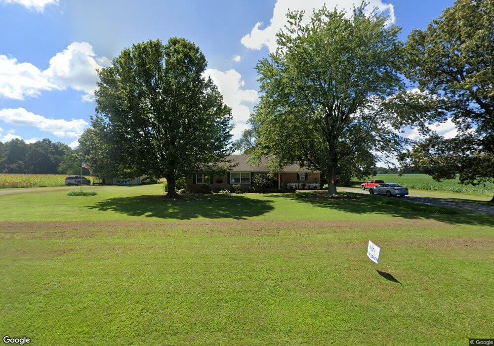
633 Coles Campground Rd Murray, KY 42071
Estimated Value: $193,000 - $248,000
3
Beds
1
Bath
2,148
Sq Ft
$102/Sq Ft
Est. Value
About This Home
This home is located at 633 Coles Campground Rd, Murray, KY 42071 and is currently estimated at $218,766, approximately $101 per square foot. 633 Coles Campground Rd is a home located in Calloway County with nearby schools including North Calloway Elementary School, Calloway County Middle School, and Calloway County High School.
Ownership History
Date
Name
Owned For
Owner Type
Purchase Details
Closed on
Feb 28, 2025
Sold by
Walston Monica and Walston Broadway Heather
Bought by
Jones Roger Dale
Current Estimated Value
Home Financials for this Owner
Home Financials are based on the most recent Mortgage that was taken out on this home.
Original Mortgage
$160,000
Outstanding Balance
$159,208
Interest Rate
7.04%
Mortgage Type
New Conventional
Estimated Equity
$59,558
Create a Home Valuation Report for This Property
The Home Valuation Report is an in-depth analysis detailing your home's value as well as a comparison with similar homes in the area
Home Values in the Area
Average Home Value in this Area
Purchase History
| Date | Buyer | Sale Price | Title Company |
|---|---|---|---|
| Jones Roger Dale | $200,000 | None Listed On Document | |
| Jones Roger Dale | $200,000 | None Listed On Document |
Source: Public Records
Mortgage History
| Date | Status | Borrower | Loan Amount |
|---|---|---|---|
| Open | Jones Roger Dale | $160,000 | |
| Closed | Jones Roger Dale | $160,000 |
Source: Public Records
Tax History Compared to Growth
Tax History
| Year | Tax Paid | Tax Assessment Tax Assessment Total Assessment is a certain percentage of the fair market value that is determined by local assessors to be the total taxable value of land and additions on the property. | Land | Improvement |
|---|---|---|---|---|
| 2024 | $1,002 | $158,000 | $0 | $0 |
| 2023 | $735 | $125,000 | $0 | $0 |
| 2022 | $803 | $125,000 | $0 | $0 |
| 2021 | $818 | $125,000 | $0 | $0 |
| 2020 | $817 | $125,000 | $0 | $0 |
| 2019 | $786 | $125,000 | $0 | $0 |
| 2018 | $776 | $125,000 | $0 | $0 |
| 2017 | $754 | $125,000 | $0 | $0 |
| 2016 | $752 | $125,000 | $0 | $0 |
| 2015 | $715 | $125,000 | $0 | $0 |
| 2011 | $715 | $125,000 | $0 | $0 |
Source: Public Records
Map
Nearby Homes
- Lot 17 Jordyn Bailey Rd
- 202 John Purdom Dr
- 0 U S 641 N
- 000 North Dr
- 206 Metcalf Ln
- 0000 Brinn Rd
- 363 Grant Rd
- 1087 Poor Farm Rd
- 1515 Boggess Dr
- 00 N 16th St
- 1612 N 16th St
- 000 Spring Rd
- 1783 Radio Rd
- 2809 W Fork Rd
- 1536 Almo Rd
- 1005 Southwood Dr
- 906 Southwood Dr
- 000 Keepers Way Unit Tract A
- 000 Keepers Way
- 1 Logan Trail
- 652 Coles Campground Rd
- 29 Wells Purdom Dr
- 3 Wells Purdom Dr
- 6 Wells Purdom Dr
- 59 Wells Purdom Dr
- 44 Wells Purdom Dr
- 22 Wells Purdom Dr
- 90 Wells Purdom Dr
- 77 Wells Purdom Dr
- 68 Wells Purdom Dr
- Lot 32 Marina Way
- 16 Drew Dr
- 53 Jordyn Bailey Dr
- 000 Jordyn Bailey Rd
- Lot 9 Jordyn Bailey Rd
- 165 Wells Purdom Dr
- 73 Washington Dr
- 801 Coles Campground Rd
- 114 Wells Purdom Dr
- 182 Wells Purdom Dr