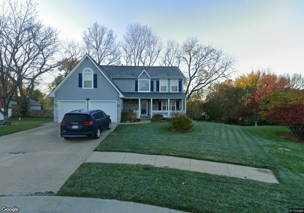
633 Hillcrest Cir Lansing, KS 66043
Estimated Value: $401,819 - $433,000
About This Home
This home is located at 633 Hillcrest Cir, Lansing, KS 66043 and is currently estimated at $418,455, approximately $179 per square foot. 633 Hillcrest Cir is a home located in Leavenworth County with nearby schools including Lansing Elementary School, Lansing Middle 6-8, and Lansing High 9-12.
Ownership History
We collect this data history from publicly available records. To have your information removed, we recommend requesting removal directly through your county’s website.
Purchase Details
Home Financials for this Owner
Home Financials are based on the most recent Mortgage that was taken out on this home.Home Values in the Area
Average Home Value in this Area
Purchase History
We collect this data history from publicly available records. To have your information removed, we recommend requesting removal directly through your county’s website.
| Date | Buyer | Sale Price | Title Company |
|---|---|---|---|
| $212,500 | -- |
Mortgage History
We collect this data history from publicly available records. To have your information removed, we recommend requesting removal directly through your county’s website.
| Date | Status | Borrower | Loan Amount |
|---|---|---|---|
| Open | $115,890 |
Tax History
We collect this data history from publicly available records. To have your information removed, we recommend requesting removal directly through your county’s website.
| Year | Tax Paid | Tax Assessment Tax Assessment Total Assessment is a certain percentage of the fair market value that is determined by local assessors to be the total taxable value of land and additions on the property. | Land | Improvement |
|---|---|---|---|---|
| 2025 | $5,901 | $44,953 | $5,781 | $39,172 |
| 2024 | $5,521 | $43,642 | $5,781 | $37,861 |
| 2023 | $5,521 | $42,377 | $5,781 | $36,596 |
| 2022 | $5,187 | $37,663 | $4,922 | $32,741 |
| 2021 | $4,949 | $34,328 | $4,922 | $29,406 |
| 2020 | $4,682 | $31,970 | $4,922 | $27,048 |
| 2019 | $4,556 | $31,073 | $4,922 | $26,151 |
| 2018 | $4,271 | $29,164 | $4,922 | $24,242 |
| 2017 | $4,175 | $28,451 | $4,922 | $23,529 |
| 2016 | $4,016 | $27,362 | $4,922 | $22,440 |
| 2015 | $4,004 | $27,362 | $4,922 | $22,440 |
| 2014 | $3,841 | $26,807 | $4,922 | $21,885 |
Map
- 634 Hillcrest Cir
- 823 Englewood St
- 114 Ethel Ln
- 106 Ethel Ln
- 98 Continental Dr
- 81 Continental Dr
- 412 Fairlane St
- 00000 Brookwood St
- 218 Oak Hill St
- 20958 Ida St
- 139 Woodland Rd
- 804 Merion St
- Lot 2 Eisenhower Rd
- 26731 147th St
- 112 W Kay St
- 124 S Main St
- 202 S Main St
- 5000 Shrine Park Rd
- 220 Debra St
- 1102 N Main St
- 631 Hillcrest Cir
- 809 Englewood St
- 807 Englewood St
- 811 Englewood St
- 805 Englewood St
- 897 Hillcrest Ln
- 632 Hillcrest Cir
- 813 Englewood St
- 630 Hillcrest Cir
- 803 Englewood St
- 899 Hillcrest Ln
- 815 Englewood St
- 894 Hillcrest Ln
- 401 Hillcrest St
- 896 Hillcrest Ln
- 403 Hillcrest St
- 892 Hillcrest Ln
- 405 Hillcrest St
- 120 Ethel Ln
- 801 Englewood St
Ask me questions while you tour the home.