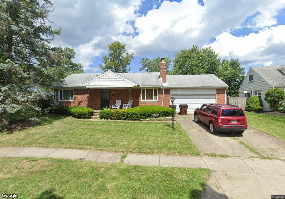
633 Lamont Dr Dayton, OH 45429
Estimated Value: $216,000 - $247,000
2
Beds
2
Baths
912
Sq Ft
$250/Sq Ft
Est. Value
About This Home
This home is located at 633 Lamont Dr, Dayton, OH 45429 and is currently estimated at $228,066, approximately $250 per square foot. 633 Lamont Dr is a home located in Montgomery County with nearby schools including Oakview Elementary School, Van Buren Middle School, and Kettering Fairmont High School.
Ownership History
Date
Name
Owned For
Owner Type
Purchase Details
Closed on
Feb 28, 2012
Sold by
Smith Ronald
Bought by
Mcdonald Ariel
Current Estimated Value
Purchase Details
Closed on
Mar 19, 2004
Sold by
Olsen Eunice A Tr
Bought by
Olsen Eunice A and Smith Ronald
Purchase Details
Closed on
Apr 20, 2001
Sold by
Olsen Eunice A
Bought by
Olsen Eunice A and Eunice A Olsen Irrevocable Trust
Purchase Details
Closed on
Mar 26, 2001
Sold by
Olsen Vernon H and Olsen Eunice A
Bought by
Olsen Eunice A
Purchase Details
Closed on
Dec 29, 1993
Sold by
Anstaett Donald Lee and Anstaett Julie F
Bought by
Anstaett Donald Lee and Anstaett Julie F
Create a Home Valuation Report for This Property
The Home Valuation Report is an in-depth analysis detailing your home's value as well as a comparison with similar homes in the area
Home Values in the Area
Average Home Value in this Area
Purchase History
| Date | Buyer | Sale Price | Title Company |
|---|---|---|---|
| Mcdonald Ariel | -- | None Available | |
| Olsen Eunice A | -- | -- | |
| Olsen Eunice A | -- | -- | |
| Olsen Eunice A | -- | -- | |
| Anstaett Donald Lee | -- | -- |
Source: Public Records
Tax History Compared to Growth
Tax History
| Year | Tax Paid | Tax Assessment Tax Assessment Total Assessment is a certain percentage of the fair market value that is determined by local assessors to be the total taxable value of land and additions on the property. | Land | Improvement |
|---|---|---|---|---|
| 2024 | $3,619 | $58,310 | $16,680 | $41,630 |
| 2023 | $3,619 | $58,310 | $16,680 | $41,630 |
| 2022 | $3,448 | $43,930 | $12,540 | $31,390 |
| 2021 | $3,189 | $43,930 | $12,540 | $31,390 |
| 2020 | $3,200 | $43,930 | $12,540 | $31,390 |
| 2019 | $2,865 | $34,760 | $11,410 | $23,350 |
| 2018 | $2,880 | $34,760 | $11,410 | $23,350 |
| 2017 | $2,653 | $34,760 | $11,410 | $23,350 |
| 2016 | $2,524 | $31,060 | $11,410 | $19,650 |
| 2015 | $2,411 | $31,060 | $11,410 | $19,650 |
| 2014 | $2,411 | $31,060 | $11,410 | $19,650 |
| 2012 | -- | $31,380 | $11,170 | $20,210 |
Source: Public Records
Map
Nearby Homes
- 791 Willowdale Ave
- 4259 Maxlin Rd
- 804 Lovetta Dr
- 959 Kimberly Dr
- 3822 Milford Dr
- 604 Schuyler Dr
- 645 Brookfield Rd
- 1013 Swango Dr
- 1008 Rio Ln
- 855 Brookfield Rd
- 1105 Greenridge Dr
- 617 Laurelann Dr
- 1033 Carlo Dr
- 3872 Maryknoll Dr
- 4808 Judith Dr
- 4817 Ackerman Blvd
- 4816 Judith Dr
- 115 N Bromfield Rd
- 501 Judith Dr
- 4824 Far Hills Ave