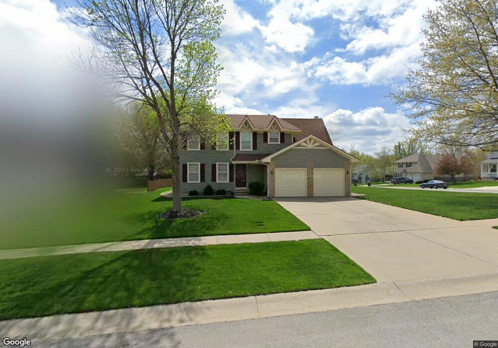
633 Meadowlark Rd Lansing, KS 66043
Estimated Value: $328,000 - $357,000
4
Beds
3
Baths
1,858
Sq Ft
$182/Sq Ft
Est. Value
About This Home
This home is located at 633 Meadowlark Rd, Lansing, KS 66043 and is currently estimated at $338,837, approximately $182 per square foot. 633 Meadowlark Rd is a home located in Leavenworth County with nearby schools including Lansing Elementary School, Lansing Middle 6-8, and Lansing High 9-12.
Ownership History
Date
Name
Owned For
Owner Type
Purchase Details
Closed on
Jul 1, 1988
Bought by
May Anthony L
Current Estimated Value
Home Financials for this Owner
Home Financials are based on the most recent Mortgage that was taken out on this home.
Original Mortgage
$197,149
Outstanding Balance
$171,855
Interest Rate
10.39%
Mortgage Type
VA
Estimated Equity
$166,982
Create a Home Valuation Report for This Property
The Home Valuation Report is an in-depth analysis detailing your home's value as well as a comparison with similar homes in the area
Home Values in the Area
Average Home Value in this Area
Purchase History
| Date | Buyer | Sale Price | Title Company |
|---|---|---|---|
| May Anthony L | $115,000 | -- |
Source: Public Records
Mortgage History
| Date | Status | Borrower | Loan Amount |
|---|---|---|---|
| Open | May Anthony L | $197,149 | |
| Closed | May Anthony L | $181,270 |
Source: Public Records
Tax History Compared to Growth
Tax History
| Year | Tax Paid | Tax Assessment Tax Assessment Total Assessment is a certain percentage of the fair market value that is determined by local assessors to be the total taxable value of land and additions on the property. | Land | Improvement |
|---|---|---|---|---|
| 2025 | $4,520 | $35,067 | $5,137 | $29,930 |
| 2024 | $4,327 | $33,718 | $4,079 | $29,639 |
| 2023 | $4,327 | $33,371 | $4,079 | $29,292 |
| 2022 | $4,160 | $30,337 | $3,210 | $27,127 |
| 2021 | $3,967 | $27,577 | $3,210 | $24,367 |
| 2020 | $3,599 | $24,645 | $3,210 | $21,435 |
| 2019 | $3,400 | $23,265 | $3,210 | $20,055 |
| 2018 | $3,162 | $21,668 | $2,677 | $18,991 |
| 2017 | $3,018 | $20,649 | $2,677 | $17,972 |
| 2016 | $2,895 | $19,815 | $2,677 | $17,138 |
| 2015 | $2,688 | $18,475 | $2,677 | $15,798 |
| 2014 | $2,606 | $18,292 | $2,677 | $15,615 |
Source: Public Records
Map
Nearby Homes
- 20958 Ida St
- 415 Fairlane St
- 129 Crestview Ct
- 542 Creekside Ct
- 129 Brookwood St
- 268 Holiday Dr
- 124 S Main St
- 202 S Main St
- 527 S Valley Dr
- 104 Olive St
- 218 E Kay St
- 811 4-H Rd
- 310 E Kansas Ave
- 306 E Kay St
- 922 Southfork St
- 728 Eisenhower Rd
- 1102 N Main St
- 522 Forestglen Ln
- 4 Eisenhower Rd
- 546 Hithergreen Dr
- 629 Meadowlark Rd
- 134 S Ethel Ln
- 115 S Ethel Ln
- 136 S Ethel Ln
- 111 S Ethel Ln
- 624 Meadowlark Rd
- 623 Meadowlark Rd
- 119 S Ethel Ln
- 620 Meadowlark Rd
- 131 S Meadow Ct
- 616 Meadowlark Rd
- 109 S Ethel Ln
- 123 S Ethel Ln
- 135 S Meadow Ct
- 140 S Ethel Ln
- 118 Hampton Ct
- 124 S Meadow Ct
- 116 Hampton Ct
- 619 Meadowlark Rd
- 122 Hampton Ct