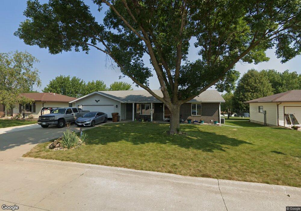
633 Mockingbird Dr Carroll, IA 51401
Estimated Value: $236,001 - $301,000
2
Beds
2
Baths
1,602
Sq Ft
$168/Sq Ft
Est. Value
About This Home
This home is located at 633 Mockingbird Dr, Carroll, IA 51401 and is currently estimated at $269,000, approximately $167 per square foot. 633 Mockingbird Dr is a home located in Carroll County with nearby schools including Fairview Elementary School, Adams Elementary School, and Carroll Middle School.
Ownership History
Date
Name
Owned For
Owner Type
Purchase Details
Closed on
Jul 7, 2020
Sold by
Myers Kenneth J and Myers Kathleen M
Bought by
Myers Kenneth J and Myers Kathleen M
Current Estimated Value
Purchase Details
Closed on
Dec 21, 2009
Sold by
Schechinger Betty R
Bought by
Myers Kenneth J
Home Financials for this Owner
Home Financials are based on the most recent Mortgage that was taken out on this home.
Original Mortgage
$155,700
Outstanding Balance
$101,556
Interest Rate
4.9%
Mortgage Type
New Conventional
Estimated Equity
$167,444
Create a Home Valuation Report for This Property
The Home Valuation Report is an in-depth analysis detailing your home's value as well as a comparison with similar homes in the area
Home Values in the Area
Average Home Value in this Area
Purchase History
| Date | Buyer | Sale Price | Title Company |
|---|---|---|---|
| Myers Kenneth J | -- | None Available | |
| Myers Kenneth J | $150,000 | Security Title & Investment |
Source: Public Records
Mortgage History
| Date | Status | Borrower | Loan Amount |
|---|---|---|---|
| Open | Myers Kenneth J | $155,700 |
Source: Public Records
Tax History
| Year | Tax Paid | Tax Assessment Tax Assessment Total Assessment is a certain percentage of the fair market value that is determined by local assessors to be the total taxable value of land and additions on the property. | Land | Improvement |
|---|---|---|---|---|
| 2025 | $2,520 | $227,660 | $27,050 | $200,610 |
| 2024 | $25 | $202,380 | $27,050 | $175,330 |
| 2023 | $3,027 | $202,380 | $27,050 | $175,330 |
| 2022 | $2,872 | $207,020 | $27,050 | $179,970 |
| 2021 | $2,872 | $207,020 | $27,050 | $179,970 |
| 2020 | $2,940 | $207,020 | $27,050 | $179,970 |
| 2019 | $2,916 | $207,020 | $27,050 | $179,970 |
| 2018 | $2,744 | $207,020 | $27,050 | $179,970 |
| 2017 | $2,744 | $200,219 | $23,979 | $176,240 |
| 2016 | $2,554 | $187,120 | $0 | $0 |
| 2015 | $2,554 | $166,440 | $0 | $0 |
| 2014 | $2,232 | $166,440 | $0 | $0 |
Source: Public Records
Map
Nearby Homes
- 641 Alta Vista Dr
- 1546 Olive St
- 746 Granada Rd
- 1206 Amy Ave
- 1550 Edgewood Dr
- 265 Perch St
- 505 Parkview Dr
- 1059 Amy Ave
- 1515 N Main St
- 1601 N Main St
- 1208 N Adams St
- 1108 N Main St
- 1102 N Main St
- 1816 N Main St
- 1399 E 11th St
- 1401 E 11th St
- 1509 Birch St
- 1525 Birch St
- 110 E 10th St
- 1124 N Carroll St Unit 11
- 630 Mockingbird Dr
- 623 Mockingbird Dr
- 636 Mockingbird Dr
- 622 Mockingbird Dr
- 703 Mockingbird Dr
- 614 Mockingbird Dr
- 611 Mockingbird Dr
- 712 Mockingbird Dr
- 631 Capistrano Ave
- 711 Mockingbird Dr
- 610 Mockingbird Dr
- 639 Capistrano Ave
- 623 Capistrano Ave
- 620 Troy Dr
- 605 Mockingbird Dr
- 614 Troy Dr
- 716 Mockingbird Dr
- 703 Capistrano Ave
- 606 Mockingbird Dr
- 626 Troy Dr
Your Personal Tour Guide
Ask me questions while you tour the home.