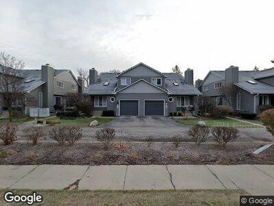
633 S Crooks Rd Unit B8 Clawson, MI 48017
Estimated Value: $210,000 - $246,000
1
Bed
2
Baths
1,186
Sq Ft
$194/Sq Ft
Est. Value
About This Home
This home is located at 633 S Crooks Rd Unit B8, Clawson, MI 48017 and is currently estimated at $230,618, approximately $194 per square foot. 633 S Crooks Rd Unit B8 is a home located in Oakland County with nearby schools including Clawson High School and Japhet School.
Ownership History
Date
Name
Owned For
Owner Type
Purchase Details
Closed on
Apr 24, 2013
Sold by
Bowlin Gilbert David
Bought by
Bowlin Gilbert David and Bowlin Revocable Living Trust
Current Estimated Value
Home Financials for this Owner
Home Financials are based on the most recent Mortgage that was taken out on this home.
Original Mortgage
$72,500
Outstanding Balance
$53,054
Interest Rate
3.38%
Mortgage Type
New Conventional
Purchase Details
Closed on
Dec 15, 2011
Sold by
Bowlin Gilbert David
Bought by
Bowlin Gilbert David and Bowlin Revocable Living Trust
Purchase Details
Closed on
Aug 2, 2004
Sold by
Girard Linda G and Francisco Linda G
Bought by
Bowlin Gilbert D
Home Financials for this Owner
Home Financials are based on the most recent Mortgage that was taken out on this home.
Original Mortgage
$132,000
Interest Rate
6.35%
Mortgage Type
New Conventional
Create a Home Valuation Report for This Property
The Home Valuation Report is an in-depth analysis detailing your home's value as well as a comparison with similar homes in the area
Home Values in the Area
Average Home Value in this Area
Purchase History
| Date | Buyer | Sale Price | Title Company |
|---|---|---|---|
| Bowlin Gilbert David | -- | Title Source Inc | |
| Bowlin Gilbert David | -- | Title Source Inc | |
| Bowlin Gilbert David | -- | None Available | |
| Bowlin Gilbert D | $165,000 | Devon Title Agency |
Source: Public Records
Mortgage History
| Date | Status | Borrower | Loan Amount |
|---|---|---|---|
| Open | Bowlin Gilbert David | $72,500 | |
| Previous Owner | Bowlin Gilbert D | $132,000 |
Source: Public Records
Tax History Compared to Growth
Tax History
| Year | Tax Paid | Tax Assessment Tax Assessment Total Assessment is a certain percentage of the fair market value that is determined by local assessors to be the total taxable value of land and additions on the property. | Land | Improvement |
|---|---|---|---|---|
| 2024 | $2,271 | $110,630 | $0 | $0 |
| 2023 | $2,178 | $92,250 | $0 | $0 |
| 2022 | $2,195 | $87,090 | $0 | $0 |
| 2021 | $2,150 | $78,070 | $0 | $0 |
| 2020 | $2,083 | $75,020 | $0 | $0 |
| 2019 | $2,153 | $66,460 | $0 | $0 |
| 2018 | $2,138 | $64,700 | $0 | $0 |
| 2017 | $2,125 | $64,280 | $0 | $0 |
| 2016 | $2,135 | $63,650 | $0 | $0 |
| 2015 | -- | $59,730 | $0 | $0 |
| 2014 | -- | $49,590 | $0 | $0 |
| 2011 | -- | $45,430 | $0 | $0 |
Source: Public Records
Map
Nearby Homes
- 1748 Cresthill Ave
- 506 S Webik Ave
- 1630 Normandy Rd Unit 6
- 705 S Chocolay Ave
- 4122 Devon Rd
- 1807 Samoset Rd
- 4107 Devon Rd
- 2105 W 14 Mile Rd
- 4250 Kent Rd
- 1308 Broadacre Ave
- 4909 Crooks D10 Rd Unit 10 D
- 2230 W 14 Mile Rd Unit 26
- 4411 Briarwood Ave
- 2450 Massoit Rd
- 2302 W 14 Mile Rd Unit 13
- 3532 Woodland Ave
- 2346 W 14 Mile Rd Unit 6
- 3508 Durham Rd
- 2356 W 14 Mile Rd Unit 1
- 2500 Normandy Rd Unit 41
- 633 S Crooks Rd Unit B8
- 547 S Crooks Rd
- 635 S Crooks Rd
- 637 S Crooks Rd Unit 7
- 639 S Crooks Rd Unit 6
- 639 S Crooks Rd Unit 6-BldgB
- 549 S Crooks Rd Unit E19
- 551 S Crooks Rd
- 603 S Crooks Rd
- 607 S Crooks Rd
- 609 S Crooks Rd Unit 14
- 605 S Crooks Rd
- 617 S Crooks Rd
- 621 S Crooks Rd
- 623 S Crooks Rd
- 619 S Crooks Rd
- 637 S Crooks Rd Unit B7
- 639 S Crooks Rd Unit B6
- 645 S Crooks Rd Unit A4
- 649 S Crooks Rd