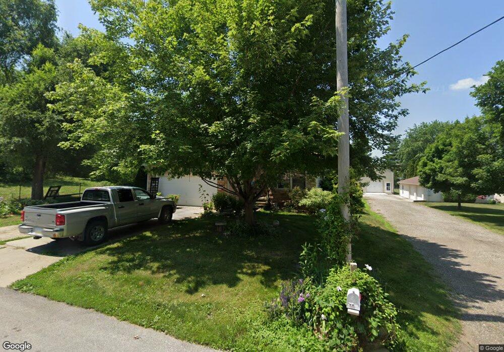
633 S Hastings Ave Colfax, IA 50054
Estimated Value: $258,000 - $315,000
3
Beds
2
Baths
1,332
Sq Ft
$220/Sq Ft
Est. Value
About This Home
This home is located at 633 S Hastings Ave, Colfax, IA 50054 and is currently estimated at $292,912, approximately $219 per square foot. 633 S Hastings Ave is a home located in Jasper County with nearby schools including Colfax-Mingo Elementary School and Colfax-Mingo High School.
Ownership History
Date
Name
Owned For
Owner Type
Purchase Details
Closed on
Dec 20, 2007
Sold by
Lincoln Kevin E and Lincoln Alice M
Bought by
Greve Christina
Current Estimated Value
Home Financials for this Owner
Home Financials are based on the most recent Mortgage that was taken out on this home.
Original Mortgage
$100,100
Interest Rate
5.95%
Mortgage Type
New Conventional
Create a Home Valuation Report for This Property
The Home Valuation Report is an in-depth analysis detailing your home's value as well as a comparison with similar homes in the area
Home Values in the Area
Average Home Value in this Area
Purchase History
| Date | Buyer | Sale Price | Title Company |
|---|---|---|---|
| Greve Christina | $170,000 | United Land Title |
Source: Public Records
Mortgage History
| Date | Status | Borrower | Loan Amount |
|---|---|---|---|
| Previous Owner | Greve Christina | $100,100 |
Source: Public Records
Tax History Compared to Growth
Tax History
| Year | Tax Paid | Tax Assessment Tax Assessment Total Assessment is a certain percentage of the fair market value that is determined by local assessors to be the total taxable value of land and additions on the property. | Land | Improvement |
|---|---|---|---|---|
| 2025 | $5,302 | $309,240 | $17,480 | $291,760 |
| 2024 | $5,302 | $278,570 | $17,480 | $261,090 |
| 2023 | $5,340 | $278,570 | $17,480 | $261,090 |
| 2022 | $4,566 | $221,730 | $17,480 | $204,250 |
| 2021 | $4,454 | $203,330 | $17,480 | $185,850 |
| 2020 | $4,454 | $186,700 | $15,850 | $170,850 |
| 2019 | $4,122 | $163,490 | $0 | $0 |
| 2018 | $4,122 | $163,490 | $0 | $0 |
| 2017 | $4,066 | $163,490 | $0 | $0 |
| 2016 | $4,066 | $163,490 | $0 | $0 |
| 2015 | $4,042 | $163,490 | $0 | $0 |
| 2014 | $3,848 | $163,490 | $0 | $0 |
Source: Public Records
Map
Nearby Homes
- 501 W Broadway St
- 215 W Spring St
- 223 W Broadway St
- 119 W Washington St
- 108 N West St
- 108 S Walnut St
- 34 E Broadway St
- 222 E Broadway St
- 226 S Iowa St
- 200 Jefferson St
- 520 S Oak Park Ave
- 0000 Lincoln St
- 400 S Goodrich St
- 624 S Goodrich St
- 20 S Oak Park Ave
- 300 E Front St
- 1161 S Goodrich St
- 655 E Division St
- 11213 Orchard Ave
- 0 W 120th St S
- 631 S Hastings Ave
- 627 S Hastings Ave
- 636 S Hastings Ave
- 634 S Hastings Ave
- 901 W High St
- 632 S Hastings Ave
- 621 S Hastings Ave
- 630 S Hastings Ave
- 628 S Hastings Ave
- 615 S Hastings Ave Unit A
- 615 S Hastings Ave
- 626 S Hastings Ave
- 624 S Hastings Ave
- 603 S Hastings Ave
- 721 W High St
- 529 S Hastings Ave
- 529 S Hastings Ave Unit A
- 715 W High St
- 524 S Hastings Ave
- 505 S Hastings Ave