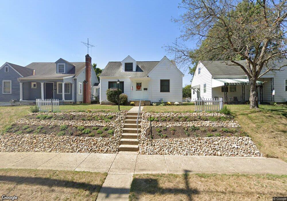
633 Sheridan Dr Lancaster, OH 43130
Estimated Value: $155,000 - $224,000
3
Beds
1
Bath
1,211
Sq Ft
$163/Sq Ft
Est. Value
About This Home
This home is located at 633 Sheridan Dr, Lancaster, OH 43130 and is currently estimated at $197,622, approximately $163 per square foot. 633 Sheridan Dr is a home located in Fairfield County with nearby schools including Medill Elementary School, Thomas Ewing Junior High School, and Lancaster High School.
Ownership History
Date
Name
Owned For
Owner Type
Purchase Details
Closed on
Dec 7, 2017
Sold by
Mowry David Dee
Bought by
Salvatori Anthony J and Salvatori Elaine G
Current Estimated Value
Home Financials for this Owner
Home Financials are based on the most recent Mortgage that was taken out on this home.
Original Mortgage
$70,650
Outstanding Balance
$59,481
Interest Rate
3.94%
Mortgage Type
Commercial
Estimated Equity
$138,141
Purchase Details
Closed on
Jun 19, 2003
Sold by
Estate Of Kathryn Doris Mericle
Bought by
Mowry David Dee
Create a Home Valuation Report for This Property
The Home Valuation Report is an in-depth analysis detailing your home's value as well as a comparison with similar homes in the area
Home Values in the Area
Average Home Value in this Area
Purchase History
| Date | Buyer | Sale Price | Title Company |
|---|---|---|---|
| Salvatori Anthony J | $78,500 | Valmer Land Title Agency Box | |
| Mowry David Dee | -- | -- |
Source: Public Records
Mortgage History
| Date | Status | Borrower | Loan Amount |
|---|---|---|---|
| Open | Salvatori Anthony J | $70,650 |
Source: Public Records
Tax History Compared to Growth
Tax History
| Year | Tax Paid | Tax Assessment Tax Assessment Total Assessment is a certain percentage of the fair market value that is determined by local assessors to be the total taxable value of land and additions on the property. | Land | Improvement |
|---|---|---|---|---|
| 2024 | $4,497 | $50,020 | $10,340 | $39,680 |
| 2023 | $1,486 | $50,020 | $10,340 | $39,680 |
| 2022 | $1,507 | $50,020 | $10,340 | $39,680 |
| 2021 | $1,114 | $37,320 | $8,670 | $28,650 |
| 2020 | $996 | $37,320 | $8,670 | $28,650 |
| 2019 | $1,325 | $37,320 | $8,670 | $28,650 |
| 2018 | $324 | $29,260 | $8,670 | $20,590 |
| 2017 | $1,083 | $28,960 | $8,370 | $20,590 |
| 2016 | $1,055 | $28,960 | $8,370 | $20,590 |
| 2015 | $1,054 | $28,070 | $8,370 | $19,700 |
| 2014 | $1,004 | $28,070 | $8,370 | $19,700 |
| 2013 | $1,004 | $28,070 | $8,370 | $19,700 |
Source: Public Records
Map
Nearby Homes
- 608 Sheridan Dr
- 1150 E Fair Ave
- 1159 E Fair Ave
- 831 Franklin Ave
- 1413 E Mulberry St
- 1275 Wetsell Ave
- 700 E Allen St
- 726 King St
- 234 S Ewing St
- 1106 E Walnut St
- 1020 Sycamore Dr
- 1560 E Main St
- 134 Kanawha Rd
- 1066 Lanreco Blvd
- 716 N Mount Pleasant Ave
- 1004 E Locust St
- 1570 E Main St Unit Lot 10
- 403 S Ewing St
- 124 Wyandotte St
- 1080 Sycamore Dr
- 627 Sheridan Dr
- 637 Sheridan Dr
- 623 Sheridan Dr
- 641 Sheridan Dr
- 619 Sheridan Dr
- 630 Medill Ave
- 626 Medill Ave
- 634 Medill Ave
- 622 Medill Ave
- 638 Medill Ave
- 615 Sheridan Dr
- 705 Sheridan Dr
- 630 Sheridan Dr
- 618 Medill Ave
- 636 Sheridan Dr
- 622 Sheridan Dr
- 640 Sheridan Dr
- 614 Medill Ave
- 709 Sheridan Dr
- 700 Medill Ave