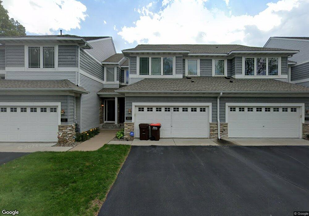
633 Sutherland Dr Woodbury, MN 55129
Estimated Value: $347,000 - $377,000
4
Beds
4
Baths
1,616
Sq Ft
$221/Sq Ft
Est. Value
About This Home
This home is located at 633 Sutherland Dr, Woodbury, MN 55129 and is currently estimated at $357,285, approximately $221 per square foot. 633 Sutherland Dr is a home located in Washington County with nearby schools including Lake Elmo Elementary School, Oak-Land Middle School, and Stillwater Area High School.
Ownership History
Date
Name
Owned For
Owner Type
Purchase Details
Closed on
Jul 24, 2017
Sold by
Hawkins Kirk and Hawkins Tatum
Bought by
Dennings Wes
Current Estimated Value
Home Financials for this Owner
Home Financials are based on the most recent Mortgage that was taken out on this home.
Original Mortgage
$265,109
Outstanding Balance
$219,407
Interest Rate
3.75%
Mortgage Type
FHA
Estimated Equity
$137,878
Purchase Details
Closed on
Jun 12, 2015
Sold by
Sparkman Louise
Bought by
Hawkins Kirk and Hawkins Tatum
Home Financials for this Owner
Home Financials are based on the most recent Mortgage that was taken out on this home.
Original Mortgage
$228,937
Interest Rate
4.12%
Mortgage Type
FHA
Purchase Details
Closed on
Oct 28, 2004
Sold by
The Ryland Group Inc
Bought by
Ossanna Michael Vincent and Ossanna Anna Elaine
Create a Home Valuation Report for This Property
The Home Valuation Report is an in-depth analysis detailing your home's value as well as a comparison with similar homes in the area
Home Values in the Area
Average Home Value in this Area
Purchase History
| Date | Buyer | Sale Price | Title Company |
|---|---|---|---|
| Dennings Wes | $270,000 | Home Title Inc | |
| Hawkins Kirk | $250,000 | Stewart Title Of Minnesota | |
| Ossanna Michael Vincent | $262,857 | -- |
Source: Public Records
Mortgage History
| Date | Status | Borrower | Loan Amount |
|---|---|---|---|
| Open | Dennings Wes | $265,109 | |
| Previous Owner | Hawkins Kirk | $228,937 |
Source: Public Records
Tax History Compared to Growth
Tax History
| Year | Tax Paid | Tax Assessment Tax Assessment Total Assessment is a certain percentage of the fair market value that is determined by local assessors to be the total taxable value of land and additions on the property. | Land | Improvement |
|---|---|---|---|---|
| 2024 | $3,282 | $343,700 | $75,000 | $268,700 |
| 2023 | $3,282 | $366,800 | $92,000 | $274,800 |
| 2022 | $2,986 | $330,300 | $82,000 | $248,300 |
| 2021 | $2,738 | $294,400 | $72,500 | $221,900 |
| 2020 | $2,670 | $281,300 | $67,500 | $213,800 |
| 2019 | $2,776 | $272,300 | $55,000 | $217,300 |
| 2018 | $2,710 | $265,800 | $70,000 | $195,800 |
| 2017 | $2,644 | $255,200 | $70,000 | $185,200 |
| 2016 | $2,732 | $240,900 | $55,000 | $185,900 |
| 2015 | $2,540 | $215,000 | $51,100 | $163,900 |
| 2013 | -- | $160,700 | $31,100 | $129,600 |
Source: Public Records
Map
Nearby Homes
- 497 Leeward Trail
- 769 Lake Ridge Dr
- 10894 Retreat Ln
- 10447 Kilbirnie Rd
- 880 Drew Dr
- 585 Markgrafs Lake Bay
- 10695 Brookview Rd
- 10035 City Walk Dr Unit 103
- 1076 Bonnieview Cir
- 1050 Wyncrest Ct
- 9851 Moonbeam Ln
- 9770 Moonbeam Ln
- 9726 Moonbeam Ln
- 1346 Clearwater Dr
- 1096 Woodbury Dr
- 10601 Watersedge Ln
- 10791 3rd Street Place N
- 1109 Siesta Dr
- 10171 Stony Creek Dr
- 11300 Sandcastle Dr Unit G
- 631 Sutherland Dr
- 637 Sutherland Dr
- 629 Sutherland Dr
- 639 Sutherland Dr
- 619 Sutherland Dr
- 621 Sutherland Dr
- 617 Sutherland Dr
- 623 Sutherland Dr
- 10584 Sterling Dr
- 613 Sutherland Dr
- 10594 Sterling Dr
- 10604 Sterling Dr
- 656 Sutherland Dr
- 654 Sutherland Dr
- 658 Sutherland Dr
- 589 Sutherland Dr
- 660 Sutherland Dr
- 662 Sutherland Dr
- 10614 Sterling Dr
- 640 Sutherland Dr