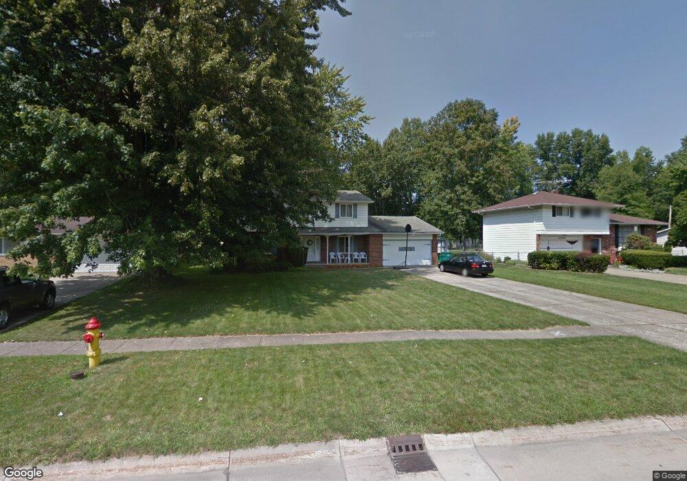
6332 Melshore Dr Mentor, OH 44060
Estimated Value: $287,000 - $318,000
4
Beds
2
Baths
938
Sq Ft
$326/Sq Ft
Est. Value
About This Home
This home is located at 6332 Melshore Dr, Mentor, OH 44060 and is currently estimated at $305,718, approximately $325 per square foot. 6332 Melshore Dr is a home located in Lake County with nearby schools including Fairfax Elementary School, Memorial Middle School, and Mentor High School.
Ownership History
Date
Name
Owned For
Owner Type
Purchase Details
Closed on
Oct 11, 1999
Sold by
Serrone David M and Serrone Kathleen M
Bought by
Gudel Joseph and Gudel Kathleen K
Current Estimated Value
Home Financials for this Owner
Home Financials are based on the most recent Mortgage that was taken out on this home.
Original Mortgage
$30,000
Outstanding Balance
$8,629
Interest Rate
7.9%
Estimated Equity
$297,089
Purchase Details
Closed on
Jan 1, 1990
Bought by
Serrone David M
Create a Home Valuation Report for This Property
The Home Valuation Report is an in-depth analysis detailing your home's value as well as a comparison with similar homes in the area
Home Values in the Area
Average Home Value in this Area
Purchase History
| Date | Buyer | Sale Price | Title Company |
|---|---|---|---|
| Gudel Joseph | $145,000 | Standard Title Agency Inc | |
| Serrone David M | -- | -- |
Source: Public Records
Mortgage History
| Date | Status | Borrower | Loan Amount |
|---|---|---|---|
| Open | Gudel Joseph | $30,000 |
Source: Public Records
Tax History
| Year | Tax Paid | Tax Assessment Tax Assessment Total Assessment is a certain percentage of the fair market value that is determined by local assessors to be the total taxable value of land and additions on the property. | Land | Improvement |
|---|---|---|---|---|
| 2025 | -- | $108,400 | $27,020 | $81,380 |
| 2024 | -- | $108,400 | $27,020 | $81,380 |
| 2023 | $7,451 | $71,710 | $19,120 | $52,590 |
| 2022 | $3,304 | $71,710 | $19,120 | $52,590 |
| 2021 | $3,313 | $71,710 | $19,120 | $52,590 |
| 2020 | $3,202 | $60,780 | $16,210 | $44,570 |
| 2019 | $3,206 | $60,780 | $16,210 | $44,570 |
| 2018 | $3,059 | $52,880 | $19,540 | $33,340 |
| 2017 | $2,922 | $52,880 | $19,540 | $33,340 |
| 2016 | $3,001 | $52,880 | $19,540 | $33,340 |
| 2015 | $2,649 | $52,880 | $19,540 | $33,340 |
| 2014 | $2,534 | $49,850 | $19,540 | $30,310 |
| 2013 | $2,537 | $49,850 | $19,540 | $30,310 |
Source: Public Records
Map
Nearby Homes
- 6270 Cumberland Dr
- 6484 Elmwood Rd
- 8031 Munson Rd
- 6239 Dunbar Dr
- 6067 Collins Rd
- 8285 Munson Rd
- 6595 Devonshire Ct
- 0 Collins Rd
- 8290 Quail Point Ln
- 5998 Collins Rd
- 8352 Quail Point Ln Unit 8352
- 6082 Andrews Rd
- 6218 Center St Unit 6218
- 7723 Rutland Dr
- 6452 Brooks Blvd
- 5950 Galaxie Dr
- 5976 Silver Ct
- 8420 Bartley Ln Unit C
- 6676 Oakdale Rd
- 6443 Chase Dr
- 6340 Melshore Dr
- 6326 Melshore Dr
- 6346 Melshore Dr
- 6318 Melshore Dr
- 6335 Bryson Dr
- 6356 Melshore Dr
- 6325 Bryson Dr
- 6310 Melshore Dr
- 8093 Danbury Ct
- 6345 Bryson Dr
- 6315 Bryson Dr
- 8090 Danbury Ct
- 6360 Melshore Dr
- 6304 Melshore Dr
- 6355 Bryson Dr
- 8099 Danbury Ct
- 6311 Melshore Dr
- 6305 Bryson Dr
- 8096 Danbury Ct
- 6366 Melshore Dr
Your Personal Tour Guide
Ask me questions while you tour the home.