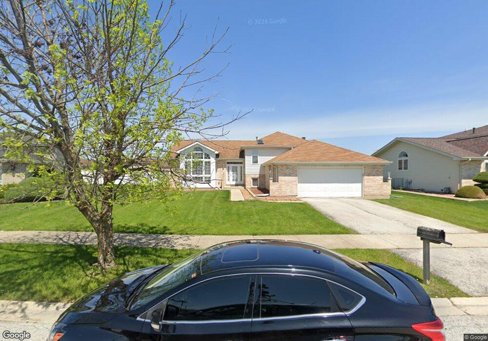
6334 Michael Ln Matteson, IL 60443
West Matteson NeighborhoodEstimated Value: $266,965 - $316,000
3
Beds
4
Baths
1,634
Sq Ft
$178/Sq Ft
Est. Value
About This Home
This home is located at 6334 Michael Ln, Matteson, IL 60443 and is currently estimated at $291,241, approximately $178 per square foot. 6334 Michael Ln is a home located in Cook County with nearby schools including Colin Powell Middle School and Dr. Wolfe's Montessori School.
Ownership History
Date
Name
Owned For
Owner Type
Purchase Details
Closed on
Dec 15, 2005
Sold by
Sims Kathleen
Bought by
Johnson Gregory and Wilson Veronica
Current Estimated Value
Home Financials for this Owner
Home Financials are based on the most recent Mortgage that was taken out on this home.
Original Mortgage
$206,000
Outstanding Balance
$114,126
Interest Rate
6.42%
Mortgage Type
Fannie Mae Freddie Mac
Estimated Equity
$177,115
Purchase Details
Closed on
Nov 12, 1999
Sold by
South Holland Trust & Svgs Bank
Bought by
Hutcherson Darryl and Hutcherson Lisa
Home Financials for this Owner
Home Financials are based on the most recent Mortgage that was taken out on this home.
Original Mortgage
$211,745
Interest Rate
10.25%
Create a Home Valuation Report for This Property
The Home Valuation Report is an in-depth analysis detailing your home's value as well as a comparison with similar homes in the area
Home Values in the Area
Average Home Value in this Area
Purchase History
| Date | Buyer | Sale Price | Title Company |
|---|---|---|---|
| Johnson Gregory | $257,500 | First American Title Ins Co | |
| Hutcherson Darryl | $200,000 | -- |
Source: Public Records
Mortgage History
| Date | Status | Borrower | Loan Amount |
|---|---|---|---|
| Open | Johnson Gregory | $206,000 | |
| Previous Owner | Hutcherson Darryl | $211,745 |
Source: Public Records
Tax History
| Year | Tax Paid | Tax Assessment Tax Assessment Total Assessment is a certain percentage of the fair market value that is determined by local assessors to be the total taxable value of land and additions on the property. | Land | Improvement |
|---|---|---|---|---|
| 2025 | $2,918 | $8,034 | $2,112 | $5,922 |
| 2024 | $2,918 | $8,034 | $2,112 | $5,922 |
| 2023 | $2,342 | $8,034 | $2,112 | $5,922 |
| 2022 | $2,342 | $5,401 | $1,824 | $3,577 |
| 2021 | $2,378 | $5,400 | $1,824 | $3,576 |
| 2020 | $2,334 | $5,400 | $1,824 | $3,576 |
| 2019 | $2,349 | $5,329 | $1,632 | $3,697 |
| 2018 | $2,314 | $5,329 | $1,632 | $3,697 |
| 2017 | $2,260 | $5,329 | $1,632 | $3,697 |
| 2016 | $2,321 | $5,235 | $1,440 | $3,795 |
| 2015 | $2,260 | $5,235 | $1,440 | $3,795 |
| 2014 | $2,207 | $5,235 | $1,440 | $3,795 |
| 2013 | $2,262 | $5,706 | $1,440 | $4,266 |
Source: Public Records
Map
Nearby Homes
- 6237 Michael Ln
- 443 Danielle Rd
- 34 Wedgewood Rd
- 6128 Wedgewood Ct
- 41 Willow Rd
- 6306 Beaver Dam Rd
- 10 Wedgewood Rd
- 42 Pheasant Rd
- 124 Oriole Rd
- 123 Oriole Rd
- 6005 Woodgate Dr
- 152 Oakhurst Rd
- 25 Pheasant Rd
- 5943 Woodgate Dr
- 5911 Timberlane Rd
- 13 Oakview Rd
- 6037 Spring Ln
- 6021 Spring Ln
- 12 Iliad Dr
- 6158 White Birch Ln
- 6334 Michael Ln
- 6326 Michael Ln
- 6342 Michael Ln
- 6333 Michael Ln
- 6318 Michael Ln
- 6318 Michael Ln
- 6325 Michael Ln
- 208 Highland Rd
- 6337 Applehill Rd
- 6347 Applehill Rd
- 216 Highland Rd
- 6317 Michael Ln
- 122 Old Mill Rd
- 224 Highland Rd
- 6357 Applehill Rd
- 6332 Virginia Ln
- 6309 Michael Ln
- 6324 Virginia Ln
- 6300 Michael Ln
- 6300 Michael Ln
Your Personal Tour Guide
Ask me questions while you tour the home.