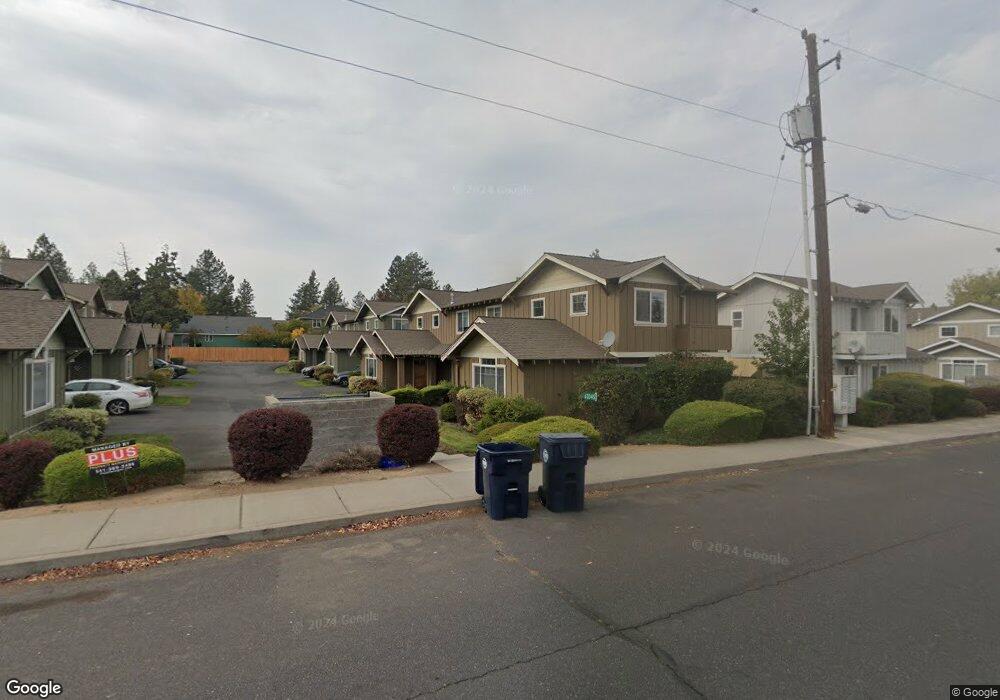
63345 Britta St Bend, OR 97701
Boyd Acres NeighborhoodEstimated Value: $1,141,091 - $1,513,000
8
Beds
4
Baths
5,048
Sq Ft
$270/Sq Ft
Est. Value
About This Home
This home is located at 63345 Britta St, Bend, OR 97701 and is currently estimated at $1,361,023, approximately $269 per square foot. 63345 Britta St is a home located in Deschutes County with nearby schools including North Star Elementary School, Sky View Middle School, and Mountain View Senior High School.
Ownership History
Date
Name
Owned For
Owner Type
Purchase Details
Closed on
Aug 2, 2016
Sold by
Wilber James P and Wilber Lawnae E
Bought by
Wilber James P and Wilber Lawnae E
Current Estimated Value
Purchase Details
Closed on
Sep 17, 2004
Sold by
Iadiano Frank
Bought by
Wilber James P and Wilber Lawnae E
Home Financials for this Owner
Home Financials are based on the most recent Mortgage that was taken out on this home.
Original Mortgage
$330,000
Outstanding Balance
$158,185
Interest Rate
5.5%
Mortgage Type
Unknown
Estimated Equity
$1,202,838
Create a Home Valuation Report for This Property
The Home Valuation Report is an in-depth analysis detailing your home's value as well as a comparison with similar homes in the area
Home Values in the Area
Average Home Value in this Area
Purchase History
| Date | Buyer | Sale Price | Title Company |
|---|---|---|---|
| Wilber James P | -- | None Available | |
| Wilber James P | $450,000 | Amerititle |
Source: Public Records
Mortgage History
| Date | Status | Borrower | Loan Amount |
|---|---|---|---|
| Open | Wilber James P | $330,000 |
Source: Public Records
Tax History
| Year | Tax Paid | Tax Assessment Tax Assessment Total Assessment is a certain percentage of the fair market value that is determined by local assessors to be the total taxable value of land and additions on the property. | Land | Improvement |
|---|---|---|---|---|
| 2025 | $8,791 | $520,290 | -- | -- |
| 2024 | $8,458 | $505,140 | -- | -- |
| 2023 | $7,840 | $490,430 | $0 | $0 |
| 2022 | $7,315 | $462,290 | $0 | $0 |
| 2021 | $7,475 | $448,830 | $0 | $0 |
| 2020 | $6,950 | $448,830 | $0 | $0 |
| 2019 | $6,757 | $435,760 | $0 | $0 |
| 2018 | $6,566 | $423,070 | $0 | $0 |
| 2017 | $6,373 | $410,750 | $0 | $0 |
| 2016 | $6,078 | $398,790 | $0 | $0 |
| 2015 | $5,910 | $387,180 | $0 | $0 |
| 2014 | $5,736 | $375,910 | $0 | $0 |
Source: Public Records
Map
Nearby Homes
- 63290 NW Ski Ln
- 63266 NW Ski Ln
- 20298 Poe Sholes Dr
- 20211 Glen Vista Rd
- 20164 Glen Vista Rd
- 63326 NW Thoroughbred Place
- 4219 NW Lower Village Rd
- 62507 NW Woodsman Loop
- 3650 N Hwy 97
- 20160 Cooley Rd
- 20570 Fred Meyers Rd
- 63201 Boyd Acres Rd
- 20585 Fred Meyers Rd
- 20514 NE Empire Ave
- 63672 O B Riley Rd
- 20528 NE Empire Ave
- 20532 NE Empire Ave
- 20530 NE Empire Ave
- 20560 Boyd Ct
- 20583 Sierra Dr
- 63345 NW Britta St
- 63339 Britta St
- 63351 NW Britta St
- 63339 NW Britta St
- 63335 NW Britta St
- 63335 Britta St
- 63357 Britta St
- 63357 NW Britta St
- 63348 Lavacrest St
- 63344 Lavacrest St
- 63352 Lavacrest St
- 63352 NW Lavacrest St
- 63340 Lavacrest St
- 63329 Britta St
- 63356 Lavacrest St
- 63329 NW Britta St
- 63340 NW Lavacrest St
- 63356 NW Lavacrest St
- 20289 Hardy Rd
Your Personal Tour Guide
Ask me questions while you tour the home.