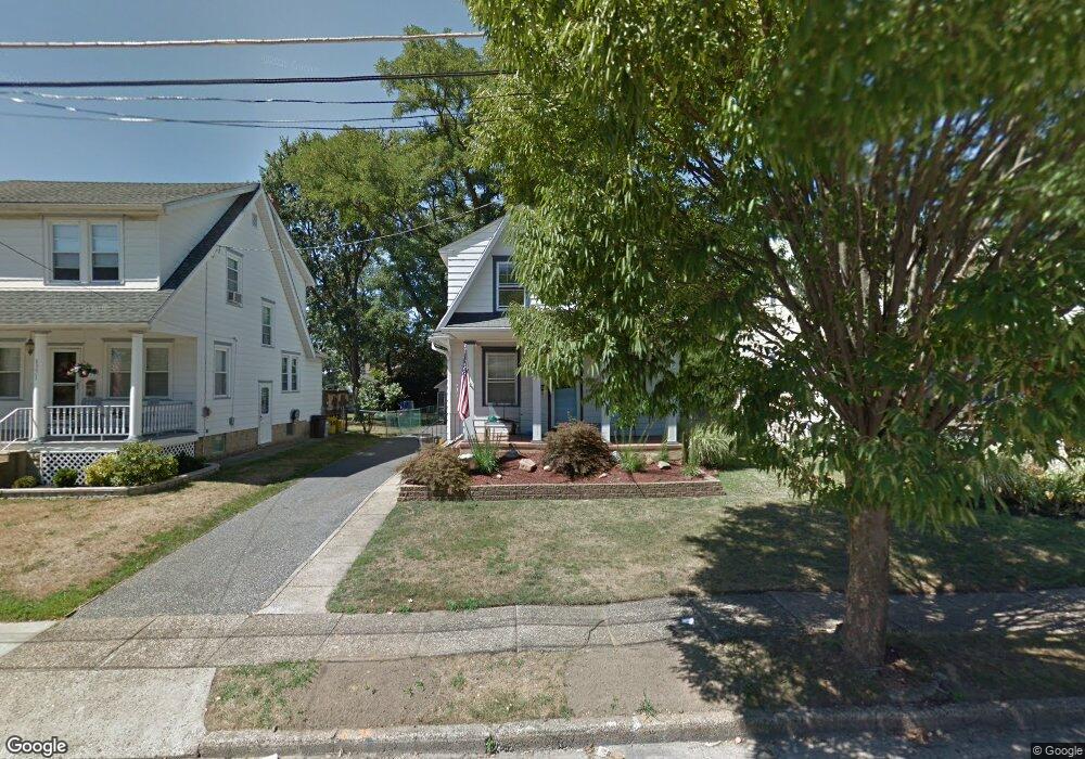
6337 Grant Ave Pennsauken, NJ 08109
Estimated Value: $233,000 - $316,000
3
Beds
1
Bath
1,344
Sq Ft
$203/Sq Ft
Est. Value
About This Home
This home is located at 6337 Grant Ave, Pennsauken, NJ 08109 and is currently estimated at $272,787, approximately $202 per square foot. 6337 Grant Ave is a home located in Camden County with nearby schools including Pennsauken High School, St. Peter Elementary School, and St. Cecilia School.
Ownership History
Date
Name
Owned For
Owner Type
Purchase Details
Closed on
Mar 28, 2025
Sold by
Horton Joseph Gerard and Morales Denise
Bought by
Horton Dorothy
Current Estimated Value
Home Financials for this Owner
Home Financials are based on the most recent Mortgage that was taken out on this home.
Original Mortgage
$188,000
Outstanding Balance
$187,166
Interest Rate
6.65%
Mortgage Type
New Conventional
Estimated Equity
$85,622
Purchase Details
Closed on
Oct 12, 2018
Sold by
Mccann Carolyn
Bought by
Horton Joseph G
Purchase Details
Closed on
Mar 8, 2012
Sold by
Horton Joscph G
Bought by
Mccann Carolyn and Mccann Jospeh G
Purchase Details
Closed on
Oct 20, 2000
Sold by
Giordano Jean
Bought by
Horton Joseph Gerard
Home Financials for this Owner
Home Financials are based on the most recent Mortgage that was taken out on this home.
Original Mortgage
$61,750
Interest Rate
7.83%
Create a Home Valuation Report for This Property
The Home Valuation Report is an in-depth analysis detailing your home's value as well as a comparison with similar homes in the area
Home Values in the Area
Average Home Value in this Area
Purchase History
| Date | Buyer | Sale Price | Title Company |
|---|---|---|---|
| Horton Dorothy | $235,000 | None Listed On Document | |
| Horton Dorothy | $235,000 | None Listed On Document | |
| Horton Joseph G | -- | None Available | |
| Mccann Carolyn | $500 | None Available | |
| Horton Joseph Gerard | $65,000 | -- |
Source: Public Records
Mortgage History
| Date | Status | Borrower | Loan Amount |
|---|---|---|---|
| Open | Horton Dorothy | $188,000 | |
| Closed | Horton Dorothy | $188,000 | |
| Previous Owner | Horton Joseph Gerard | $61,750 |
Source: Public Records
Tax History Compared to Growth
Tax History
| Year | Tax Paid | Tax Assessment Tax Assessment Total Assessment is a certain percentage of the fair market value that is determined by local assessors to be the total taxable value of land and additions on the property. | Land | Improvement |
|---|---|---|---|---|
| 2025 | $5,827 | $303,100 | $68,400 | $234,700 |
| 2024 | $5,715 | $133,900 | $47,500 | $86,400 |
| 2023 | $5,715 | $133,900 | $47,500 | $86,400 |
| 2022 | $5,167 | $133,900 | $47,500 | $86,400 |
| 2021 | $5,306 | $133,900 | $47,500 | $86,400 |
| 2020 | $4,753 | $133,900 | $47,500 | $86,400 |
| 2019 | $4,808 | $133,900 | $47,500 | $86,400 |
| 2018 | $4,834 | $133,900 | $47,500 | $86,400 |
| 2017 | $4,843 | $133,900 | $47,500 | $86,400 |
| 2016 | $4,756 | $133,900 | $47,500 | $86,400 |
| 2015 | $4,898 | $133,900 | $47,500 | $86,400 |
| 2014 | $4,472 | $80,400 | $24,800 | $55,600 |
Source: Public Records
Map
Nearby Homes
- 6134 Grant Ave
- 2429 Norwood Ave
- 6702 Grant Ave
- 6116 Rogers Ave
- 2254 Hollinshed Ave
- 2217 Hillcrest Ave
- 6902 Collins Ave
- 5745 Cedar Ave
- 117 Leslie Ave
- 116 N Centre St
- 3204 Merchantville Ave
- 15 W Walnut Ave
- 5532 Whitman Terrace
- 3300 Springfield Ave
- 117 E Park Ave
- 1765 Hillcrest Ave
- 6936 Cedar Ave
- 21 Alexander Ave
- 6902 Walnut Ave
- 2154 Browning Rd