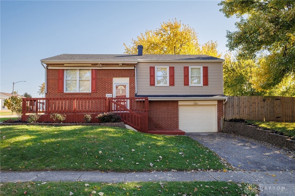
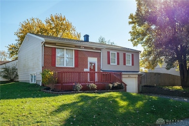
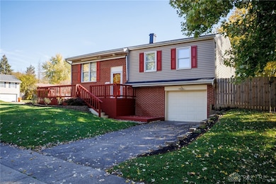

634 Bowser Dr New Carlisle, OH 45344
Estimated payment $1,442/month
Highlights
- Deck
- 1 Car Attached Garage
- Forced Air Heating and Cooling System
- No HOA
- Bathroom on Main Level
- Water Softener
About This Home
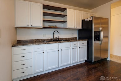
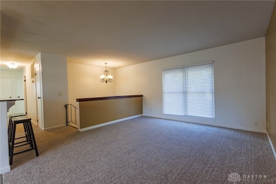
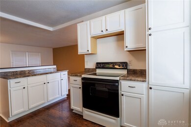
This well-maintained 4-bedroom, 2 1/2 bath bi-level home sits on a desirable corner lot and offers convenience, comfort, and thoughtful updates throughout. With two driveways, parking and access are never an issue. Step inside to find a newly updated kitchen with modern finishes and new flooring throughout the upper level. The main bath was remodeled in 2021, and a second full bath has been added for extra convenience. The home also features a fourth bedroom addition, perfect for guests or a growing family. Major system updates include New roof 25, updated plumbing, a replaced water heater, whole-house filter, new water softener, and upgraded 100-amp electrical service. Enjoy outdoor living on the updated deck, replaced just this past summer, overlooking the spacious yard. This move-in-ready home combines modern upgrades with everyday functionality—truly a must-see!
Listing Agent
Keller Williams Community Part Brokerage Phone: (937) 530-4904 Listed on: 11/05/2025

Home Details
Home Type
- Single Family
Est. Annual Taxes
- $2,143
Year Built
- 1961
Lot Details
- 9,360 Sq Ft Lot
- Fenced
Parking
- 1 Car Attached Garage
Home Design
- 1,657 Sq Ft Home
- Bi-Level Home
- Shingle Siding
- Vinyl Siding
Bedrooms and Bathrooms
- 4 Bedrooms
- Bathroom on Main Level
Utilities
- Forced Air Heating and Cooling System
- Heating System Uses Natural Gas
- Gas Water Heater
- Water Softener
Additional Features
- Range
- Deck
- Finished Basement
Community Details
- No Home Owners Association
- Park Layne Manor Subdivision
Listing and Financial Details
- Assessor Parcel Number 0100500031114001
Map
Home Values in the Area
Average Home Value in this Area
Tax History
| Year | Tax Paid | Tax Assessment Tax Assessment Total Assessment is a certain percentage of the fair market value that is determined by local assessors to be the total taxable value of land and additions on the property. | Land | Improvement |
|---|---|---|---|---|
| 2024 | $2,143 | $45,120 | $7,740 | $37,380 |
| 2023 | $2,143 | $45,120 | $7,740 | $37,380 |
| 2022 | $2,156 | $45,120 | $7,740 | $37,380 |
| 2021 | $1,926 | $36,430 | $5,910 | $30,520 |
| 2020 | $1,930 | $36,430 | $5,910 | $30,520 |
| 2019 | $1,925 | $36,430 | $5,910 | $30,520 |
| 2018 | $1,608 | $28,090 | $5,750 | $22,340 |
| 2017 | $1,598 | $32,106 | $5,747 | $26,359 |
| 2016 | $1,531 | $32,106 | $5,747 | $26,359 |
| 2015 | $1,588 | $31,732 | $5,373 | $26,359 |
| 2014 | $1,579 | $31,732 | $5,373 | $26,359 |
| 2013 | $1,582 | $31,732 | $5,373 | $26,359 |
Property History
| Date | Event | Price | List to Sale | Price per Sq Ft |
|---|---|---|---|---|
| 11/05/2025 11/05/25 | For Sale | $239,900 | -- | $145 / Sq Ft |
Purchase History
| Date | Type | Sale Price | Title Company |
|---|---|---|---|
| Deed | $63,000 | Ohio Real Estate Title | |
| Interfamily Deed Transfer | -- | -- | |
| Deed | -- | -- |
Mortgage History
| Date | Status | Loan Amount | Loan Type |
|---|---|---|---|
| Open | $64,285 | New Conventional |
Source: Dayton REALTORS®
MLS Number: 947112
APN: 01-00500-03111-4001
Disclaimer: Certain information contained herein is derived from information provided by parties other than Homes.com. All information provided is deemed reliable, but is not guaranteed to be accurate and should be independently verified.
![]() The information is being provided by Dayton Area Board of Realtors MLS. Information deemed reliable but not guaranteed. Information is provided for the consumer's personal, non-commercial use, and may not be used for any purpose other than the identification of potential properties for purchase. Copyright 2025 Dayton Area Board of Realtors MLS. All Rights Reserved.
The information is being provided by Dayton Area Board of Realtors MLS. Information deemed reliable but not guaranteed. Information is provided for the consumer's personal, non-commercial use, and may not be used for any purpose other than the identification of potential properties for purchase. Copyright 2025 Dayton Area Board of Realtors MLS. All Rights Reserved.
- 1689 Dale Ridge Rd
- 842 Edgewick Rd
- 419 E Carpenter Dr
- 12165 Dille Rd
- 1124 Burket Dr
- 1037 Frayne Dr
- 326 Kennedy Dr
- 0 Kennedy Rd
- 16 Laurel Rd
- 851 Corvette Ave
- 122 Lake Shore Dr
- 108 N Park Dr
- 15 Tulip Rd
- 0 N Dayton-Lakeview Rd Unit 944532
- 0 N Dayton-Lakeview Rd Unit 1041631
- 11591 Lower Valley Pike
- 9705 E Haskett Ln
- 11315 W National Rd
- 1292 Medway New Carlisle Rd
- 204 E Main St
- 2359 S Dayton Lakeview Rd
- 1130 Wendall Ave
- 1998 Persimmon Way
- 3044 Burgoyne Ct
- 2200 Cooley Ln
- 8677 Deer Hollow Dr
- 204 Brubaker Dr
- 7247 Bostelman Place
- 8870 Christygate Ln
- 557 N Broad St
- 49 W Whittier Ave
- 6851 Wayne Estates Blvd
- 6807 Brandt Pike
- 621 Koogler St
- 905 Brubaker Dr
- 221 N Central Ave
- 9865 Whispering Pine Dr
- 318 W Xenia Dr
- 9937 Whispering Pine Dr
- 219-237 E Xenia Dr