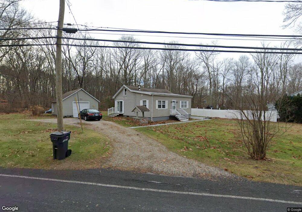
634 Daly Rd Coventry, CT 06238
Estimated Value: $270,913 - $337,000
1
Bed
1
Bath
1,257
Sq Ft
$243/Sq Ft
Est. Value
About This Home
This home is located at 634 Daly Rd, Coventry, CT 06238 and is currently estimated at $305,478, approximately $243 per square foot. 634 Daly Rd is a home located in Tolland County with nearby schools including George Hersey Robertson School, Coventry Grammar School, and Capt. Nathan Hale School.
Create a Home Valuation Report for This Property
The Home Valuation Report is an in-depth analysis detailing your home's value as well as a comparison with similar homes in the area
Home Values in the Area
Average Home Value in this Area
Tax History
| Year | Tax Paid | Tax Assessment Tax Assessment Total Assessment is a certain percentage of the fair market value that is determined by local assessors to be the total taxable value of land and additions on the property. | Land | Improvement |
|---|---|---|---|---|
| 2025 | $3,785 | $159,300 | $41,000 | $118,300 |
| 2024 | $3,148 | $94,500 | $35,600 | $58,900 |
| 2023 | $2,999 | $94,500 | $35,600 | $58,900 |
| 2022 | $2,944 | $94,500 | $35,600 | $58,900 |
| 2021 | $2,944 | $94,500 | $35,600 | $58,900 |
| 2020 | $2,946 | $94,500 | $35,600 | $58,900 |
| 2019 | $3,036 | $94,300 | $35,600 | $58,700 |
| 2018 | $3,065 | $95,200 | $35,600 | $59,600 |
| 2017 | $3,046 | $95,200 | $35,600 | $59,600 |
| 2016 | $2,970 | $95,200 | $35,600 | $59,600 |
| 2015 | $2,970 | $95,200 | $35,600 | $59,600 |
| 2014 | $3,021 | $106,100 | $44,100 | $62,000 |
Source: Public Records
Map
Nearby Homes
- 0 Seneca Trail
- 27 Fox Trail
- 0 Hinkel Mae Dr
- 17 Ireland Dr
- 152 Cheney Ln
- 0 Daly Rd Unit 24146464
- 2478 Main St
- 316 Shore Dr
- 198 Forest Rd
- 0 Woodland Rd
- 109 Sam Green Rd
- 0 Skinner Hill Rd Unit 24077239
- 0 Wheeling Rd Unit 24116879
- 864 Boston Turnpike
- 498 Root Rd
- 550 High St
- 97 Armstrong Rd
- 1091 Flanders Rd
- 17 Route 6
- 55 Whites Hill Rd
Your Personal Tour Guide
Ask me questions while you tour the home.