Estimated Value: $434,214 - $519,000
5
Beds
3
Baths
3,028
Sq Ft
$154/Sq Ft
Est. Value
About This Home
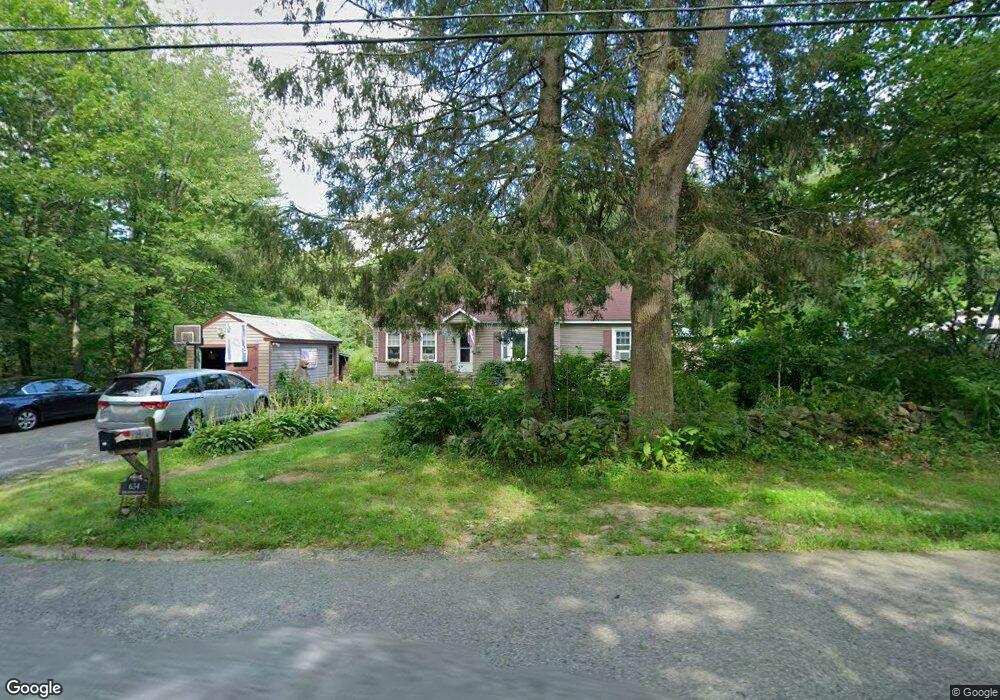
This home is located at 634 New Sherborn Rd, Athol, MA 01331 and is currently estimated at $465,804, approximately $153 per square foot. 634 New Sherborn Rd is a home located in Worcester County with nearby schools including Athol High School.
Ownership History
Date
Name
Owned For
Owner Type
Purchase Details
Closed on
Dec 23, 2014
Sold by
Marshall Donna B and Marshall Donna L
Bought by
Marshall Donna L
Current Estimated Value
Home Financials for this Owner
Home Financials are based on the most recent Mortgage that was taken out on this home.
Original Mortgage
$114,000
Outstanding Balance
$87,644
Interest Rate
4.02%
Mortgage Type
New Conventional
Estimated Equity
$378,160
Purchase Details
Closed on
Aug 1, 2001
Sold by
Roberts Jeremy J and Roberts Christine M
Bought by
Marshall Donna B
Purchase Details
Closed on
Jun 22, 1999
Sold by
King Gilbert and King Linda
Bought by
Roberts Christine M and Roberts Jeremy J
Purchase Details
Closed on
Aug 8, 1990
Sold by
Thayer Timothy W
Bought by
King Gilbert M
Create a Home Valuation Report for This Property
The Home Valuation Report is an in-depth analysis detailing your home's value as well as a comparison with similar homes in the area
Home Values in the Area
Average Home Value in this Area
Purchase History
| Date | Buyer | Sale Price | Title Company |
|---|---|---|---|
| Marshall Donna L | -- | -- | |
| Marshall Donna B | $145,000 | -- | |
| Roberts Christine M | $125,000 | -- | |
| King Gilbert M | $125,000 | -- |
Source: Public Records
Mortgage History
| Date | Status | Borrower | Loan Amount |
|---|---|---|---|
| Open | Marshall Donna L | $114,000 | |
| Previous Owner | King Gilbert M | $10,820 |
Source: Public Records
Tax History Compared to Growth
Tax History
| Year | Tax Paid | Tax Assessment Tax Assessment Total Assessment is a certain percentage of the fair market value that is determined by local assessors to be the total taxable value of land and additions on the property. | Land | Improvement |
|---|---|---|---|---|
| 2025 | $4,648 | $365,700 | $75,100 | $290,600 |
| 2024 | $4,570 | $356,200 | $75,100 | $281,100 |
| 2023 | $4,455 | $317,300 | $55,100 | $262,200 |
| 2022 | $4,284 | $266,900 | $52,600 | $214,300 |
| 2021 | $161 | $209,800 | $47,800 | $162,000 |
| 2020 | $3,634 | $211,500 | $43,800 | $167,700 |
| 2019 | $3,216 | $184,300 | $41,200 | $143,100 |
| 2018 | $3,558 | $181,800 | $37,300 | $144,500 |
| 2017 | $87 | $161,700 | $37,300 | $124,400 |
| 2016 | $3,064 | $154,500 | $37,300 | $117,200 |
| 2015 | $2,940 | $154,500 | $37,300 | $117,200 |
| 2014 | $2,847 | $154,500 | $37,300 | $117,200 |
Source: Public Records
Map
Nearby Homes
- 321 Doe Valley Rd
- 00 Miles Rd
- Lot 2 Petersham Rd
- Lot 1 Petersham Rd
- 0 Riceville Rd Unit 73429842
- 706 Petersham Rd
- 572 Pleasant St
- 266 Petersham Rd
- 62 Lindsay Ln
- 288 Chase Rd
- 696 Cottage St Unit Lot 10
- 2428 Main St
- 31 Kelton St
- 792 Cottage St
- 551 Sanders St
- 64 Garfield Rd
- 7-L New Athol Rd
- 11-L New Athol Rd
- 12-L New Athol Rd
- 71 Wendell St
- 688 New Sherborn Rd
- 590 New Sherborn Rd
- 706 New Sherborn Rd
- 685 New Sherborn Rd
- 556 New Sherborn Rd
- 559 New Sherborn Rd
- 591 New Sherborn Rd
- 719 New Sherborn Rd
- 533 New Sherborn Rd
- 750 New Sherborn Rd
- 516 New Sherborn Rd
- 495 New Sherborn Rd
- 480 New Sherborn Rd
- 425 New Sherborn Rd
- 452 New Sherborn Rd
- 843 New Sherborn Rd
- 872 New Sherborn Rd
- 898 New Sherborn Rd
- 142 Cailan Way
- 381 New Sherborn Rd