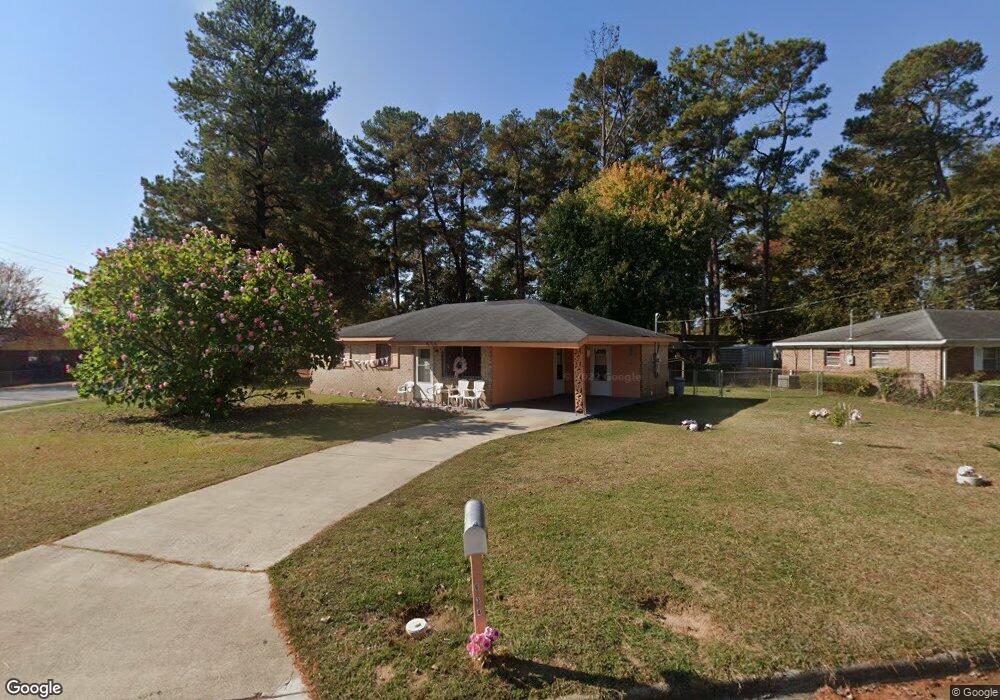
634 Sea Isle Dr Augusta, GA 30901
East Augusta NeighborhoodEstimated Value: $88,000 - $134,000
3
Beds
2
Baths
1,008
Sq Ft
$101/Sq Ft
Est. Value
About This Home
This home is located at 634 Sea Isle Dr, Augusta, GA 30901 and is currently estimated at $102,000, approximately $101 per square foot. 634 Sea Isle Dr is a home located in Richmond County with nearby schools including W.S. Hornsby School, W.S. Hornsby Elementary School, and Johnson Magnet.
Ownership History
Date
Name
Owned For
Owner Type
Purchase Details
Closed on
Jul 9, 2018
Sold by
Griffin George
Bought by
Knights Shirley M
Current Estimated Value
Purchase Details
Closed on
Nov 22, 2002
Sold by
Knight Larry and Knight Shirley M
Bought by
Griffin George
Purchase Details
Closed on
Jun 25, 1993
Sold by
Griffin George
Bought by
Knight Larry
Purchase Details
Closed on
Sep 1, 1989
Sold by
Johnson Deborah L
Bought by
Griffin George
Purchase Details
Closed on
Nov 1, 1988
Sold by
Mitchell Willie By
Bought by
Johnson Deborah L
Create a Home Valuation Report for This Property
The Home Valuation Report is an in-depth analysis detailing your home's value as well as a comparison with similar homes in the area
Home Values in the Area
Average Home Value in this Area
Purchase History
| Date | Buyer | Sale Price | Title Company |
|---|---|---|---|
| Knights Shirley M | -- | -- | |
| Griffin George | -- | -- | |
| Knight Larry | -- | -- | |
| Griffin George | $42,500 | -- | |
| Johnson Deborah L | $15,600 | -- |
Source: Public Records
Tax History Compared to Growth
Tax History
| Year | Tax Paid | Tax Assessment Tax Assessment Total Assessment is a certain percentage of the fair market value that is determined by local assessors to be the total taxable value of land and additions on the property. | Land | Improvement |
|---|---|---|---|---|
| 2025 | $693 | $32,476 | $1,600 | $30,876 |
| 2024 | $693 | $34,344 | $1,600 | $32,744 |
| 2023 | $421 | $24,832 | $1,600 | $23,232 |
| 2022 | $532 | $18,224 | $1,600 | $16,624 |
| 2021 | $544 | $17,773 | $1,600 | $16,173 |
| 2020 | $931 | $17,773 | $1,600 | $16,173 |
| 2019 | $913 | $15,996 | $1,440 | $14,556 |
| 2018 | $906 | $15,653 | $1,440 | $14,213 |
| 2017 | $860 | $15,653 | $1,440 | $14,213 |
| 2016 | $861 | $15,653 | $1,440 | $14,213 |
| 2015 | $865 | $15,653 | $1,440 | $14,213 |
| 2014 | $866 | $15,653 | $1,440 | $14,213 |
Source: Public Records
Map
Nearby Homes
- 615 Aiken St
- 526 Rachael St
- 1319 Wallace St
- 406 E Espinosa St
- 264 Japonica Ave
- 1326 Bruce St
- 503 Dupont St
- 503 Dupont St Unit 1
- 505 NE Dupont St
- 505 NE Dupont St Unit 1
- 205 Japonica Ave
- 206 E Hale St
- 109 E Walker St
- 765 Sand Bar Ferry Rd
- 37 Sand Bar Ferry Rd
- 26 Taylor St
- 170 Altamaha Dr
- 306 1st St
- 592 Rivernorth Dr
- 707 Rivernorth Dr