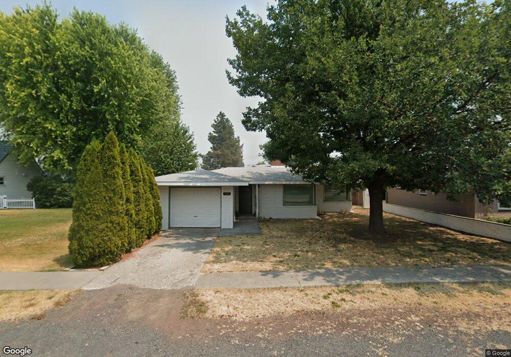
634 Second St Tulelake, CA 96134
Estimated Value: $125,000 - $162,000
2
Beds
2
Baths
1,458
Sq Ft
$95/Sq Ft
Est. Value
About This Home
This home is located at 634 Second St, Tulelake, CA 96134 and is currently estimated at $138,970, approximately $95 per square foot. 634 Second St is a home with nearby schools including Tulelake Basin Elementary School and Tulelake High School.
Ownership History
Date
Name
Owned For
Owner Type
Purchase Details
Closed on
Oct 5, 2015
Sold by
Wood Kenneth J
Bought by
Duncan Dawn
Current Estimated Value
Home Financials for this Owner
Home Financials are based on the most recent Mortgage that was taken out on this home.
Original Mortgage
$58,913
Outstanding Balance
$46,194
Interest Rate
3.78%
Mortgage Type
FHA
Estimated Equity
$92,776
Purchase Details
Closed on
Sep 25, 2007
Sold by
Va
Bought by
Wood Kenneth J
Home Financials for this Owner
Home Financials are based on the most recent Mortgage that was taken out on this home.
Original Mortgage
$64,000
Interest Rate
6.46%
Mortgage Type
Unknown
Purchase Details
Closed on
Apr 25, 2006
Sold by
Wood Kenneth J
Bought by
Va
Create a Home Valuation Report for This Property
The Home Valuation Report is an in-depth analysis detailing your home's value as well as a comparison with similar homes in the area
Purchase History
| Date | Buyer | Sale Price | Title Company |
|---|---|---|---|
| Duncan Dawn | $60,000 | Fidelity Natl Title Ins Co | |
| Wood Kenneth J | -- | None Available | |
| Wood Kenneth J | -- | Siskiyou County Title Co | |
| Va | -- | Mt Shasta Title & Escrow Co | |
| Wood Kenneth J | $48,500 | Mt Shasta Title & Escrow Co |
Source: Public Records
Mortgage History
| Date | Status | Borrower | Loan Amount |
|---|---|---|---|
| Open | Duncan Dawn | $58,913 | |
| Previous Owner | Wood Kenneth J | $64,000 |
Source: Public Records
Tax History
| Year | Tax Paid | Tax Assessment Tax Assessment Total Assessment is a certain percentage of the fair market value that is determined by local assessors to be the total taxable value of land and additions on the property. | Land | Improvement |
|---|---|---|---|---|
| 2025 | $729 | $72,868 | $8,045 | $64,823 |
| 2023 | $729 | $70,343 | $7,734 | $62,609 |
| 2022 | $701 | $68,976 | $7,583 | $61,393 |
| 2021 | $690 | $67,795 | $7,435 | $60,360 |
| 2020 | $685 | $67,273 | $7,359 | $59,914 |
| 2019 | $674 | $66,120 | $7,215 | $58,905 |
| 2018 | $661 | $64,923 | $7,074 | $57,849 |
| 2017 | $650 | $63,800 | $6,936 | $56,864 |
| 2016 | $640 | $62,780 | $6,800 | $55,980 |
| 2015 | -- | $64,802 | $6,817 | $57,985 |
| 2014 | -- | $63,534 | $6,684 | $56,850 |
Source: Public Records
Map
Nearby Homes
- 563 4th St
- 186 Siskiyou St
- 22994 Highway 50
- 2130 E-Z St
- 2236 3rd St
- 2567 County Road 106
- 1731 County Road 106 Unit 1
- 1731 Cr-106
- 2806 Front St
- 2709 California Ave
- 21173 Harpold Rd
- 22579 Malin Cemetery Rd
- 0 Drazil Rd
- Lot 56 County Road 113
- Lot 56 County Rd 1123
- 0 Dodds Hollow Rd Unit 895073 220200218
- 330 N Elm St
- 235 N Roosevelt St
- 18610 Taylor Rd
- 0 Oregon 39 Unit 4110-00200-01100
Your Personal Tour Guide
Ask me questions while you tour the home.