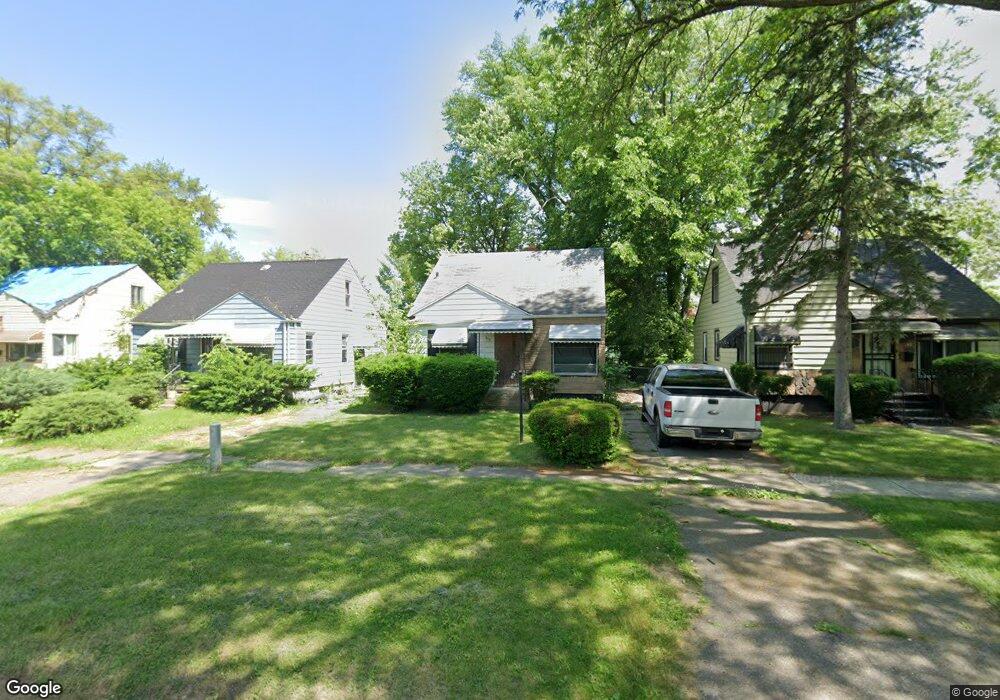
634 W Pulaski Ave Flint, MI 48505
King Avenue Plus NeighborhoodEstimated Value: $48,000 - $54,000
3
Beds
1
Bath
870
Sq Ft
$59/Sq Ft
Est. Value
About This Home
This home is located at 634 W Pulaski Ave, Flint, MI 48505 and is currently estimated at $51,000, approximately $58 per square foot. 634 W Pulaski Ave is a home located in Genesee County with nearby schools including Brownell STEM Academy, The New Standard Academy, and Eagle's Nest Academy.
Ownership History
Date
Name
Owned For
Owner Type
Purchase Details
Closed on
Mar 12, 2015
Sold by
The Genesee County Land Bank Authority
Bought by
Jones Rajhan Jameen
Current Estimated Value
Purchase Details
Closed on
Dec 20, 2012
Sold by
Cherry Deborah L and Genesee County Treasurer
Bought by
Genesee County Land Bank
Purchase Details
Closed on
Dec 9, 2002
Sold by
Morgan Debra A and Moore Sylvester
Bought by
Moore Theodore Wade
Purchase Details
Closed on
Mar 19, 2002
Sold by
Groves Terry and John D Groves Revocable Trust
Bought by
Moore Sylvester
Create a Home Valuation Report for This Property
The Home Valuation Report is an in-depth analysis detailing your home's value as well as a comparison with similar homes in the area
Home Values in the Area
Average Home Value in this Area
Purchase History
| Date | Buyer | Sale Price | Title Company |
|---|---|---|---|
| Jones Rajhan Jameen | $3,000 | None Available | |
| Genesee County Land Bank | -- | None Available | |
| Moore Theodore Wade | -- | Cislo Title Company | |
| Moore Sylvester | $15,900 | Guaranty Title Company |
Source: Public Records
Mortgage History
| Date | Status | Borrower | Loan Amount |
|---|---|---|---|
| Closed | Jones Rajhan Jameen | $0 |
Source: Public Records
Tax History Compared to Growth
Tax History
| Year | Tax Paid | Tax Assessment Tax Assessment Total Assessment is a certain percentage of the fair market value that is determined by local assessors to be the total taxable value of land and additions on the property. | Land | Improvement |
|---|---|---|---|---|
| 2025 | -- | $0 | $0 | $0 |
| 2024 | -- | $0 | $0 | $0 |
| 2023 | -- | $0 | $0 | $0 |
| 2022 | $0 | $0 | $0 | $0 |
| 2021 | $0 | $0 | $0 | $0 |
| 2020 | $268 | $0 | $0 | $0 |
| 2019 | $705 | $6,700 | $0 | $0 |
| 2018 | $717 | $7,100 | $0 | $0 |
| 2017 | $715 | $0 | $0 | $0 |
| 2016 | $710 | $0 | $0 | $0 |
| 2015 | -- | $0 | $0 | $0 |
| 2014 | -- | $0 | $0 | $0 |
| 2012 | -- | $9,700 | $0 | $0 |
Source: Public Records
Map
Nearby Homes
- 5210 Dupont St
- 525 W Pulaski Ave
- 506 W Marengo Ave
- 4808 Edwards Ave
- 325 W Marengo Ave
- 329 W Baltimore Blvd
- 5610 Baldwin Blvd
- 5302 Susan St
- 4515 Baldwin Blvd
- 702/718 W Flint Park Blvd
- 5714 Suburban Ct
- 306 W Bishop Ave
- 606 W Stewart Ave
- 124 W Flint Park Blvd
- 536 W Home Ave
- 5413 Fleming Rd
- 618 W Austin Ave
- 610 W Austin Ave
- 1720 Marlowe Dr
- 4702 Warrington Dr
- 630 W Pulaski Ave
- 642 W Pulaski Ave
- 626 W Pulaski Ave
- 642 W Pulaski St
- 633 W Pierson Rd
- 629 W Pierson Rd
- 637 W Pierson Rd
- 622 W Pulaski Ave
- 625 W Pierson Rd
- 645 W Pierson Rd
- 621 W Pierson Rd
- 633 W Pulaski Ave
- 633 W Pulaski St
- 618 W Pulaski Ave
- 629 W Pulaski Ave
- 637 W Pulaski Ave
- 617 W Pierson Rd
- 625 W Pulaski Ave
- 621 W Pulaski Ave
- 645 W Pulaski Ave