Estimated Value: $324,000 - $368,000
3
Beds
2
Baths
1,636
Sq Ft
$211/Sq Ft
Est. Value
About This Home
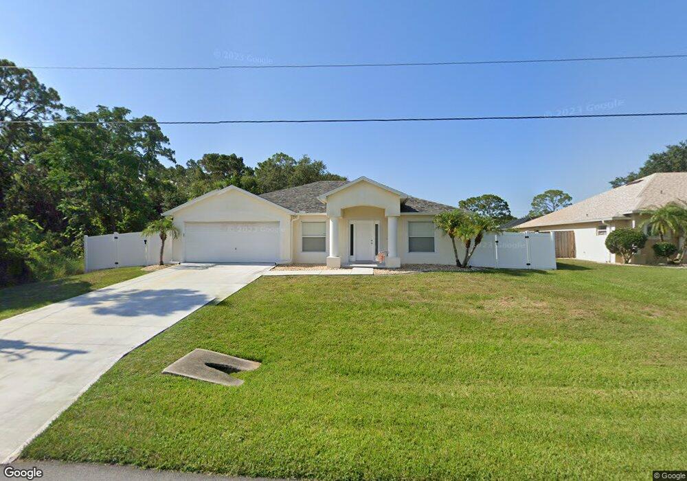
This home is located at 6340 Angus St, Cocoa, FL 32927 and is currently estimated at $344,702, approximately $210 per square foot. 6340 Angus St is a home located in Brevard County with nearby schools including Enterprise Elementary School, Space Coast Junior/Senior High School, and East Atlantic Prep of Brevard County.
Ownership History
Date
Name
Owned For
Owner Type
Purchase Details
Closed on
Nov 21, 2002
Sold by
Holiday Bldr Inc
Bought by
Wisniewski Eugene M and Wisniewski Donna L
Current Estimated Value
Home Financials for this Owner
Home Financials are based on the most recent Mortgage that was taken out on this home.
Original Mortgage
$111,536
Outstanding Balance
$47,164
Interest Rate
6.15%
Mortgage Type
Purchase Money Mortgage
Estimated Equity
$297,538
Purchase Details
Closed on
Jun 7, 2002
Sold by
Leavy Maurice
Bought by
Holiday Bldr Inc
Purchase Details
Closed on
May 8, 2001
Sold by
Vogel Walter R and Vogel Patricia J
Bought by
Leavy Maurice
Create a Home Valuation Report for This Property
The Home Valuation Report is an in-depth analysis detailing your home's value as well as a comparison with similar homes in the area
Home Values in the Area
Average Home Value in this Area
Purchase History
| Date | Buyer | Sale Price | Title Company |
|---|---|---|---|
| Wisniewski Eugene M | $113,300 | -- | |
| Holiday Bldr Inc | $14,000 | -- | |
| Leavy Maurice | $8,800 | -- |
Source: Public Records
Mortgage History
| Date | Status | Borrower | Loan Amount |
|---|---|---|---|
| Open | Wisniewski Eugene M | $111,536 |
Source: Public Records
Tax History
| Year | Tax Paid | Tax Assessment Tax Assessment Total Assessment is a certain percentage of the fair market value that is determined by local assessors to be the total taxable value of land and additions on the property. | Land | Improvement |
|---|---|---|---|---|
| 2025 | $1,586 | $117,070 | -- | -- |
| 2024 | $1,548 | $113,780 | -- | -- |
| 2023 | $1,548 | $110,470 | $0 | $0 |
| 2022 | $1,444 | $107,260 | $0 | $0 |
| 2021 | $1,447 | $104,140 | $0 | $0 |
| 2020 | $1,386 | $102,710 | $0 | $0 |
| 2019 | $1,323 | $100,410 | $0 | $0 |
| 2018 | $1,317 | $98,540 | $0 | $0 |
| 2017 | $1,312 | $96,520 | $0 | $0 |
| 2016 | $1,316 | $94,540 | $18,000 | $76,540 |
| 2015 | $1,334 | $93,890 | $15,000 | $78,890 |
| 2014 | $1,336 | $93,150 | $11,000 | $82,150 |
Source: Public Records
Map
Nearby Homes
- 6177 Brandt St
- 6115 Allmont St
- 23-35-21-J No Name
- 6135 Allmont St
- 6510 Aspen Ln
- 6555 Corsica Blvd
- 6105 Banyan St
- 6220 Golfview Ave
- 6545 Addie Ave
- 6200 Edison St
- 6665 Addie Ave
- 23-35-21-JX-B-2 Aruin St
- 6365 Homestead Ave
- 6150 Baltimore Ave
- 6085 Edison St
- 00000 Golfview Ave
- 6010 Fay Blvd
- 0 Golfview Ave
- 5715 Fairbridge St
- 6230 Balsam St
- 6330 Angus St
- 6285 Corsica Blvd
- 6275 Corsica Blvd
- 6320 Angus St
- 6360 Angus St
- 6355 Angus Rd
- 6355 Angus St
- 6265 Corsica Blvd
- 6325 Angus St
- 6365 Angus St
- 6370 Angus St
- 6315 Angus St
- 6375 Angus St
- 6340 Dearman St
- 6348 Dearman St
- 6380 Angus St
- 6470 Ailes Ave
- 6478 Ailes Ave
- 6280 Corsica Blvd
- 6245 Corsica Blvd
Your Personal Tour Guide
Ask me questions while you tour the home.