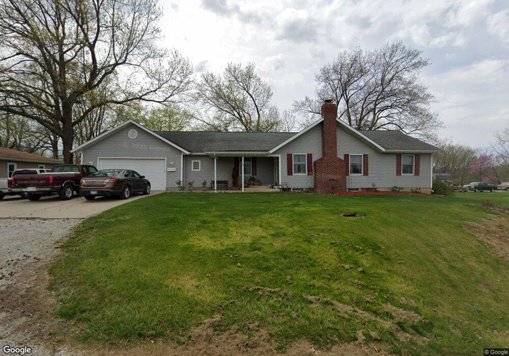
6341 Strode Rd Cantrall, IL 62625
Estimated Value: $109,000 - $172,000
2
Beds
1
Bath
1,100
Sq Ft
$127/Sq Ft
Est. Value
About This Home
This home is located at 6341 Strode Rd, Cantrall, IL 62625 and is currently estimated at $139,537, approximately $126 per square foot. 6341 Strode Rd is a home located in Sangamon County with nearby schools including Cantrall Elementary School, Cantrall Intermediate School, and Athens Junior High School.
Ownership History
Date
Name
Owned For
Owner Type
Purchase Details
Closed on
Apr 8, 2003
Current Estimated Value
Purchase Details
Closed on
Feb 20, 2003
Purchase Details
Closed on
May 9, 2002
Purchase Details
Closed on
Mar 31, 1999
Create a Home Valuation Report for This Property
The Home Valuation Report is an in-depth analysis detailing your home's value as well as a comparison with similar homes in the area
Purchase History
| Date | Buyer | Sale Price | Title Company |
|---|---|---|---|
| -- | $49,900 | -- | |
| -- | -- | -- | |
| -- | -- | -- | |
| -- | $89,800 | -- |
Source: Public Records
Tax History
| Year | Tax Paid | Tax Assessment Tax Assessment Total Assessment is a certain percentage of the fair market value that is determined by local assessors to be the total taxable value of land and additions on the property. | Land | Improvement |
|---|---|---|---|---|
| 2024 | $2,021 | $31,312 | $13,467 | $17,845 |
| 2023 | $1,933 | $28,963 | $12,457 | $16,506 |
| 2022 | $1,827 | $26,977 | $11,603 | $15,374 |
| 2021 | $1,778 | $25,719 | $11,062 | $14,657 |
| 2020 | $1,739 | $25,187 | $10,833 | $14,354 |
| 2019 | $1,686 | $24,997 | $10,751 | $14,246 |
| 2018 | $1,718 | $24,853 | $10,689 | $14,164 |
| 2017 | $1,679 | $24,581 | $10,572 | $14,009 |
| 2016 | $1,621 | $23,993 | $10,319 | $13,674 |
| 2015 | $1,573 | $23,681 | $10,185 | $13,496 |
| 2014 | $1,572 | $22,805 | $9,808 | $12,997 |
| 2013 | $1,537 | $22,496 | $9,675 | $12,821 |
Source: Public Records
Map
Nearby Homes
- 1130 Cantrall Creek Rd
- 6555 Coolidge Dr
- 0 Presidential Lake Estates Unit RMACA1024912
- 61 Thistle Ridge
- 6897 N Cantrall Creek Rd Unit 1
- 24862 Brookwood Hills Rd
- 202 1st St Unit 1
- 20 Hickory Ridge Ln Unit 1
- 1237 Golf Crest Ct
- 1215 Golf Crest Ct
- 0 Cabin Smoke Trail
- 3406 Hazlett Rd
- 520 Vanderbilt Unit 1
- 509 Wingate Dr Unit 1
- 505 Emory Dr Unit 1
- 0 S Sherman Blvd
- 3945 N Peoria Rd
- 2025 Catalina Ln
- 14 Sycamore Row
- 1901 Cory Dr
- 6325 Strode Rd
- 6303 Strode Rd
- 6391 Strode Rd
- 6269 Strode Rd Unit 1
- 6201 Strode Rd
- 6445 Strode Rd
- 1660 Cantrall Creek Rd Unit 1
- 1866 Cantrall Creek Rd Unit 1
- 1600 Cantrall Creek Rd
- 6133 Strode Rd
- 6188 Strode Rd Unit 1
- 1655 Cantrall Creek Rd
- 6134 Strode Rd Unit 1
- 1585 Cantrall Creek Rd
- 1965 Jeffries Rd Unit 1
- 2196 Cantrall Creek Rd
- 1454 Jefferies Rd
- 0 Cantrall Creek Rd Unit RMACA990285
- 0 Cantrall Creek Rd Unit RMACA981099
- 0 Cantrall Creek Rd Unit CA1014508
Your Personal Tour Guide
Ask me questions while you tour the home.