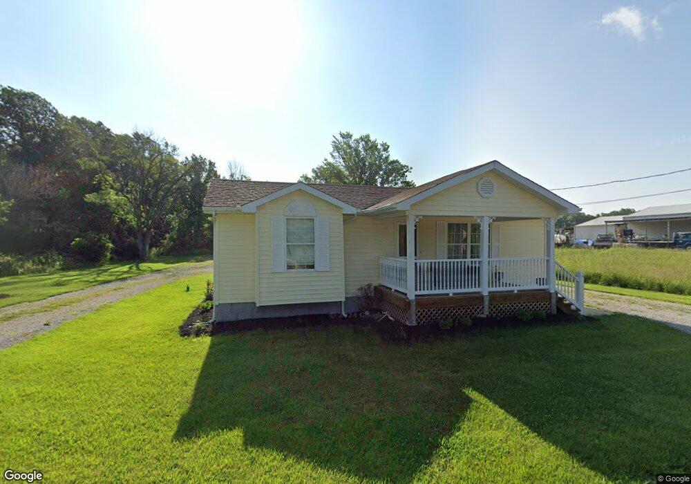
6342 Cedar Srings Cedar Hill, MO 63016
Estimated Value: $221,000 - $463,000
2
Beds
1
Bath
901
Sq Ft
$331/Sq Ft
Est. Value
About This Home
This home is located at 6342 Cedar Srings, Cedar Hill, MO 63016 and is currently estimated at $298,658, approximately $331 per square foot. 6342 Cedar Srings is a home located in Jefferson County with nearby schools including Northwest High School.
Ownership History
Date
Name
Owned For
Owner Type
Purchase Details
Closed on
Feb 1, 2023
Sold by
Miller Randy K and Miller Charlotte M
Bought by
Randal K Miller And Charlotte M Miller Joint and Miller
Current Estimated Value
Purchase Details
Closed on
Feb 17, 2017
Sold by
Becker David John and Becker Amy Nicole
Bought by
Austin Terry W and Austin Michelle R
Home Financials for this Owner
Home Financials are based on the most recent Mortgage that was taken out on this home.
Original Mortgage
$215,200
Interest Rate
4.09%
Mortgage Type
New Conventional
Purchase Details
Closed on
Mar 8, 2006
Sold by
Revoca Donald H Lechner and Revoca Mary C Lechner
Bought by
Miller Randy K and Miller Charlotte
Home Financials for this Owner
Home Financials are based on the most recent Mortgage that was taken out on this home.
Original Mortgage
$354,700
Interest Rate
6.09%
Mortgage Type
Purchase Money Mortgage
Purchase Details
Closed on
Dec 20, 2004
Sold by
Lechner Mary C
Bought by
Livi Donald H and Lechner Revocable Livi C L
Create a Home Valuation Report for This Property
The Home Valuation Report is an in-depth analysis detailing your home's value as well as a comparison with similar homes in the area
Purchase History
| Date | Buyer | Sale Price | Title Company |
|---|---|---|---|
| Randal K Miller And Charlotte M Miller Joint | -- | None Listed On Document | |
| Austin Terry W | -- | None Available | |
| Miller Randy K | -- | Commonwealth Land Title | |
| Livi Donald H | -- | -- |
Source: Public Records
Mortgage History
| Date | Status | Borrower | Loan Amount |
|---|---|---|---|
| Previous Owner | Austin Terry W | $215,200 | |
| Previous Owner | Miller Randy K | $354,700 |
Source: Public Records
Tax History
| Year | Tax Paid | Tax Assessment Tax Assessment Total Assessment is a certain percentage of the fair market value that is determined by local assessors to be the total taxable value of land and additions on the property. | Land | Improvement |
|---|---|---|---|---|
| 2025 | $1,781 | $24,700 | $8,200 | $16,500 |
| 2024 | $1,781 | $23,500 | $8,200 | $15,300 |
| 2023 | $1,781 | $23,500 | $8,200 | $15,300 |
| 2022 | $1,773 | $23,500 | $8,200 | $15,300 |
| 2021 | $1,756 | $23,500 | $8,200 | $15,300 |
| 2020 | $1,648 | $21,400 | $7,500 | $13,900 |
| 2019 | $1,647 | $21,400 | $7,500 | $13,900 |
| 2018 | $1,643 | $21,400 | $7,500 | $13,900 |
| 2016 | $1,478 | $20,200 | $7,500 | $12,700 |
Source: Public Records
Map
Nearby Homes
- 6207 Cedar Brook Dr
- 8911 Kitson Ln
- 0 Terri Hill Dr
- 69 Cedar Hill Estates Unit C-47
- 0 Land B Deer Run Rd
- 0 Land A Deer Run Rd
- 7016 Oakwood Dr
- 6127 Barrington Oaks Dr
- 6566 Cedar Hill Rd
- 7205 Lakeshore Dr
- 7218 Lakeshore Dr
- 6105 Eime Rd
- 8405 Midway Dr
- 7320 Woodland Dr
- 0 Lakeshore Dr
- 7322 Springdale
- 8353 Graham Rd
- 5450 Dutch Creek Rd
- 0 Twin Ridge Rd
- 5961 White Oak Dr
- 6342 Cedar Dr Unit SRINGS
- 6386 Cedar Dr
- 9085 Hickory Dr
- 6344 Cedar Dr
- 6385 Cedar Dr
- 6302 Cedar Dr
- 6305 Cedar Dr
- 9054 Hickory Dr
- 9053 Hickory Dr
- 9096 Hickory Dr
- 9050 Hickory Dr
- 9045 Hickory Dr
- 6315 Cedar Brook Dr
- 6396 Cedar Dr
- 9018 State Road Nn
- 9018 Highway Nn
- 8906 Riverview Dr
- 8905 Riverview Dr
- 9002 Highway Nn
- 9050 Highway Nn
Your Personal Tour Guide
Ask me questions while you tour the home.