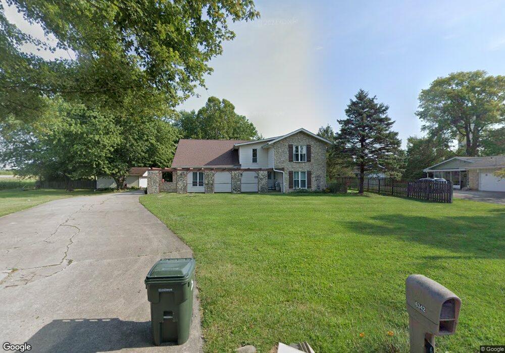
6342 W 800 N Mc Cordsville, IN 46055
Brooks-Luxhaven NeighborhoodEstimated Value: $430,000 - $483,000
4
Beds
3
Baths
4,224
Sq Ft
$109/Sq Ft
Est. Value
About This Home
This home is located at 6342 W 800 N, Mc Cordsville, IN 46055 and is currently estimated at $461,234, approximately $109 per square foot. 6342 W 800 N is a home located in Hancock County with nearby schools including McCordsville Elementary School, Mt. Vernon Middle School, and Mt. Vernon High School.
Ownership History
Date
Name
Owned For
Owner Type
Purchase Details
Closed on
Jun 25, 2008
Sold by
Fannie Mae
Bought by
Adams Grant Paul and Adams Darlene L
Current Estimated Value
Home Financials for this Owner
Home Financials are based on the most recent Mortgage that was taken out on this home.
Original Mortgage
$171,576
Interest Rate
5.94%
Mortgage Type
FHA
Purchase Details
Closed on
Mar 5, 2008
Sold by
Irwin Union Bank And Trust Co
Bought by
Federal National Mortgage Association
Purchase Details
Closed on
Feb 19, 2008
Sold by
Towne William D
Bought by
Irwin Union Bank And Trust Co
Purchase Details
Closed on
Aug 22, 2006
Sold by
Towne William D
Bought by
Towne Taja
Create a Home Valuation Report for This Property
The Home Valuation Report is an in-depth analysis detailing your home's value as well as a comparison with similar homes in the area
Home Values in the Area
Average Home Value in this Area
Purchase History
| Date | Buyer | Sale Price | Title Company |
|---|---|---|---|
| Adams Grant Paul | -- | -- | |
| Federal National Mortgage Association | -- | -- | |
| Irwin Union Bank And Trust Co | $197,024 | -- | |
| Towne Taja | -- | -- |
Source: Public Records
Mortgage History
| Date | Status | Borrower | Loan Amount |
|---|---|---|---|
| Previous Owner | Adams Grant Paul | $171,576 |
Source: Public Records
Tax History Compared to Growth
Tax History
| Year | Tax Paid | Tax Assessment Tax Assessment Total Assessment is a certain percentage of the fair market value that is determined by local assessors to be the total taxable value of land and additions on the property. | Land | Improvement |
|---|---|---|---|---|
| 2024 | $3,210 | $299,100 | $57,700 | $241,400 |
| 2023 | $3,210 | $281,900 | $57,700 | $224,200 |
| 2022 | $3,047 | $256,600 | $38,500 | $218,100 |
| 2021 | $2,697 | $247,100 | $38,500 | $208,600 |
| 2020 | $2,643 | $241,700 | $38,500 | $203,200 |
| 2019 | $2,510 | $232,800 | $38,500 | $194,300 |
| 2018 | $2,565 | $238,300 | $38,500 | $199,800 |
| 2017 | $2,501 | $228,800 | $38,500 | $190,300 |
| 2016 | $2,481 | $228,900 | $38,500 | $190,400 |
| 2014 | $2,608 | $227,400 | $38,500 | $188,900 |
| 2013 | $2,608 | $232,200 | $38,500 | $193,700 |
Source: Public Records
Map
Nearby Homes
- 6475 Teakwood Way
- 7904 N 600 W
- 8348 N Doheny Dr
- 6471 W Clearview Dr
- 8079 N 600 W
- 8365 N Nathan Ct
- 6481 W Treeline Ln
- 6533 Treeline Ln
- Mckinley Plan at The Preserve at Brookside
- Lincoln Plan at The Preserve at Brookside
- Montgomery Plan at The Preserve at Brookside
- Grant Plan at The Preserve at Brookside
- Eisenhower Plan at The Preserve at Brookside
- Pennington Plan at The Preserve at Brookside
- Dean Plan at The Preserve at Brookside
- Cleveland Plan at The Preserve at Brookside
- 6890 Enclave Dr
- 8384 W Treeline Ln
- 6348 W 750 N
- 6820 Vail Ct
- 6318 W 800 N
- 6361 W 800 N
- 6419 W 800 N
- 6549 W 800 N
- 6190 W 800 N
- 6142 W 800 N
- 6399 Teakwood Way
- 6357 Teakwood Way
- 6427 Teakwood Way
- 6341 Teakwood Way
- 6327 Teakwood Way
- 7776 Depot St
- 6084 W 800 N
- 6414 Teakwood Way
- 6501 Teakwood Way
- 6428 Teakwood Way
- 7762 Depot St
- 6452 Teakwood Way
- 6648 W 800 N
- 6150 N Railroad St