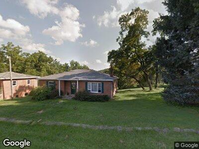
6348 State Route 342 Tippecanoe, OH 44699
Estimated Value: $137,000 - $181,000
2
Beds
1
Bath
1,778
Sq Ft
$88/Sq Ft
Est. Value
About This Home
This home is located at 6348 State Route 342, Tippecanoe, OH 44699 and is currently estimated at $155,922, approximately $87 per square foot. 6348 State Route 342 is a home located in Tuscarawas County with nearby schools including Harrison East Elementary School, Harrison North Elementary School, and Harrison Central Junior/Senior High School.
Ownership History
Date
Name
Owned For
Owner Type
Purchase Details
Closed on
Mar 23, 2016
Sold by
Bardall Sandra P
Bought by
Bardall Mark T
Current Estimated Value
Home Financials for this Owner
Home Financials are based on the most recent Mortgage that was taken out on this home.
Original Mortgage
$64,000
Outstanding Balance
$6,894
Interest Rate
3.68%
Mortgage Type
New Conventional
Estimated Equity
$149,028
Purchase Details
Closed on
Aug 1, 2005
Sold by
Jp Morgan Chase Bank
Bought by
Bardall Mark T and Bardall Sandra P
Home Financials for this Owner
Home Financials are based on the most recent Mortgage that was taken out on this home.
Original Mortgage
$50,800
Interest Rate
5.38%
Mortgage Type
Fannie Mae Freddie Mac
Purchase Details
Closed on
Jul 30, 1993
Bought by
Bardall Mark T
Create a Home Valuation Report for This Property
The Home Valuation Report is an in-depth analysis detailing your home's value as well as a comparison with similar homes in the area
Home Values in the Area
Average Home Value in this Area
Purchase History
| Date | Buyer | Sale Price | Title Company |
|---|---|---|---|
| Bardall Mark T | -- | None Available | |
| Bardall Mark T | $63,500 | Resource Title Agency Inc | |
| Bardall Mark T | -- | -- |
Source: Public Records
Mortgage History
| Date | Status | Borrower | Loan Amount |
|---|---|---|---|
| Open | Bardall Mark T | $64,000 | |
| Closed | Bardall Mark T | $10,000 | |
| Closed | Bardall Mark T | $50,800 |
Source: Public Records
Tax History Compared to Growth
Tax History
| Year | Tax Paid | Tax Assessment Tax Assessment Total Assessment is a certain percentage of the fair market value that is determined by local assessors to be the total taxable value of land and additions on the property. | Land | Improvement |
|---|---|---|---|---|
| 2024 | $1,578 | $122,220 | $6,040 | $116,180 |
| 2023 | $1,578 | $122,220 | $6,040 | $116,180 |
| 2022 | $1,499 | $42,777 | $2,114 | $40,663 |
| 2021 | $1,269 | $34,409 | $1,005 | $33,404 |
| 2020 | $897 | $24,060 | $1,005 | $23,055 |
| 2019 | $903 | $24,060 | $1,005 | $23,055 |
| 2018 | $905 | $23,000 | $960 | $22,040 |
| 2017 | $907 | $23,000 | $960 | $22,040 |
| 2016 | $911 | $23,000 | $960 | $22,040 |
| 2014 | $851 | $20,940 | $620 | $20,320 |
| 2013 | $822 | $20,940 | $620 | $20,320 |
Source: Public Records
Map
Nearby Homes
- 17980 Westchester South Rd SE
- 26655 Norris Rd
- 16315 Grove Rd SE
- 78560 Kinsey Orchard Rd
- 28838 Norris Rd
- 105 N Philadelphia St
- 0 Smyrna Rd
- 16909 Sligo Rd
- 73117 Deck Rd
- 23033 Cadiz Rd
- 17832 Sugartree Rd
- 82755 Laughlin Rd
- 78542 Bose Rd
- 78400 Bose Rd
- 32290 Richey Ln
- 32265 Clendening Lake Rd
- 74184 Broadhead Rd
- 1171 Allgyer Rd SE
- 6716 Tracy Rd SE
- 78520 Lakeview Dr