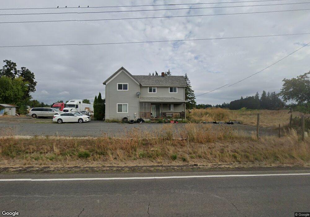
6349 Highway 211 Hubbard, OR 97032
Estimated Value: $587,000 - $958,988
4
Beds
1
Bath
1,688
Sq Ft
$473/Sq Ft
Est. Value
About This Home
This home is located at 6349 Highway 211, Hubbard, OR 97032 and is currently estimated at $798,997, approximately $473 per square foot. 6349 Highway 211 is a home located in Clackamas County with nearby schools including Josefa L. Sambrano Elementary School, Philander Lee Elementary School, and Baker Prairie Middle School.
Ownership History
Date
Name
Owned For
Owner Type
Purchase Details
Closed on
Aug 23, 2021
Sold by
Columbia Trust Company
Bought by
Keptya Ivan and Keptya Galina
Current Estimated Value
Home Financials for this Owner
Home Financials are based on the most recent Mortgage that was taken out on this home.
Original Mortgage
$548,250
Outstanding Balance
$495,914
Interest Rate
2.7%
Mortgage Type
New Conventional
Estimated Equity
$303,083
Purchase Details
Closed on
Dec 13, 1995
Sold by
Straub Otto and Straub Kathy
Bought by
Bronec Frank J
Home Financials for this Owner
Home Financials are based on the most recent Mortgage that was taken out on this home.
Original Mortgage
$120,000
Interest Rate
7.36%
Mortgage Type
Seller Take Back
Create a Home Valuation Report for This Property
The Home Valuation Report is an in-depth analysis detailing your home's value as well as a comparison with similar homes in the area
Home Values in the Area
Average Home Value in this Area
Purchase History
| Date | Buyer | Sale Price | Title Company |
|---|---|---|---|
| Keptya Ivan | $500,000 | Fidelity Natl Ttl Co Of Or | |
| Bronec Frank J | -- | First American Title Ins Co |
Source: Public Records
Mortgage History
| Date | Status | Borrower | Loan Amount |
|---|---|---|---|
| Open | Keptya Ivan | $548,250 | |
| Previous Owner | Bronec Frank J | $120,000 |
Source: Public Records
Tax History Compared to Growth
Tax History
| Year | Tax Paid | Tax Assessment Tax Assessment Total Assessment is a certain percentage of the fair market value that is determined by local assessors to be the total taxable value of land and additions on the property. | Land | Improvement |
|---|---|---|---|---|
| 2025 | $1,513 | $119,668 | -- | -- |
| 2024 | $1,472 | $116,305 | -- | -- |
| 2023 | $1,472 | $113,036 | $0 | $0 |
| 2022 | $1,342 | $109,869 | $0 | $0 |
| 2021 | $1,289 | $106,792 | $0 | $0 |
| 2020 | $1,273 | $103,802 | $0 | $0 |
| 2019 | $1,203 | $100,896 | $0 | $0 |
| 2018 | $1,205 | $98,083 | $0 | $0 |
| 2017 | $1,178 | $95,340 | $0 | $0 |
| 2016 | $1,138 | $92,685 | $0 | $0 |
| 2015 | $1,108 | $90,097 | $0 | $0 |
| 2014 | $1,077 | $87,594 | $0 | $0 |
Source: Public Records
Map
Nearby Homes
- 6150 S Miller Rd
- 30413 S Stuwe Rd
- 29497 S Meridian Rd
- 30700 S Highway 170
- 12984 Elliott Prairie Rd NE
- 15145 Woodburn Monitor Rd NE
- 17765 Monnier Rd NE
- 14604 Woodburn Monitor Rd NE
- 2995 Molalla Rd
- 6939 S Zimmerman Rd
- 29474 S Highway 170
- 3197 Rainbow Loop Unit 10
- 3472 Hoodview Dr
- 3921 Pacific Cir
- 3370 Maple St
- 3370 Maple St Unit 44
- 2225 Molalla Rd
- 18767 Oregon 99e
- 16688 Highway 99e NE
- 16688 Highway 99e NE Unit 54
- 6349 Oregon 211
- 31976 Yoder Rd
- 31976 Yoder Rd
- 6311 S Hwy 211
- 6674 Highway 211
- 6460 Highway 211
- 6090 Highway 211
- 6650 Highway 211
- 6677 Highway 211
- 31717 Yoder Rd
- 32032 S Barlow Rd
- 31601 Yoder Rd
- 32062 S Barlow Rd
- 6002 Highway 211
- 31531 Yoder Rd
- 5990 Highway 211
- 31501 Yoder Rd
- 31818 Barlow Rd
- 5895 Highway 211
- 5895 Highway 211