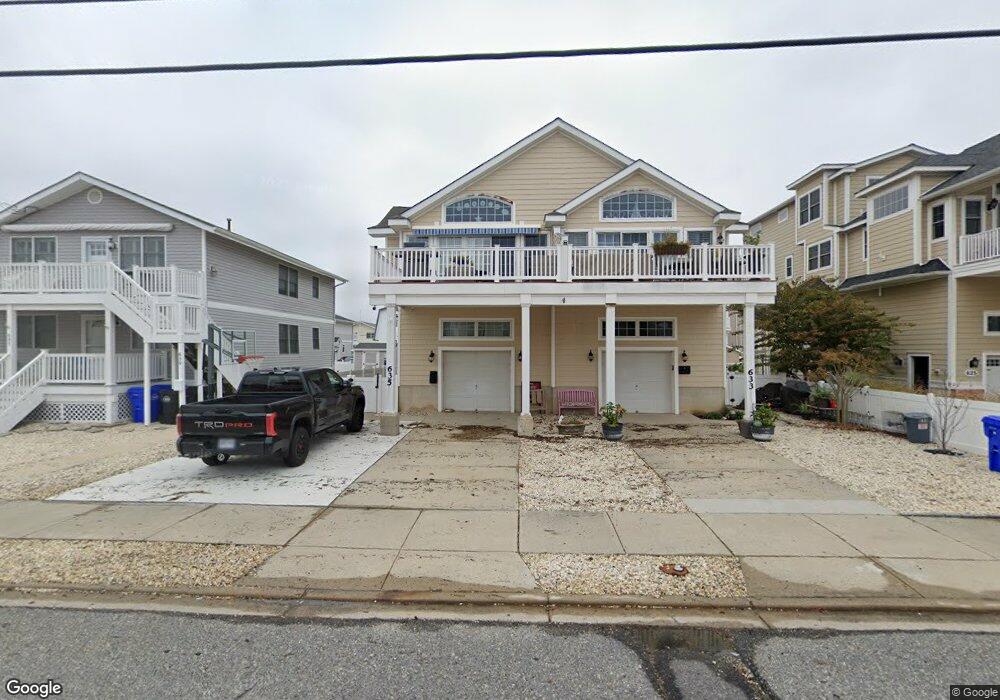
635 21st St Unit 635 Avalon, NJ 08202
Estimated Value: $1,889,000 - $2,486,000
--
Bed
--
Bath
1,941
Sq Ft
$1,139/Sq Ft
Est. Value
About This Home
This home is located at 635 21st St Unit 635, Avalon, NJ 08202 and is currently estimated at $2,209,946, approximately $1,138 per square foot. 635 21st St Unit 635 is a home located in Cape May County with nearby schools including Avalon Elementary School.
Ownership History
Date
Name
Owned For
Owner Type
Purchase Details
Closed on
May 1, 2015
Sold by
Hogan Richard and Cruz Rowena Ann
Bought by
Pavone John A and Pavone Barbara A
Current Estimated Value
Home Financials for this Owner
Home Financials are based on the most recent Mortgage that was taken out on this home.
Original Mortgage
$110,250
Outstanding Balance
$84,963
Interest Rate
3.69%
Mortgage Type
Credit Line Revolving
Estimated Equity
$2,124,983
Purchase Details
Closed on
Mar 8, 2013
Sold by
Woody Patricia C
Bought by
Woody Robert
Purchase Details
Closed on
Mar 31, 2004
Sold by
Watson Joseph
Bought by
Woody Robert and Woody Patricia C
Home Financials for this Owner
Home Financials are based on the most recent Mortgage that was taken out on this home.
Original Mortgage
$550,000
Interest Rate
4.62%
Mortgage Type
Purchase Money Mortgage
Purchase Details
Closed on
Feb 28, 2003
Sold by
Zeigler Ranalli Hanson Llc
Bought by
Watson Jospeh C and Watson Elaine M
Home Financials for this Owner
Home Financials are based on the most recent Mortgage that was taken out on this home.
Original Mortgage
$416,000
Interest Rate
5.45%
Create a Home Valuation Report for This Property
The Home Valuation Report is an in-depth analysis detailing your home's value as well as a comparison with similar homes in the area
Home Values in the Area
Average Home Value in this Area
Purchase History
| Date | Buyer | Sale Price | Title Company |
|---|---|---|---|
| Pavone John A | $735,000 | Seaboard Title Agency | |
| Woody Robert | -- | Seaboard Title Agency | |
| Woody Robert | $710,000 | -- | |
| Woody Robert | $710,000 | Shore Title Agency Inc | |
| Watson Jospeh C | $520,000 | -- |
Source: Public Records
Mortgage History
| Date | Status | Borrower | Loan Amount |
|---|---|---|---|
| Open | Pavone John A | $110,250 | |
| Previous Owner | Woody Robert | $550,000 | |
| Previous Owner | Watson Jospeh C | $416,000 |
Source: Public Records
Tax History Compared to Growth
Tax History
| Year | Tax Paid | Tax Assessment Tax Assessment Total Assessment is a certain percentage of the fair market value that is determined by local assessors to be the total taxable value of land and additions on the property. | Land | Improvement |
|---|---|---|---|---|
| 2025 | $5,047 | $822,000 | $450,000 | $372,000 |
| 2024 | $5,047 | $822,000 | $450,000 | $372,000 |
| 2023 | $5,006 | $822,000 | $450,000 | $372,000 |
| 2022 | $4,669 | $822,000 | $450,000 | $372,000 |
| 2021 | $4,496 | $822,000 | $450,000 | $372,000 |
| 2020 | $4,096 | $778,700 | $450,000 | $328,700 |
| 2019 | $3,971 | $778,700 | $450,000 | $328,700 |
| 2018 | $3,800 | $778,700 | $450,000 | $328,700 |
| 2017 | $3,309 | $595,200 | $325,000 | $270,200 |
| 2016 | $3,274 | $595,200 | $325,000 | $270,200 |
| 2015 | $3,220 | $595,200 | $325,000 | $270,200 |
| 2014 | -- | $595,200 | $325,000 | $270,200 |
Source: Public Records
Map
Nearby Homes
- 647 Barry Rd
- 503 20th St
- 440 21st St Unit South (B)
- 431 24th St
- 415 20th St
- 890 21st St
- 389 22nd St
- 297 24th St Unit 297
- 297 24th St
- 2425 Harbor Ave Unit 2425
- 211 23rd St
- 212 25th St
- 212 25th St Unit East Unit
- 178 19th St
- 174 23rd St
- 704 Old Avalon Blvd
- 161 24th St
- 279 13th St Unit C-6
- 279 13th St
- 179 27th St
- 635 21st St Unit West
- 637 21st St
- 637 21st St Unit First Flr
- 639 21st St Unit 639
- 639 21st St Unit Top Floor
- 633 21st St Unit 633
- 633 21st St Unit E
- 625 21st St
- 645 21st St
- 623 21st St
- 623 21st St Unit East
- 623 21st St Unit West
- 634 Sunrise Dr
- 624 Sunrise Dr
- 644 Sunrise Dr
- 653 21st St
- 653 21st St
- 653 21st St Unit A
- 612 Sunrise Dr
- 628 21st St