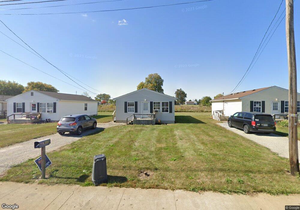
635 Bartram Ave Marion, OH 43302
Estimated Value: $69,000 - $100,000
3
Beds
1
Bath
960
Sq Ft
$90/Sq Ft
Est. Value
About This Home
This home is located at 635 Bartram Ave, Marion, OH 43302 and is currently estimated at $86,093, approximately $89 per square foot. 635 Bartram Ave is a home located in Marion County with nearby schools including Rutherford B. Hayes Elementary School, Ulysses S. Grant Middle School, and Harding High School.
Ownership History
Date
Name
Owned For
Owner Type
Purchase Details
Closed on
Mar 26, 2010
Sold by
Buckeye Acres Inc
Bought by
Cwra Llc
Current Estimated Value
Purchase Details
Closed on
Oct 5, 2004
Bought by
Cwra Llc
Purchase Details
Closed on
Jun 24, 2004
Bought by
Cwra Llc
Purchase Details
Closed on
Dec 31, 2003
Bought by
Cwra Llc
Purchase Details
Closed on
Jul 19, 2002
Bought by
Cwra Llc
Create a Home Valuation Report for This Property
The Home Valuation Report is an in-depth analysis detailing your home's value as well as a comparison with similar homes in the area
Home Values in the Area
Average Home Value in this Area
Purchase History
| Date | Buyer | Sale Price | Title Company |
|---|---|---|---|
| Cwra Llc | $170,500 | Talon Title Agency | |
| Cwra Llc | -- | -- | |
| Cwra Llc | -- | -- | |
| Cwra Llc | -- | -- | |
| Cwra Llc | -- | -- |
Source: Public Records
Tax History Compared to Growth
Tax History
| Year | Tax Paid | Tax Assessment Tax Assessment Total Assessment is a certain percentage of the fair market value that is determined by local assessors to be the total taxable value of land and additions on the property. | Land | Improvement |
|---|---|---|---|---|
| 2024 | $688 | $14,430 | $1,510 | $12,920 |
| 2023 | $688 | $14,430 | $1,510 | $12,920 |
| 2022 | $515 | $14,430 | $1,510 | $12,920 |
| 2021 | $446 | $11,250 | $1,310 | $9,940 |
| 2020 | $447 | $11,250 | $1,310 | $9,940 |
| 2019 | $447 | $11,250 | $1,310 | $9,940 |
| 2018 | $401 | $10,080 | $1,290 | $8,790 |
| 2017 | $447 | $10,080 | $1,290 | $8,790 |
| 2016 | $402 | $10,080 | $1,290 | $8,790 |
| 2015 | $402 | $9,840 | $1,230 | $8,610 |
| 2014 | $594 | $9,840 | $1,230 | $8,610 |
| 2012 | $267 | $6,500 | $1,300 | $5,200 |
Source: Public Records
Map
Nearby Homes
- 641 Blake Ave
- 520 Toledo Ave
- 531 Toledo Ave
- 485 Avondale Ave
- 468 Avondale Ave
- 551 Universal Ave Unit 555
- 523 Thompson St
- 636 Mary St
- 343 Commercial St
- 355 Lee St
- 233 Tully St
- 347 Mary St
- 552 N Prospect St
- 178 Leader St
- 736 N Main St
- 395 N Main St
- 593 N State St
- 197 Harrison St
- 434 N State St
- 1015 N Main St
- 641 Bartram Ave
- 629 Bartram Ave
- 647 Bartram Ave
- 623 Bartram Ave
- 653 Bartram Ave
- 617 Bartram Ave
- 659 Bartram Ave
- 611 Bartram Ave
- 583 W Fairground St
- 605 Bartram Ave
- 665 Bartram Ave
- 570 Blake Ave
- 592 Blake Ave
- 576 Avondale Ave
- 582 Blake Ave
- 565 Blake Ave
- 575 Blake Ave
- 570 Avondale Ave
- 566 Avondale Ave
- 562 Avondale Ave