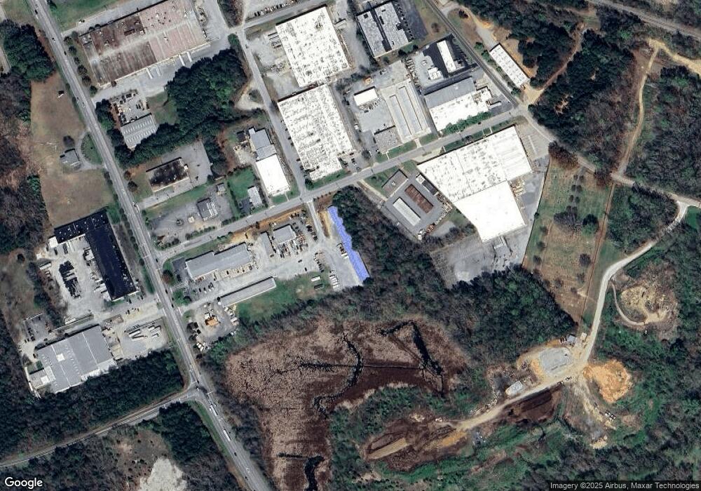
635 Industrial Ave Salisbury, NC 28144
--
Bed
--
Bath
14,095
Sq Ft
1.6
Acres
About This Home
This home is located at 635 Industrial Ave, Salisbury, NC 28144. 635 Industrial Ave is a home located in Rowan County with nearby schools including H D Isenberg Elementary, Knox Middle School, and North Rowan Middle School.
Ownership History
Date
Name
Owned For
Owner Type
Purchase Details
Closed on
Oct 31, 2019
Sold by
Julian Kadie Ketchie and Julian Robert B
Bought by
Ketchie Properties Llc
Home Financials for this Owner
Home Financials are based on the most recent Mortgage that was taken out on this home.
Original Mortgage
$1,407,568
Outstanding Balance
$1,238,297
Interest Rate
3.6%
Mortgage Type
Future Advance Clause Open End Mortgage
Purchase Details
Closed on
Jan 1, 1997
Bought by
Ketchie Bobby Ray
Create a Home Valuation Report for This Property
The Home Valuation Report is an in-depth analysis detailing your home's value as well as a comparison with similar homes in the area
Home Values in the Area
Average Home Value in this Area
Purchase History
| Date | Buyer | Sale Price | Title Company |
|---|---|---|---|
| Ketchie Properties Llc | -- | None Available | |
| Ketchie Bobby Ray | -- | -- |
Source: Public Records
Mortgage History
| Date | Status | Borrower | Loan Amount |
|---|---|---|---|
| Open | Ketchie Properties Llc | $1,407,568 |
Source: Public Records
Tax History Compared to Growth
Tax History
| Year | Tax Paid | Tax Assessment Tax Assessment Total Assessment is a certain percentage of the fair market value that is determined by local assessors to be the total taxable value of land and additions on the property. | Land | Improvement |
|---|---|---|---|---|
| 2025 | $6,340 | $530,074 | $117,450 | $412,624 |
| 2024 | $6,340 | $530,074 | $117,450 | $412,624 |
| 2023 | $6,340 | $530,074 | $117,450 | $412,624 |
| 2022 | $7,333 | $532,485 | $117,450 | $415,035 |
| 2021 | $7,333 | $532,485 | $117,450 | $415,035 |
| 2020 | $7,333 | $532,485 | $117,450 | $415,035 |
| 2019 | $7,333 | $532,485 | $117,450 | $415,035 |
| 2018 | $5,781 | $425,504 | $117,450 | $308,054 |
| 2017 | $5,751 | $425,504 | $117,450 | $308,054 |
| 2016 | $5,593 | $425,504 | $117,450 | $308,054 |
| 2015 | $5,627 | $425,504 | $117,450 | $308,054 |
| 2014 | $6,117 | $468,041 | $129,600 | $338,441 |
Source: Public Records
Map
Nearby Homes
- 1521 W Colonial Dr
- 1300 Larchmont Place Unit 208
- 1300 Larchmont Place Unit 107
- 1300 Larchmont Place
- 1300 Larchmont Place Unit 210
- 1638 W Colonial Dr
- 103 Spring Dr
- 1441 Statesville Blvd
- 1312 W Monroe St
- 1304 W Horah St
- 636 Statesville Blvd
- 1317 Arden Dr
- 1218 Forestdale Dr
- 1931 Calvin Ave
- 1612 Mooresville Rd
- 1027 Old Plank Rd
- 1612 Statesville Blvd
- BEAUMONT Plan at Milford Terrace
- 122 Eaman Ave
- 406 Grace St
- 1504 Jake Alexander Blvd W
- 14 Harrison Rd
- 454458 Jake Alexander Blvd W
- 1525 Jake Alexander Blvd W
- 1504 Old Wilkesboro Rd
- 000 Harrison Rd
- 1606 Jake Alexander Blvd W
- 2412 Old Wilkesboro Rd
- 2418 Old Wilkesboro Rd
- 2424 Old Wilkesboro Rd
- 304 S Mccoy Rd
- 2430 Old Wilkesboro Rd
- 302 S Mccoy Rd
- 2436 Old Wilkesboro Rd
- 2502 Old Wilkesboro Rd
- 1418 E Colonial Dr
- 1424 E Colonial Dr
- 1410 E Colonial Dr
- 1500 W Colonial Dr
- 1508 W Colonial Dr
