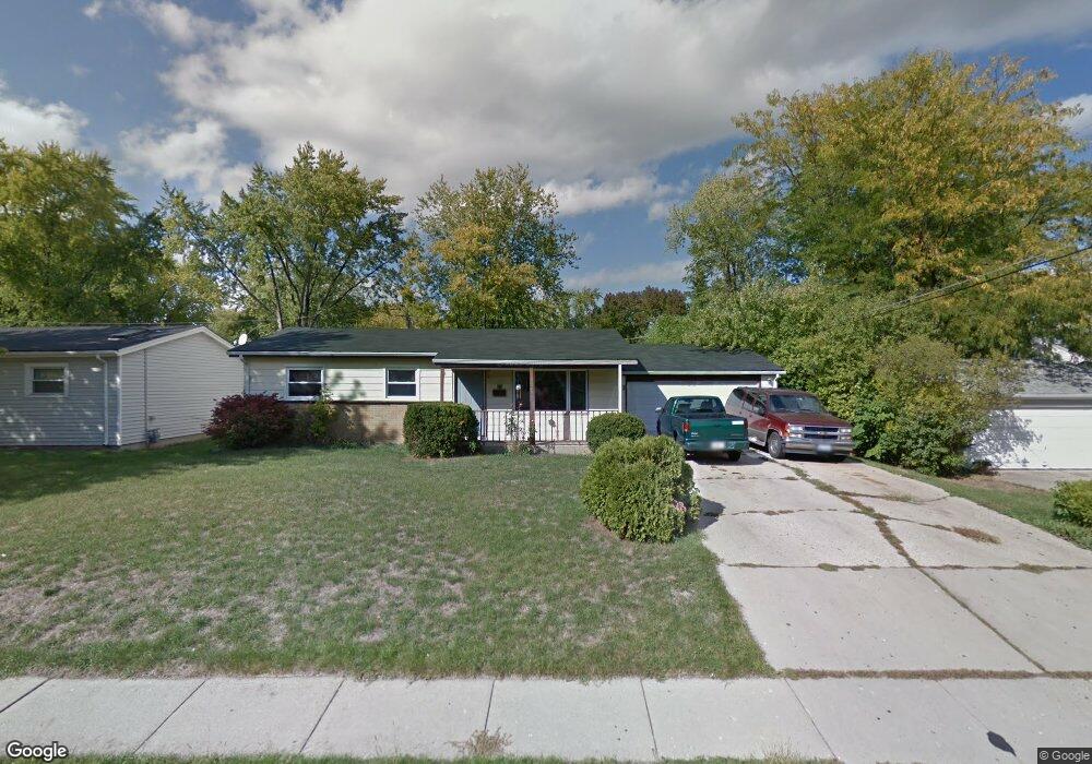
635 Walnut Rd Wauconda, IL 60084
Estimated Value: $244,000 - $283,000
Studio
1
Bath
936
Sq Ft
$282/Sq Ft
Est. Value
About This Home
This home is located at 635 Walnut Rd, Wauconda, IL 60084 and is currently estimated at $264,068, approximately $282 per square foot. 635 Walnut Rd is a home located in Lake County with nearby schools including Robert Crown School, Wauconda Middle School, and Wauconda High School.
Ownership History
Date
Name
Owned For
Owner Type
Purchase Details
Closed on
Jul 28, 2015
Sold by
Bltrejv3 Chicago Llc
Bought by
Csma Blt Llc
Current Estimated Value
Purchase Details
Closed on
Jun 26, 2013
Sold by
Dominguez Miguel N
Bought by
Bltrejv3 Chicago Llc
Purchase Details
Closed on
Apr 2, 1999
Sold by
Dominguez Miguel N and Pena Encaranacion
Bought by
Dominguez Miguel N and Dominguez Norma
Home Financials for this Owner
Home Financials are based on the most recent Mortgage that was taken out on this home.
Original Mortgage
$95,600
Interest Rate
7.05%
Create a Home Valuation Report for This Property
The Home Valuation Report is an in-depth analysis detailing your home's value as well as a comparison with similar homes in the area
Home Values in the Area
Average Home Value in this Area
Purchase History
| Date | Buyer | Sale Price | Title Company |
|---|---|---|---|
| Csma Blt Llc | $14,553,748 | Attorney | |
| Bltrejv3 Chicago Llc | $60,500 | Greater Illinois Title Compa | |
| Dominguez Miguel N | -- | -- |
Source: Public Records
Mortgage History
| Date | Status | Borrower | Loan Amount |
|---|---|---|---|
| Previous Owner | Dominguez Miguel N | $95,600 |
Source: Public Records
Tax History
| Year | Tax Paid | Tax Assessment Tax Assessment Total Assessment is a certain percentage of the fair market value that is determined by local assessors to be the total taxable value of land and additions on the property. | Land | Improvement |
|---|---|---|---|---|
| 2024 | $6,010 | $66,916 | $13,156 | $53,760 |
| 2023 | $6,841 | $61,167 | $12,026 | $49,141 |
| 2022 | $6,841 | $62,695 | $14,651 | $48,044 |
| 2021 | $6,557 | $59,241 | $13,844 | $45,397 |
| 2020 | $6,371 | $56,463 | $13,195 | $43,268 |
| 2019 | $5,679 | $53,362 | $12,470 | $40,892 |
| 2018 | $5,080 | $44,163 | $13,144 | $31,019 |
| 2017 | $5,116 | $43,652 | $12,992 | $30,660 |
| 2016 | $4,791 | $41,337 | $12,303 | $29,034 |
| 2015 | $3,775 | $31,573 | $11,294 | $20,279 |
| 2014 | $2,745 | $31,215 | $8,211 | $23,004 |
| 2012 | $2,705 | $29,510 | $7,856 | $21,654 |
Source: Public Records
Map
Nearby Homes
- 515 Indian Ridge Trail
- 27514 N Forest Garden Rd
- 212 Lewis Ave
- 245 Regency Ct Unit E
- 225 Regency Ct Unit A
- 450 N Main St Unit S208A
- 124 Hubbard Ct
- 125 E Mill St Unit D103
- 541 Meadowview Dr
- 155 E Mill St Unit 8
- 28048 N Hickory Ln
- 318 E Liberty St
- 731 Saddlewood Dr
- 26585 N Pheasant Ct
- 25586 W High St
- 25578 W High St
- 25570 W High St
- 1105 Monroe Ave
- 0 Bonner Rd
- 303 Stillwater Ct Unit 1106